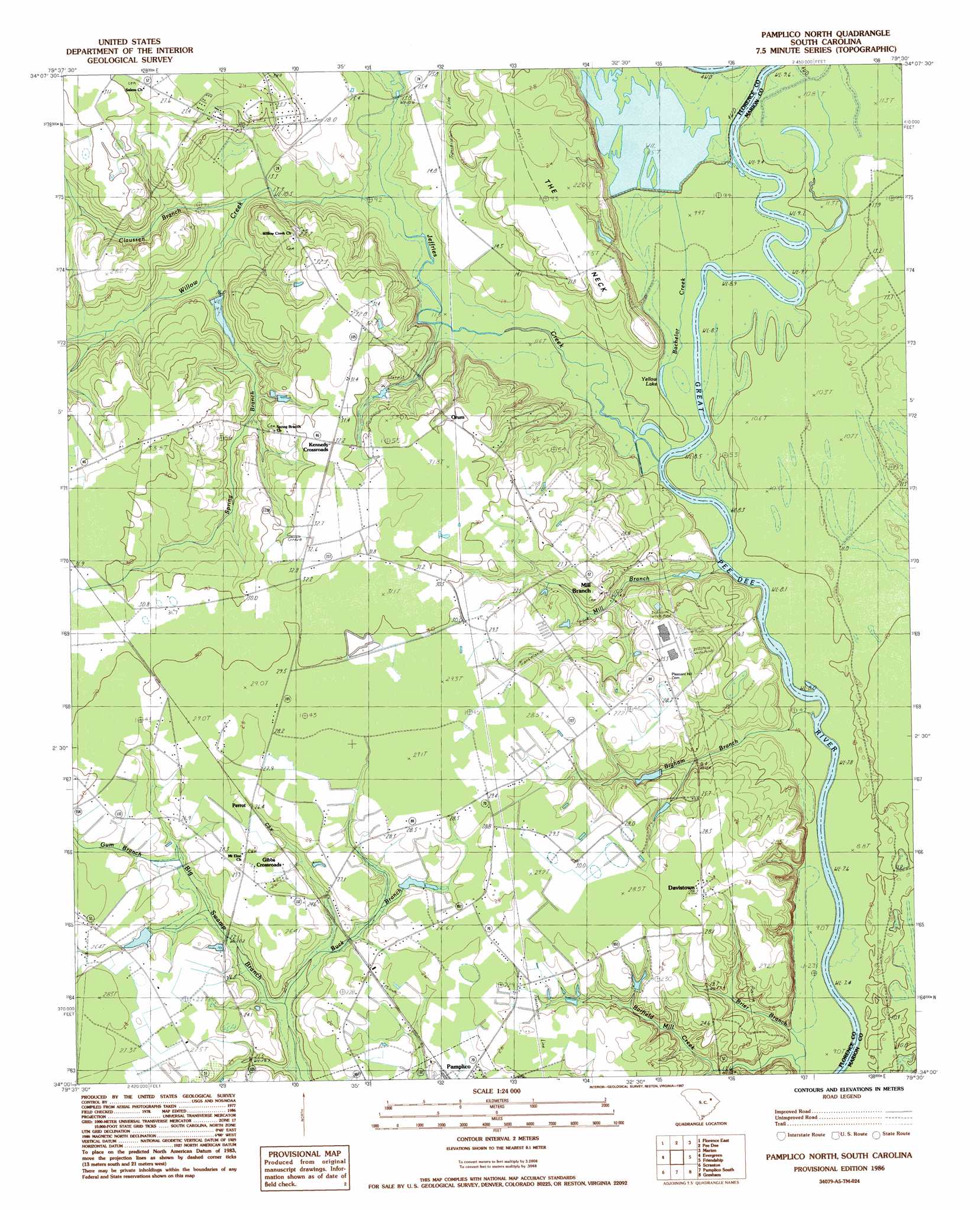
Pamplico North Topo Map South Carolina
To zoom in, hover over the map of Pamplico North
USGS Topo Quad 34079a5 - 1:24,000 scale
| Topo Map Name: | Pamplico North |
| USGS Topo Quad ID: | 34079a5 |
| Print Size: | ca. 21 1/4" wide x 27" high |
| Southeast Coordinates: | 34° N latitude / 79.5° W longitude |
| Map Center Coordinates: | 34.0625° N latitude / 79.5625° W longitude |
| U.S. State: | SC |
| Filename: | o34079a5.jpg |
| Download Map JPG Image: | Pamplico North topo map 1:24,000 scale |
| Map Type: | Topographic |
| Topo Series: | 7.5´ |
| Map Scale: | 1:24,000 |
| Source of Map Images: | United States Geological Survey (USGS) |
| Alternate Map Versions: |
Pamplico North SC 1986, updated 1987 Download PDF Buy paper map Pamplico North SC 2011 Download PDF Buy paper map Pamplico North SC 2014 Download PDF Buy paper map |
1:24,000 Topo Quads surrounding Pamplico North
Darlington East |
Witherspoon Island |
Oak Grove |
Latta |
Fork |
Florence West |
Florence East |
Pee Dee |
Marion |
Mullins |
Effingham |
Evergreen |
Pamplico North |
Friendship |
Centenary |
Mill Bay |
Scranton |
Pamplico South |
Gresham |
Britton Neck |
Lake City West |
Lake City East |
Prospect Crossroads |
Johnsonville |
Snow Island |
> Back to 34079a1 at 1:100,000 scale
> Back to 34078a1 at 1:250,000 scale
> Back to U.S. Topo Maps home
Pamplico North topo map: Gazetteer
Pamplico North: Capes
The Neck elevation 23m 75′Pamplico North: Dams
Bowling Pond Dam D-3580 elevation 20m 65′H S Hyman Pond Dam D-3578 elevation 26m 85′
South Carolina Noname 21009 D-3563 Dam elevation 15m 49′
Pamplico North: Lakes
Booger Pond elevation 23m 75′Yellow Lake elevation 8m 26′
Pamplico North: Populated Places
Davistown elevation 28m 91′Gibbs Crossroads elevation 28m 91′
Kennedy Crossroads elevation 32m 104′
Mill Branch elevation 28m 91′
Orum elevation 29m 95′
Perrot elevation 26m 85′
Pamplico North: Reservoirs
Bowling Pond elevation 20m 65′H S Hyman Pond elevation 26m 85′
Palles Pond Dam elevation 15m 49′
Pamplico North: Streams
Bachelor Creek elevation 8m 26′Barfields Old Mill Creek elevation 12m 39′
Bigham Branch elevation 9m 29′
Brier Branch elevation 10m 32′
Buck Branch elevation 18m 59′
Claussen Branch elevation 11m 36′
Gum Branch elevation 23m 75′
Jeffries Creek elevation 8m 26′
Mill Branch elevation 8m 26′
Spring Branch elevation 14m 45′
Willow Creek elevation 11m 36′
Pamplico North: Swamps
Horse Bay elevation 30m 98′Pamplico North digital topo map on disk
Buy this Pamplico North topo map showing relief, roads, GPS coordinates and other geographical features, as a high-resolution digital map file on DVD:
South Carolina, Western North Carolina & Northeastern Georgia
Buy digital topo maps: South Carolina, Western North Carolina & Northeastern Georgia