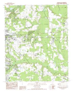
Florence East Topo Map South Carolina
To zoom in, hover over the map of Florence East
USGS Topo Quad 34079b6 - 1:24,000 scale
| Topo Map Name: | Florence East |
| USGS Topo Quad ID: | 34079b6 |
| Print Size: | ca. 21 1/4" wide x 27" high |
| Southeast Coordinates: | 34.125° N latitude / 79.625° W longitude |
| Map Center Coordinates: | 34.1875° N latitude / 79.6875° W longitude |
| U.S. State: | SC |
| Filename: | o34079b6.jpg |
| Download Map JPG Image: | Florence East topo map 1:24,000 scale |
| Map Type: | Topographic |
| Topo Series: | 7.5´ |
| Map Scale: | 1:24,000 |
| Source of Map Images: | United States Geological Survey (USGS) |
| Alternate Map Versions: |
Florence East SC 1986, updated 1987 Download PDF Buy paper map Florence East SC 2011 Download PDF Buy paper map Florence East SC 2014 Download PDF Buy paper map |
1:24,000 Topo Quads surrounding Florence East
> Back to 34079a1 at 1:100,000 scale
> Back to 34078a1 at 1:250,000 scale
> Back to U.S. Topo Maps home
Florence East topo map: Gazetteer
Florence East: Airports
Florence Regional Airport elevation 42m 137′Florence East: Canals
Polk Swamp Canal elevation 21m 68′Florence East: Dams
Canal Industries Pond Dam D-3561 elevation 28m 91′Country Club Sc Pond Dam D-3571 elevation 24m 78′
Florence East: Lakes
Goose Pond elevation 37m 121′Florence East: Parks
Florence Memorial Stadium elevation 41m 134′Levy Park elevation 37m 121′
Florence East: Populated Places
Air Base Heights elevation 43m 141′Brandon Woods elevation 34m 111′
Burch Crossroads elevation 34m 111′
Carolina Acres elevation 44m 144′
Claussen elevation 27m 88′
Country Manor elevation 32m 104′
East View Estates elevation 33m 108′
Fendall elevation 31m 101′
Fenwick Grove elevation 34m 111′
Glencove elevation 41m 134′
Glendale elevation 40m 131′
Glendale Acres elevation 39m 127′
Greenbriar elevation 38m 124′
Greenwood Estates elevation 33m 108′
Gregg Camp elevation 27m 88′
Hewitt Subdivision elevation 34m 111′
Kenwood Acres elevation 30m 98′
Malibu elevation 40m 131′
Mars Bluff elevation 30m 98′
McElveen elevation 27m 88′
Meeks elevation 42m 137′
Park City elevation 36m 118′
Parkwood elevation 34m 111′
Ponderosa elevation 40m 131′
Price Crossroads elevation 30m 98′
Quinby elevation 36m 118′
Quinby Forest elevation 39m 127′
Rosemont elevation 34m 111′
Sandridge elevation 28m 91′
Tremont Terrace elevation 29m 95′
Woodmont elevation 44m 144′
Florence East: Post Offices
Quinby Post Office elevation 39m 127′Florence East: Reservoirs
Canal Industries Pond elevation 28m 91′Country Club Sc Pond elevation 24m 78′
Florence East: Streams
Adams Branch elevation 26m 85′Ashby Branch elevation 23m 75′
Billy Branch elevation 20m 65′
Canal Branch elevation 24m 78′
Cane Branch elevation 16m 52′
Eastman Branch elevation 19m 62′
Middle Swamp elevation 20m 65′
Twomile Creek elevation 23m 75′
Florence East: Summits
The Stockade elevation 30m 98′Florence East: Swamps
Polk Swamp elevation 23m 75′Florence East digital topo map on disk
Buy this Florence East topo map showing relief, roads, GPS coordinates and other geographical features, as a high-resolution digital map file on DVD:
South Carolina, Western North Carolina & Northeastern Georgia
Buy digital topo maps: South Carolina, Western North Carolina & Northeastern Georgia


