Rowland Topo Map North Carolina
To zoom in, hover over the map of Rowland
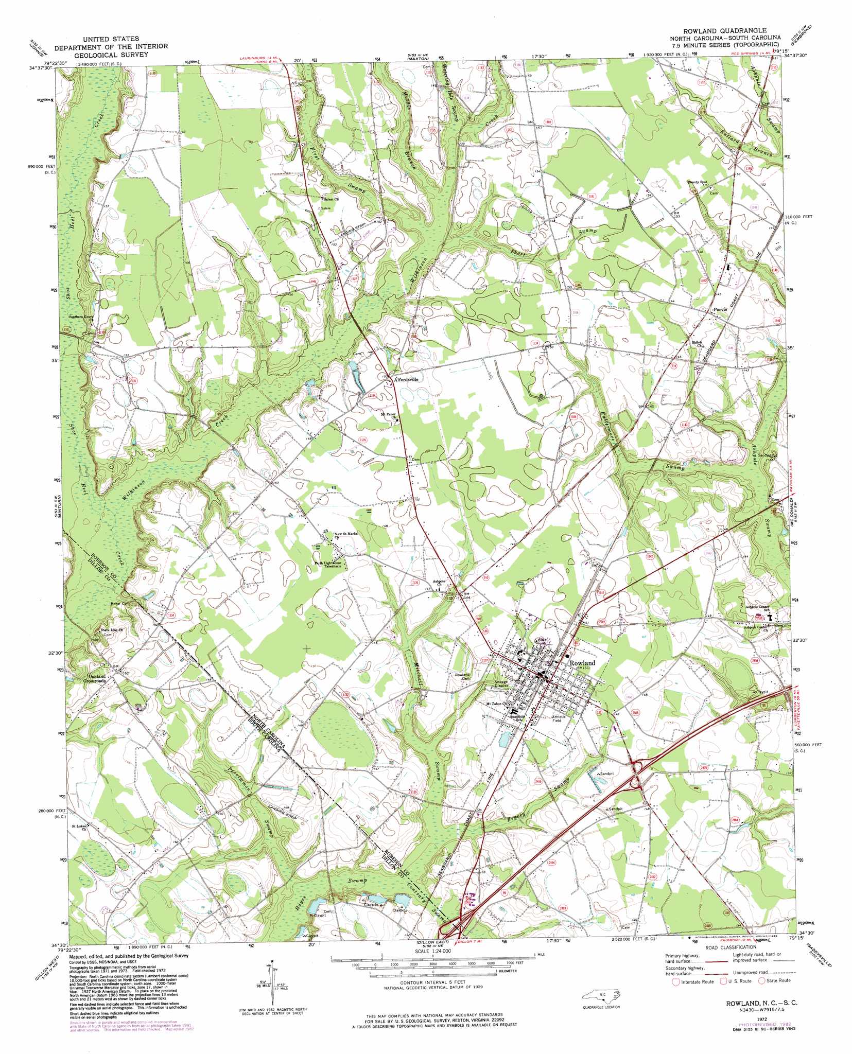
USGS Topo Quad 34079e3 - 1:24,000 scale
| Topo Map Name: | Rowland |
| USGS Topo Quad ID: | 34079e3 |
| Print Size: | ca. 21 1/4" wide x 27" high |
| Southeast Coordinates: | 34.5° N latitude / 79.25° W longitude |
| Map Center Coordinates: | 34.5625° N latitude / 79.3125° W longitude |
| U.S. States: | NC, SC |
| Filename: | o34079e3.jpg |
| Download Map JPG Image: | Rowland topo map 1:24,000 scale |
| Map Type: | Topographic |
| Topo Series: | 7.5´ |
| Map Scale: | 1:24,000 |
| Source of Map Images: | United States Geological Survey (USGS) |
| Alternate Map Versions: |
Rowland NC 1972, updated 1976 Download PDF Buy paper map Rowland NC 1972, updated 1983 Download PDF Buy paper map Rowland NC 1976, updated 1978 Download PDF Buy paper map Rowland NC 1997, updated 2000 Download PDF Buy paper map Rowland NC 2011 Download PDF Buy paper map Rowland NC 2013 Download PDF Buy paper map Rowland NC 2016 Download PDF Buy paper map |
1:24,000 Topo Quads surrounding Rowland
Gibson |
Laurinburg |
Wakulla |
Red Springs |
Rennert |
Mccoll |
Johns |
Maxton |
Pembroke |
Northwest Lumberton |
Clio |
Minturn |
Rowland |
Mcdonald |
Southwest Lumberton |
Bingham |
Dillon West |
Dillon East |
Gaddysville |
Fairmont |
Oak Grove |
Latta |
Fork |
Lake View |
Fair Bluff |
> Back to 34079e1 at 1:100,000 scale
> Back to 34078a1 at 1:250,000 scale
> Back to U.S. Topo Maps home
Rowland topo map: Gazetteer
Rowland: Populated Places
Alfordsville elevation 45m 147′Oakland Crossroads elevation 47m 154′
Purvis elevation 45m 147′
Rowland elevation 45m 147′
Rowland: Streams
Bracey Swamp elevation 34m 111′Bullard Branch elevation 41m 134′
Contrary Swamp elevation 33m 108′
First Swamp elevation 39m 127′
Fullermore Swamp elevation 34m 111′
Middle Branch Wilkinson Creek elevation 40m 131′
Mitchell Swamp elevation 34m 111′
Persimmon Swamp elevation 32m 104′
Persimmon Swamp elevation 32m 104′
Short Swamp elevation 38m 124′
Watering Hole Swamp elevation 40m 131′
Wilkinson Creek elevation 34m 111′
Rowland: Swamps
Contrary Swamp elevation 33m 108′Rowland digital topo map on disk
Buy this Rowland topo map showing relief, roads, GPS coordinates and other geographical features, as a high-resolution digital map file on DVD:
South Carolina, Western North Carolina & Northeastern Georgia
Buy digital topo maps: South Carolina, Western North Carolina & Northeastern Georgia