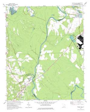
Society Hill Topo Map South Carolina
To zoom in, hover over the map of Society Hill
USGS Topo Quad 34079e7 - 1:24,000 scale
| Topo Map Name: | Society Hill |
| USGS Topo Quad ID: | 34079e7 |
| Print Size: | ca. 21 1/4" wide x 27" high |
| Southeast Coordinates: | 34.5° N latitude / 79.75° W longitude |
| Map Center Coordinates: | 34.5625° N latitude / 79.8125° W longitude |
| U.S. State: | SC |
| Filename: | o34079e7.jpg |
| Download Map JPG Image: | Society Hill topo map 1:24,000 scale |
| Map Type: | Topographic |
| Topo Series: | 7.5´ |
| Map Scale: | 1:24,000 |
| Source of Map Images: | United States Geological Survey (USGS) |
| Alternate Map Versions: |
Society Hill SC 1971, updated 1977 Download PDF Buy paper map Society Hill SC 2011 Download PDF Buy paper map Society Hill SC 2014 Download PDF Buy paper map |
1:24,000 Topo Quads surrounding Society Hill
> Back to 34079e1 at 1:100,000 scale
> Back to 34078a1 at 1:250,000 scale
> Back to U.S. Topo Maps home
Society Hill topo map: Gazetteer
Society Hill: Bridges
Welch Neck Memorial Bridge elevation 20m 65′Society Hill: Capes
Welsh Neck elevation 29m 95′Society Hill: Cliffs
Gardners Bluff elevation 28m 91′Society Hill: Crossings
Sparks Ferry (historical) elevation 20m 65′Society Hill: Dams
Becker Pond Dam D-3449 elevation 29m 95′Noname 16028 D-3538 Dam elevation 20m 65′
Society Hill: Lakes
Cash Lake elevation 22m 72′Mares Lake elevation 22m 72′
Mathesons Millpond elevation 26m 85′
Society Hill: Parks
Davis Field elevation 56m 183′Society Hill: Populated Places
Dyers Hill elevation 39m 127′Plumfield Landing elevation 22m 72′
Society Hill elevation 52m 170′
Welsh Neck (historical) elevation 29m 95′
Society Hill: Reservoirs
Becker Pond elevation 29m 95′Klopman Mill Pond elevation 20m 65′
Society Hill: Streams
Boggy Branch elevation 32m 104′Cedar Creek elevation 22m 72′
Crooked Creek elevation 21m 68′
Hugh Creek elevation 30m 98′
Naked Creek elevation 22m 72′
Reedys Branch elevation 27m 88′
Spot Mill Creek elevation 30m 98′
Society Hill: Swamps
Goose Marsh elevation 28m 91′Society Hill digital topo map on disk
Buy this Society Hill topo map showing relief, roads, GPS coordinates and other geographical features, as a high-resolution digital map file on DVD:
South Carolina, Western North Carolina & Northeastern Georgia
Buy digital topo maps: South Carolina, Western North Carolina & Northeastern Georgia


