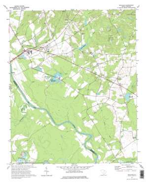
Wallace Topo Map South Carolina
To zoom in, hover over the map of Wallace
USGS Topo Quad 34079f7 - 1:24,000 scale
| Topo Map Name: | Wallace |
| USGS Topo Quad ID: | 34079f7 |
| Print Size: | ca. 21 1/4" wide x 27" high |
| Southeast Coordinates: | 34.625° N latitude / 79.75° W longitude |
| Map Center Coordinates: | 34.6875° N latitude / 79.8125° W longitude |
| U.S. State: | SC |
| Filename: | o34079f7.jpg |
| Download Map JPG Image: | Wallace topo map 1:24,000 scale |
| Map Type: | Topographic |
| Topo Series: | 7.5´ |
| Map Scale: | 1:24,000 |
| Source of Map Images: | United States Geological Survey (USGS) |
| Alternate Map Versions: |
Wallace SC 1971, updated 1975 Download PDF Buy paper map Wallace SC 1971, updated 1975 Download PDF Buy paper map Wallace SC 2011 Download PDF Buy paper map Wallace SC 2014 Download PDF Buy paper map |
1:24,000 Topo Quads surrounding Wallace
> Back to 34079e1 at 1:100,000 scale
> Back to 34078a1 at 1:250,000 scale
> Back to U.S. Topo Maps home
Wallace topo map: Gazetteer
Wallace: Bridges
Cheraw Bridge (historical) elevation 23m 75′Wallace: Dams
Camp Pee Dee Pond Number One Dam D-3434 elevation 57m 187′Camp Sandy Ridge Pond Dam D-3433 elevation 55m 180′
Grants Mill Pond Dam D-3429 elevation 34m 111′
McMeekin Pond Dam D-3430 elevation 40m 131′
Rollins Pond Dam D-2945 elevation 36m 118′
South Carolina Noname 35002 Dam elevation 27m 88′
South Carolina Noname 35003 D-3411 Dam elevation 47m 154′
South Carolina Noname 35017 D-3428 Dam elevation 37m 121′
South Carolina Noname 35020 D-3432 Dam elevation 38m 124′
South Carolina Noname 35024 D-2946 Dam elevation 55m 180′
South Carolina Noname 35039 D-3461 Dam elevation 31m 101′
Wallace: Lakes
McLaurins Millpond elevation 47m 154′Wallace: Populated Places
Chavistown elevation 64m 209′Everetts (historical) elevation 34m 111′
Hickson (historical) elevation 46m 150′
Irby (historical) elevation 30m 98′
Madeline elevation 35m 114′
Montrose elevation 39m 127′
Wallace elevation 46m 150′
Wallace: Reservoirs
Anderson Millpond elevation 27m 88′Andersons Millpond elevation 27m 88′
Camp Pee Dee Pond Number One elevation 57m 187′
Camp Sandy Ridge Pond elevation 55m 180′
Doctor Mays Pond elevation 38m 124′
Girl Scout Pond elevation 55m 180′
Grants Mill Pond elevation 34m 111′
Grants Millpond elevation 34m 111′
J E Powe Pond elevation 37m 121′
J P Stevens Pond elevation 31m 101′
McMeekin Pond elevation 40m 131′
Rollins Pond elevation 36m 118′
Wallace: Streams
Beaverdam Creek elevation 23m 75′Phils Creek elevation 24m 78′
Tarkiln Creek elevation 23m 75′
Thompson Creek elevation 22m 72′
Wolf Creek elevation 35m 114′
Wallace: Summits
Beattie Hill elevation 26m 85′Wallace digital topo map on disk
Buy this Wallace topo map showing relief, roads, GPS coordinates and other geographical features, as a high-resolution digital map file on DVD:
South Carolina, Western North Carolina & Northeastern Georgia
Buy digital topo maps: South Carolina, Western North Carolina & Northeastern Georgia


