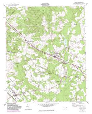
Gibson Topo Map North Carolina
To zoom in, hover over the map of Gibson
USGS Topo Quad 34079g5 - 1:24,000 scale
| Topo Map Name: | Gibson |
| USGS Topo Quad ID: | 34079g5 |
| Print Size: | ca. 21 1/4" wide x 27" high |
| Southeast Coordinates: | 34.75° N latitude / 79.5° W longitude |
| Map Center Coordinates: | 34.8125° N latitude / 79.5625° W longitude |
| U.S. States: | NC, SC |
| Filename: | o34079g5.jpg |
| Download Map JPG Image: | Gibson topo map 1:24,000 scale |
| Map Type: | Topographic |
| Topo Series: | 7.5´ |
| Map Scale: | 1:24,000 |
| Source of Map Images: | United States Geological Survey (USGS) |
| Alternate Map Versions: |
Gibson NC 1949, updated 1953 Download PDF Buy paper map Gibson NC 1949, updated 1978 Download PDF Buy paper map Gibson NC 1949, updated 1983 Download PDF Buy paper map Gibson NC 1976, updated 1978 Download PDF Buy paper map Gibson NC 2011 Download PDF Buy paper map Gibson NC 2013 Download PDF Buy paper map Gibson NC 2016 Download PDF Buy paper map |
1:24,000 Topo Quads surrounding Gibson
> Back to 34079e1 at 1:100,000 scale
> Back to 34078a1 at 1:250,000 scale
> Back to U.S. Topo Maps home
Gibson topo map: Gazetteer
Gibson: Dams
Richmond Mill Pond Dam elevation 63m 206′Gibson: Populated Places
Elmore elevation 73m 239′Elmore Crossroads elevation 73m 239′
Gibson elevation 76m 249′
Ida Mill elevation 58m 190′
Laurel Hill elevation 77m 252′
Livingstons Quarters elevation 71m 232′
Old Hundred elevation 95m 311′
Richmond Mill elevation 64m 209′
Sandy Bottoms elevation 72m 236′
Springfield elevation 60m 196′
Gibson: Reservoirs
Guinns Mill Pond elevation 71m 232′Ida Mill Pond elevation 59m 193′
McNeill Pond elevation 76m 249′
Richmond Mill Lake elevation 63m 206′
Gibson: Streams
Bass Branch elevation 74m 242′Beasley Branch elevation 58m 190′
Browns Branch elevation 63m 206′
Granny Branch elevation 78m 255′
Joes Creek elevation 52m 170′
Lower Beaverdam Creek elevation 53m 173′
Upper Beaverdam Creek elevation 64m 209′
Gibson digital topo map on disk
Buy this Gibson topo map showing relief, roads, GPS coordinates and other geographical features, as a high-resolution digital map file on DVD:
South Carolina, Western North Carolina & Northeastern Georgia
Buy digital topo maps: South Carolina, Western North Carolina & Northeastern Georgia


