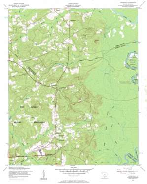
Leesburg Topo Map South Carolina
To zoom in, hover over the map of Leesburg
USGS Topo Quad 34080a6 - 1:24,000 scale
| Topo Map Name: | Leesburg |
| USGS Topo Quad ID: | 34080a6 |
| Print Size: | ca. 21 1/4" wide x 27" high |
| Southeast Coordinates: | 34° N latitude / 80.625° W longitude |
| Map Center Coordinates: | 34.0625° N latitude / 80.6875° W longitude |
| U.S. State: | SC |
| Filename: | o34080a6.jpg |
| Download Map JPG Image: | Leesburg topo map 1:24,000 scale |
| Map Type: | Topographic |
| Topo Series: | 7.5´ |
| Map Scale: | 1:24,000 |
| Source of Map Images: | United States Geological Survey (USGS) |
| Alternate Map Versions: |
Leesburg SC 1953, updated 1957 Download PDF Buy paper map Leesburg SC 2011 Download PDF Buy paper map Leesburg SC 2014 Download PDF Buy paper map |
1:24,000 Topo Quads surrounding Leesburg
> Back to 34080a1 at 1:100,000 scale
> Back to 34080a1 at 1:250,000 scale
> Back to U.S. Topo Maps home
Leesburg topo map: Gazetteer
Leesburg: Dams
Wilson Mill Pond D-0594 Dam elevation 55m 180′Leesburg: Lakes
Chaver Pond elevation 66m 216′English Pond elevation 53m 173′
Otter Lake elevation 36m 118′
Leesburg: Populated Places
Beaver Creek elevation 107m 351′Cedar Creek elevation 82m 269′
English (historical) elevation 59m 193′
Leesburg elevation 79m 259′
McCaskill elevation 53m 173′
Meadow View elevation 61m 200′
Spears Creek elevation 76m 249′
Leesburg: Reservoirs
Wilson Mill Pond elevation 57m 187′Wilson Mill Pond elevation 55m 180′
Leesburg: Streams
Bee Branch elevation 51m 167′Daley Branch elevation 45m 147′
Jumping Run Creek elevation 48m 157′
Leesburg Branch elevation 44m 144′
Madraw Branch elevation 35m 114′
McCaskill Creek elevation 39m 127′
Moke Branch elevation 34m 111′
Otterslide Branch elevation 45m 147′
Pigeon Roost Branch elevation 33m 108′
Raglins Creek elevation 36m 118′
Rununder Branch elevation 54m 177′
Sloan Branch elevation 48m 157′
Spears Creek elevation 33m 108′
Leesburg: Summits
Dunns Mount elevation 91m 298′Leesburg: Swamps
English Swamp elevation 37m 121′White Marsh Swamp elevation 35m 114′
Leesburg digital topo map on disk
Buy this Leesburg topo map showing relief, roads, GPS coordinates and other geographical features, as a high-resolution digital map file on DVD:
South Carolina, Western North Carolina & Northeastern Georgia
Buy digital topo maps: South Carolina, Western North Carolina & Northeastern Georgia


