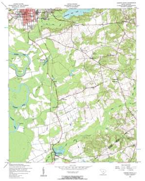
Camden South Topo Map South Carolina
To zoom in, hover over the map of Camden South
USGS Topo Quad 34080b5 - 1:24,000 scale
| Topo Map Name: | Camden South |
| USGS Topo Quad ID: | 34080b5 |
| Print Size: | ca. 21 1/4" wide x 27" high |
| Southeast Coordinates: | 34.125° N latitude / 80.5° W longitude |
| Map Center Coordinates: | 34.1875° N latitude / 80.5625° W longitude |
| U.S. State: | SC |
| Filename: | o34080b5.jpg |
| Download Map JPG Image: | Camden South topo map 1:24,000 scale |
| Map Type: | Topographic |
| Topo Series: | 7.5´ |
| Map Scale: | 1:24,000 |
| Source of Map Images: | United States Geological Survey (USGS) |
| Alternate Map Versions: |
Camden South SC 1953, updated 1957 Download PDF Buy paper map Camden South SC 2011 Download PDF Buy paper map Camden South SC 2014 Download PDF Buy paper map |
1:24,000 Topo Quads surrounding Camden South
> Back to 34080a1 at 1:100,000 scale
> Back to 34080a1 at 1:250,000 scale
> Back to U.S. Topo Maps home
Camden South topo map: Gazetteer
Camden South: Airports
El Porvenir Airpark elevation 59m 193′Camden South: Bends
Devils Elbow elevation 39m 127′Camden South: Capes
Belmont Neck elevation 42m 137′Betty Neck elevation 39m 127′
Friends Neck elevation 42m 137′
Gibsons Neck elevation 39m 127′
Camden South: Crossings
Interchange 101 elevation 74m 242′Interchange 98 elevation 46m 150′
Camden South: Dams
Frank Martin Pond Dam D-2504 elevation 57m 187′Graham Pond Dam D-2503 elevation 76m 249′
Hermitage Mill Pond Dam elevation 46m 150′
Mulberry House Pond Dam D-2505 elevation 41m 134′
Mulberry Picnic Pond Dam D-2506 elevation 44m 144′
South Carolina Noname 28006 D-1144 Dam elevation 45m 147′
Camden South: Lakes
Lake Clear elevation 42m 137′Sip Hole elevation 42m 137′
Camden South: Parks
City of Camden Historic District elevation 57m 187′Hampton Park elevation 59m 193′
Jackson Park elevation 60m 196′
Legion Park elevation 50m 164′
Zemp Field elevation 50m 164′
Camden South: Populated Places
Camden elevation 57m 187′Cantys Lane elevation 52m 170′
Deloach (historical) elevation 42m 137′
Du Bose Park elevation 55m 180′
Ellerbee (historical) elevation 52m 170′
Hammond elevation 45m 147′
Hermitage Mill elevation 49m 160′
Paint Hill elevation 78m 255′
Stockton (historical) elevation 52m 170′
Tickle Hill elevation 59m 193′
Camden South: Post Offices
Camden Post Office elevation 57m 187′Camden South: Reservoirs
Boykin Mill Pond elevation 45m 147′Boykin Millpond elevation 45m 147′
Graham Pond elevation 76m 249′
Hermitage Mill Pond elevation 46m 150′
Hermitage Millpond elevation 49m 160′
House Pond elevation 41m 134′
Mulberry House Pond elevation 41m 134′
Mulberry Picnic Pond elevation 44m 144′
Retriever Training Pond elevation 57m 187′
Camden South: Streams
Big Pine Tree Creek elevation 40m 131′Little Pine Tree Creek elevation 40m 131′
Little Swift Creek elevation 52m 170′
Town Creek elevation 39m 127′
Camden South: Summits
Paint Hill elevation 82m 269′Camden South digital topo map on disk
Buy this Camden South topo map showing relief, roads, GPS coordinates and other geographical features, as a high-resolution digital map file on DVD:
South Carolina, Western North Carolina & Northeastern Georgia
Buy digital topo maps: South Carolina, Western North Carolina & Northeastern Georgia


