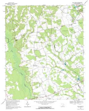
Kellytown Topo Map South Carolina
To zoom in, hover over the map of Kellytown
USGS Topo Quad 34080c2 - 1:24,000 scale
| Topo Map Name: | Kellytown |
| USGS Topo Quad ID: | 34080c2 |
| Print Size: | ca. 21 1/4" wide x 27" high |
| Southeast Coordinates: | 34.25° N latitude / 80.125° W longitude |
| Map Center Coordinates: | 34.3125° N latitude / 80.1875° W longitude |
| U.S. State: | SC |
| Filename: | o34080c2.jpg |
| Download Map JPG Image: | Kellytown topo map 1:24,000 scale |
| Map Type: | Topographic |
| Topo Series: | 7.5´ |
| Map Scale: | 1:24,000 |
| Source of Map Images: | United States Geological Survey (USGS) |
| Alternate Map Versions: |
Kellytown SC 1968, updated 1971 Download PDF Buy paper map Kellytown SC 2011 Download PDF Buy paper map Kellytown SC 2014 Download PDF Buy paper map |
1:24,000 Topo Quads surrounding Kellytown
> Back to 34080a1 at 1:100,000 scale
> Back to 34080a1 at 1:250,000 scale
> Back to U.S. Topo Maps home
Kellytown topo map: Gazetteer
Kellytown: Basins
Big Cypress Bay elevation 70m 229′Little Cypress Bay elevation 71m 232′
Kellytown: Crossings
Spiveys Ferry (historical) elevation 53m 173′Kellytown: Dams
South Carolina Noname 16003 D-3516 Dam elevation 55m 180′South Carolina Noname 16031 D-3515 Dam elevation 55m 180′
South Carolina Noname 31001 D-2425 Dam elevation 59m 193′
Kellytown: Populated Places
Alcot elevation 64m 209′Ashland elevation 95m 311′
Botany Woods elevation 69m 226′
Forest Hills elevation 68m 223′
Kellytown elevation 73m 239′
Shannon Hill elevation 55m 180′
Una elevation 61m 200′
Kellytown: Reservoirs
Bell Pond elevation 60m 196′Marco Millpond elevation 55m 180′
Marco Millpond elevation 55m 180′
Segars Millpond elevation 55m 180′
Smith Pond elevation 59m 193′
Kellytown: Streams
Beaverdam Creek elevation 58m 190′Bells Branch elevation 51m 167′
Burnt Branch elevation 60m 196′
Gully Run elevation 56m 183′
Merchants Mill Creek elevation 54m 177′
Segars Mill Stream elevation 55m 180′
Turkey Creek elevation 54m 177′
Kellytown digital topo map on disk
Buy this Kellytown topo map showing relief, roads, GPS coordinates and other geographical features, as a high-resolution digital map file on DVD:
South Carolina, Western North Carolina & Northeastern Georgia
Buy digital topo maps: South Carolina, Western North Carolina & Northeastern Georgia


