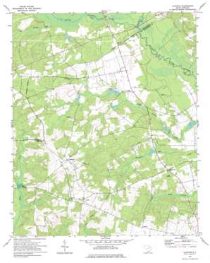
Lucknow Topo Map South Carolina
To zoom in, hover over the map of Lucknow
USGS Topo Quad 34080c3 - 1:24,000 scale
| Topo Map Name: | Lucknow |
| USGS Topo Quad ID: | 34080c3 |
| Print Size: | ca. 21 1/4" wide x 27" high |
| Southeast Coordinates: | 34.25° N latitude / 80.25° W longitude |
| Map Center Coordinates: | 34.3125° N latitude / 80.3125° W longitude |
| U.S. State: | SC |
| Filename: | o34080c3.jpg |
| Download Map JPG Image: | Lucknow topo map 1:24,000 scale |
| Map Type: | Topographic |
| Topo Series: | 7.5´ |
| Map Scale: | 1:24,000 |
| Source of Map Images: | United States Geological Survey (USGS) |
| Alternate Map Versions: |
Lucknow SC 1970, updated 1975 Download PDF Buy paper map Lucknow SC 2011 Download PDF Buy paper map Lucknow SC 2014 Download PDF Buy paper map |
1:24,000 Topo Quads surrounding Lucknow
> Back to 34080a1 at 1:100,000 scale
> Back to 34080a1 at 1:250,000 scale
> Back to U.S. Topo Maps home
Lucknow topo map: Gazetteer
Lucknow: Bridges
Stokes Bridge (historical) elevation 56m 183′Tillers Bridge elevation 57m 187′
Lucknow: Crossings
Tillers Ferry (historical) elevation 57m 187′Lucknow: Dams
Hancocks Pond Dam D-1720 elevation 82m 269′South Carolina Noname 31007 D-2419 Dam elevation 58m 190′
South Carolina Noname 31009 D-2412 Dam elevation 68m 223′
South Carolina Noname 31015 D-2413 Dam elevation 71m 232′
Sunesac Lake Dam D-2417 elevation 61m 200′
Lucknow: Parks
Sandy Grove Park elevation 81m 265′Lucknow: Populated Places
Lucknow elevation 107m 351′Thursa elevation 93m 305′
Tillersville elevation 80m 262′
Zemp elevation 104m 341′
Lucknow: Reservoirs
Clyburns Pond elevation 68m 223′Halls Millpond elevation 71m 232′
Hancocks Pond elevation 82m 269′
Newson Pond elevation 58m 190′
Sunesac Lake elevation 61m 200′
Lucknow: Streams
Bell Branch elevation 64m 209′Black Creek elevation 63m 206′
Little Lynches River elevation 57m 187′
Lucknow digital topo map on disk
Buy this Lucknow topo map showing relief, roads, GPS coordinates and other geographical features, as a high-resolution digital map file on DVD:
South Carolina, Western North Carolina & Northeastern Georgia
Buy digital topo maps: South Carolina, Western North Carolina & Northeastern Georgia


