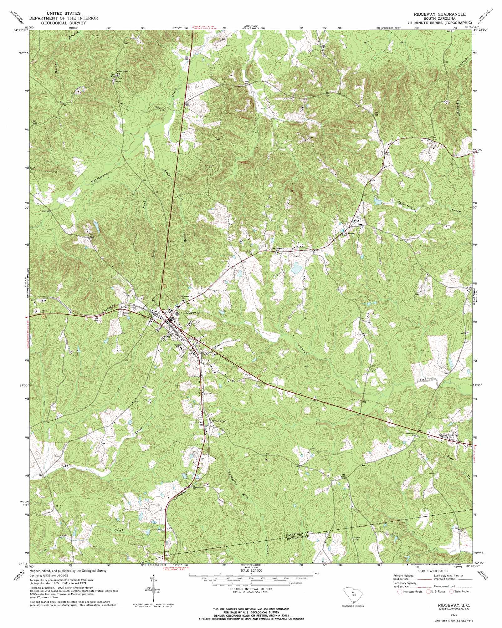
Ridgeway Topo Map South Carolina
To zoom in, hover over the map of Ridgeway
USGS Topo Quad 34080c8 - 1:24,000 scale
| Topo Map Name: | Ridgeway |
| USGS Topo Quad ID: | 34080c8 |
| Print Size: | ca. 21 1/4" wide x 27" high |
| Southeast Coordinates: | 34.25° N latitude / 80.875° W longitude |
| Map Center Coordinates: | 34.3125° N latitude / 80.9375° W longitude |
| U.S. State: | SC |
| Filename: | o34080c8.jpg |
| Download Map JPG Image: | Ridgeway topo map 1:24,000 scale |
| Map Type: | Topographic |
| Topo Series: | 7.5´ |
| Map Scale: | 1:24,000 |
| Source of Map Images: | United States Geological Survey (USGS) |
| Alternate Map Versions: |
Ridgeway SC 1971, updated 1972 Download PDF Buy paper map Ridgeway SC 2011 Download PDF Buy paper map Ridgeway SC 2014 Download PDF Buy paper map |
1:24,000 Topo Quads surrounding Ridgeway
Blackstock |
Stover |
Great Falls |
Lancaster Se |
Heath Springs |
Lebanon |
Winnsboro |
Flint Hill |
Liberty Hill |
Whiteoak Creek |
Rion |
Winnsboro Mills |
Ridgeway |
Longtown |
Rabon Crossroads |
Richtex |
Irmo Ne |
Blythewood |
Elgin |
Lugoff |
Irmo |
Columbia North |
Fort Jackson North |
Messers Pond |
Leesburg |
> Back to 34080a1 at 1:100,000 scale
> Back to 34080a1 at 1:250,000 scale
> Back to U.S. Topo Maps home
Ridgeway topo map: Gazetteer
Ridgeway: Crossings
Interchange 34 elevation 161m 528′Ridgeway: Dams
Brown Pond Dam D-1591 elevation 135m 442′South Carolina Noname 20023 D-0533 Dam elevation 161m 528′
Ridgeway: Parks
Ridgeway Historic District elevation 194m 636′Ridgeway: Populated Places
Ridgeway elevation 188m 616′Smallwood elevation 179m 587′
Ridgeway: Streams
Cedar Fork elevation 88m 288′Lots Fork elevation 91m 298′
Ridgeway digital topo map on disk
Buy this Ridgeway topo map showing relief, roads, GPS coordinates and other geographical features, as a high-resolution digital map file on DVD:
South Carolina, Western North Carolina & Northeastern Georgia
Buy digital topo maps: South Carolina, Western North Carolina & Northeastern Georgia