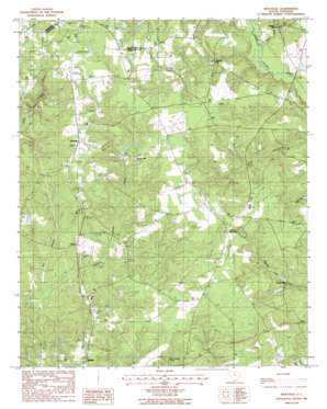
Westville Topo Map South Carolina
To zoom in, hover over the map of Westville
USGS Topo Quad 34080d5 - 1:24,000 scale
| Topo Map Name: | Westville |
| USGS Topo Quad ID: | 34080d5 |
| Print Size: | ca. 21 1/4" wide x 27" high |
| Southeast Coordinates: | 34.375° N latitude / 80.5° W longitude |
| Map Center Coordinates: | 34.4375° N latitude / 80.5625° W longitude |
| U.S. State: | SC |
| Filename: | o34080d5.jpg |
| Download Map JPG Image: | Westville topo map 1:24,000 scale |
| Map Type: | Topographic |
| Topo Series: | 7.5´ |
| Map Scale: | 1:24,000 |
| Source of Map Images: | United States Geological Survey (USGS) |
| Alternate Map Versions: |
Westville SC 1988, updated 1988 Download PDF Buy paper map Westville SC 2011 Download PDF Buy paper map Westville SC 2014 Download PDF Buy paper map |
1:24,000 Topo Quads surrounding Westville
> Back to 34080a1 at 1:100,000 scale
> Back to 34080a1 at 1:250,000 scale
> Back to U.S. Topo Maps home
Westville topo map: Gazetteer
Westville: Airports
Kershaw Airport (historical) elevation 143m 469′Westville: Bridges
Houghs Bridge elevation 87m 285′Westville: Dams
Bowers Pond Dam D-2499 elevation 101m 331′George West Pond Dam D-1332 elevation 141m 462′
Westville: Populated Places
Barfield Mill elevation 116m 380′Clyburn elevation 102m 334′
Dekalb elevation 125m 410′
Gaston Mill elevation 110m 360′
Jordan Mill elevation 106m 347′
Kirkley Mill elevation 94m 308′
Lockhart Oil Field elevation 128m 419′
Westville elevation 139m 456′
Westville: Reservoirs
Bowers Pond elevation 101m 331′George West Pond elevation 141m 462′
Westville: Streams
Gates Ford Branch elevation 88m 288′Westville digital topo map on disk
Buy this Westville topo map showing relief, roads, GPS coordinates and other geographical features, as a high-resolution digital map file on DVD:
South Carolina, Western North Carolina & Northeastern Georgia
Buy digital topo maps: South Carolina, Western North Carolina & Northeastern Georgia


