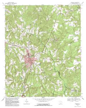
Kershaw Topo Map South Carolina
To zoom in, hover over the map of Kershaw
USGS Topo Quad 34080e5 - 1:24,000 scale
| Topo Map Name: | Kershaw |
| USGS Topo Quad ID: | 34080e5 |
| Print Size: | ca. 21 1/4" wide x 27" high |
| Southeast Coordinates: | 34.5° N latitude / 80.5° W longitude |
| Map Center Coordinates: | 34.5625° N latitude / 80.5625° W longitude |
| U.S. State: | SC |
| Filename: | o34080e5.jpg |
| Download Map JPG Image: | Kershaw topo map 1:24,000 scale |
| Map Type: | Topographic |
| Topo Series: | 7.5´ |
| Map Scale: | 1:24,000 |
| Source of Map Images: | United States Geological Survey (USGS) |
| Alternate Map Versions: |
Kershaw SC 1969, updated 1971 Download PDF Buy paper map Kershaw SC 1969, updated 1981 Download PDF Buy paper map Kershaw SC 1969, updated 1989 Download PDF Buy paper map Kershaw SC 2011 Download PDF Buy paper map Kershaw SC 2014 Download PDF Buy paper map |
1:24,000 Topo Quads surrounding Kershaw
> Back to 34080e1 at 1:100,000 scale
> Back to 34080a1 at 1:250,000 scale
> Back to U.S. Topo Maps home
Kershaw topo map: Gazetteer
Kershaw: Bridges
Youngs Bridge elevation 97m 318′Kershaw: Dams
Arthur Jones Pond D-1775 Dam elevation 119m 390′Baxley Pond Dam D-1782 elevation 150m 492′
Kershaw City Reservoir Dam D-1781 elevation 111m 364′
Lindenzwieg Pond Dam D-1783 elevation 128m 419′
Taylors Pond Dam D-1780 elevation 127m 416′
Kershaw: Mines
Haile Gold Mine elevation 132m 433′Kershaw: Parks
East Richland Street - East Church Street Historic District elevation 161m 528′Matson Street Historic District elevation 161m 528′
Stevens Acres elevation 125m 410′
Stevens Park elevation 159m 521′
Kershaw: Populated Places
Abney Crossroads elevation 123m 403′Kershaw elevation 159m 521′
Midway elevation 163m 534′
Midway Crossroads elevation 163m 534′
Pleasant Plain elevation 187m 613′
Kershaw: Post Offices
Kershaw Post Office elevation 160m 524′Kershaw: Reservoirs
Baxley Pond elevation 150m 492′City Reservoir elevation 111m 364′
Kirkleys Mill Pond (historical) elevation 95m 311′
Lindenzwiegs Pond elevation 128m 419′
Taylors Pond elevation 127m 416′
Kershaw: Streams
Baskins Creek elevation 127m 416′Blackman Branch elevation 127m 416′
Camp Branch elevation 109m 357′
Haile Gold Mine Creek elevation 106m 347′
Hanging Rock Creek elevation 91m 298′
Horton Creek elevation 112m 367′
Lick Creek elevation 110m 360′
Mill Creek elevation 112m 367′
Neds Creek elevation 100m 328′
Kershaw digital topo map on disk
Buy this Kershaw topo map showing relief, roads, GPS coordinates and other geographical features, as a high-resolution digital map file on DVD:
South Carolina, Western North Carolina & Northeastern Georgia
Buy digital topo maps: South Carolina, Western North Carolina & Northeastern Georgia


