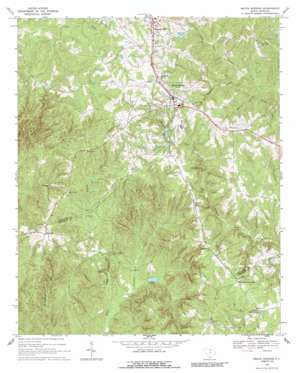
Heath Springs Topo Map South Carolina
To zoom in, hover over the map of Heath Springs
USGS Topo Quad 34080e6 - 1:24,000 scale
| Topo Map Name: | Heath Springs |
| USGS Topo Quad ID: | 34080e6 |
| Print Size: | ca. 21 1/4" wide x 27" high |
| Southeast Coordinates: | 34.5° N latitude / 80.625° W longitude |
| Map Center Coordinates: | 34.5625° N latitude / 80.6875° W longitude |
| U.S. State: | SC |
| Filename: | o34080e6.jpg |
| Download Map JPG Image: | Heath Springs topo map 1:24,000 scale |
| Map Type: | Topographic |
| Topo Series: | 7.5´ |
| Map Scale: | 1:24,000 |
| Source of Map Images: | United States Geological Survey (USGS) |
| Alternate Map Versions: |
Heath Springs SC 1968, updated 1971 Download PDF Buy paper map Heath Springs SC 1968, updated 1988 Download PDF Buy paper map Heath Springs SC 2011 Download PDF Buy paper map Heath Springs SC 2014 Download PDF Buy paper map |
1:24,000 Topo Quads surrounding Heath Springs
> Back to 34080e1 at 1:100,000 scale
> Back to 34080a1 at 1:250,000 scale
> Back to U.S. Topo Maps home
Heath Springs topo map: Gazetteer
Heath Springs: Dams
Brewers Pond Dam D-1752 elevation 101m 331′Bridges Pond Dam D-1773 elevation 210m 688′
Honkers Lake Dam D-3183 elevation 152m 498′
Pool J Dam D-3182 elevation 156m 511′
South Carolina Noname 29002 D-1774 Dam elevation 192m 629′
Heath Springs: Falls
Cedar Falls elevation 115m 377′Heath Springs: Pillars
Hanging Rock elevation 152m 498′Heath Springs: Populated Places
Anvil Rock elevation 203m 666′Coats Crossroad elevation 163m 534′
Heath Springs elevation 208m 682′
Oakhurst elevation 199m 652′
Pleasant Hill elevation 219m 718′
Robinson Crossroad elevation 176m 577′
Stoneboro elevation 175m 574′
Heath Springs: Post Offices
Heath Springs Post Office elevation 208m 682′Heath Springs: Reservoirs
Pool J elevation 156m 511′Sunrise Lake elevation 192m 629′
Heath Springs: Streams
Beckham Branch elevation 145m 475′Dye Mill Branch elevation 136m 446′
Little Lynches Creek elevation 136m 446′
Mobley Branch elevation 136m 446′
Tranham Creek elevation 93m 305′
Heath Springs: Valleys
Brewer Gully elevation 100m 328′Heath Springs digital topo map on disk
Buy this Heath Springs topo map showing relief, roads, GPS coordinates and other geographical features, as a high-resolution digital map file on DVD:
South Carolina, Western North Carolina & Northeastern Georgia
Buy digital topo maps: South Carolina, Western North Carolina & Northeastern Georgia


