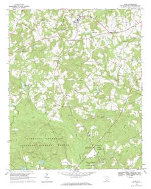
Ruby Topo Map South Carolina
To zoom in, hover over the map of Ruby
USGS Topo Quad 34080f2 - 1:24,000 scale
| Topo Map Name: | Ruby |
| USGS Topo Quad ID: | 34080f2 |
| Print Size: | ca. 21 1/4" wide x 27" high |
| Southeast Coordinates: | 34.625° N latitude / 80.125° W longitude |
| Map Center Coordinates: | 34.6875° N latitude / 80.1875° W longitude |
| U.S. State: | SC |
| Filename: | o34080f2.jpg |
| Download Map JPG Image: | Ruby topo map 1:24,000 scale |
| Map Type: | Topographic |
| Topo Series: | 7.5´ |
| Map Scale: | 1:24,000 |
| Source of Map Images: | United States Geological Survey (USGS) |
| Alternate Map Versions: |
Ruby SC 1968, updated 1970 Download PDF Buy paper map Ruby SC 2011 Download PDF Buy paper map Ruby SC 2014 Download PDF Buy paper map |
1:24,000 Topo Quads surrounding Ruby
> Back to 34080e1 at 1:100,000 scale
> Back to 34080a1 at 1:250,000 scale
> Back to U.S. Topo Maps home
Ruby topo map: Gazetteer
Ruby: Dams
Douglass Millpond Dam D-3192 elevation 88m 288′South Carolina Noname 13020 D-3190 Dam elevation 103m 337′
South Carolina Noname 13021 D-3191 Dam elevation 97m 318′
South Carolina Noname 13043 D-3189 Dam elevation 100m 328′
South Carolina Noname 13058 D-3188 Dam elevation 91m 298′
Ruby: Gaps
The Narrow Passage elevation 112m 367′Ruby: Pillars
Johnsons Rock elevation 120m 393′Ruby: Populated Places
Campbell Crossroads elevation 105m 344′Lees Crossroads elevation 114m 374′
Ruby elevation 116m 380′
Ruby: Reservoirs
Douglass Millpond elevation 88m 288′Pool K elevation 103m 337′
Pool L elevation 97m 318′
Sellers Pond elevation 91m 298′
Woodard Millpond elevation 104m 341′
Woodward Millpond elevation 100m 328′
Ruby: Streams
Bay Springs Branch elevation 71m 232′Canal Branch elevation 93m 305′
Dead Pine Branch elevation 97m 318′
Hogpen Branch elevation 99m 324′
Horsepen Branch elevation 64m 209′
Jessies Branch elevation 99m 324′
Little Black Creek elevation 94m 308′
Little Skipper Creek elevation 97m 318′
Mill Branch elevation 74m 242′
North Prong Big Bear Creek elevation 74m 242′
Peeled Oak Branch elevation 106m 347′
Pitt Branch elevation 99m 324′
Polecat Branch elevation 76m 249′
Poplar Branch elevation 90m 295′
Rattlesnake Branch elevation 100m 328′
Ruby digital topo map on disk
Buy this Ruby topo map showing relief, roads, GPS coordinates and other geographical features, as a high-resolution digital map file on DVD:
South Carolina, Western North Carolina & Northeastern Georgia
Buy digital topo maps: South Carolina, Western North Carolina & Northeastern Georgia


