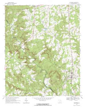
Jefferson Topo Map South Carolina
To zoom in, hover over the map of Jefferson
USGS Topo Quad 34080f4 - 1:24,000 scale
| Topo Map Name: | Jefferson |
| USGS Topo Quad ID: | 34080f4 |
| Print Size: | ca. 21 1/4" wide x 27" high |
| Southeast Coordinates: | 34.625° N latitude / 80.375° W longitude |
| Map Center Coordinates: | 34.6875° N latitude / 80.4375° W longitude |
| U.S. State: | SC |
| Filename: | o34080f4.jpg |
| Download Map JPG Image: | Jefferson topo map 1:24,000 scale |
| Map Type: | Topographic |
| Topo Series: | 7.5´ |
| Map Scale: | 1:24,000 |
| Source of Map Images: | United States Geological Survey (USGS) |
| Alternate Map Versions: |
Jefferson SC 1968, updated 1971 Download PDF Buy paper map Jefferson SC 2011 Download PDF Buy paper map Jefferson SC 2014 Download PDF Buy paper map |
1:24,000 Topo Quads surrounding Jefferson
> Back to 34080e1 at 1:100,000 scale
> Back to 34080a1 at 1:250,000 scale
> Back to U.S. Topo Maps home
Jefferson topo map: Gazetteer
Jefferson: Crossings
Griffins Ford elevation 87m 285′McManns Ford elevation 103m 337′
Jefferson: Dams
Ethel Plyler Pond Dam D-3171 elevation 167m 547′Terry Lake Dam D-3172 elevation 152m 498′
Jefferson: Lakes
Plyler Pond elevation 167m 547′Jefferson: Populated Places
Birdtown elevation 107m 351′Five Forks elevation 208m 682′
Jefferson elevation 136m 446′
White Plains elevation 188m 616′
Jefferson: Streams
Arant Branch elevation 103m 337′Belk Branch elevation 101m 331′
Canal Branch elevation 104m 341′
Cedar Falls Branch elevation 101m 331′
Dry Creek elevation 91m 298′
Flat Creek elevation 83m 272′
Horton Spring Branch elevation 114m 374′
Joes Branch elevation 91m 298′
Lick Run elevation 100m 328′
Little Fork Creek elevation 87m 285′
Meeting House Branch elevation 96m 314′
Mill Branch elevation 108m 354′
Mill Branch elevation 99m 324′
Mose Branch elevation 106m 347′
Reedy Fork elevation 168m 551′
Rocky Branch elevation 97m 318′
Shop Branch elevation 103m 337′
Turkey Creek elevation 103m 337′
Jefferson digital topo map on disk
Buy this Jefferson topo map showing relief, roads, GPS coordinates and other geographical features, as a high-resolution digital map file on DVD:
South Carolina, Western North Carolina & Northeastern Georgia
Buy digital topo maps: South Carolina, Western North Carolina & Northeastern Georgia


