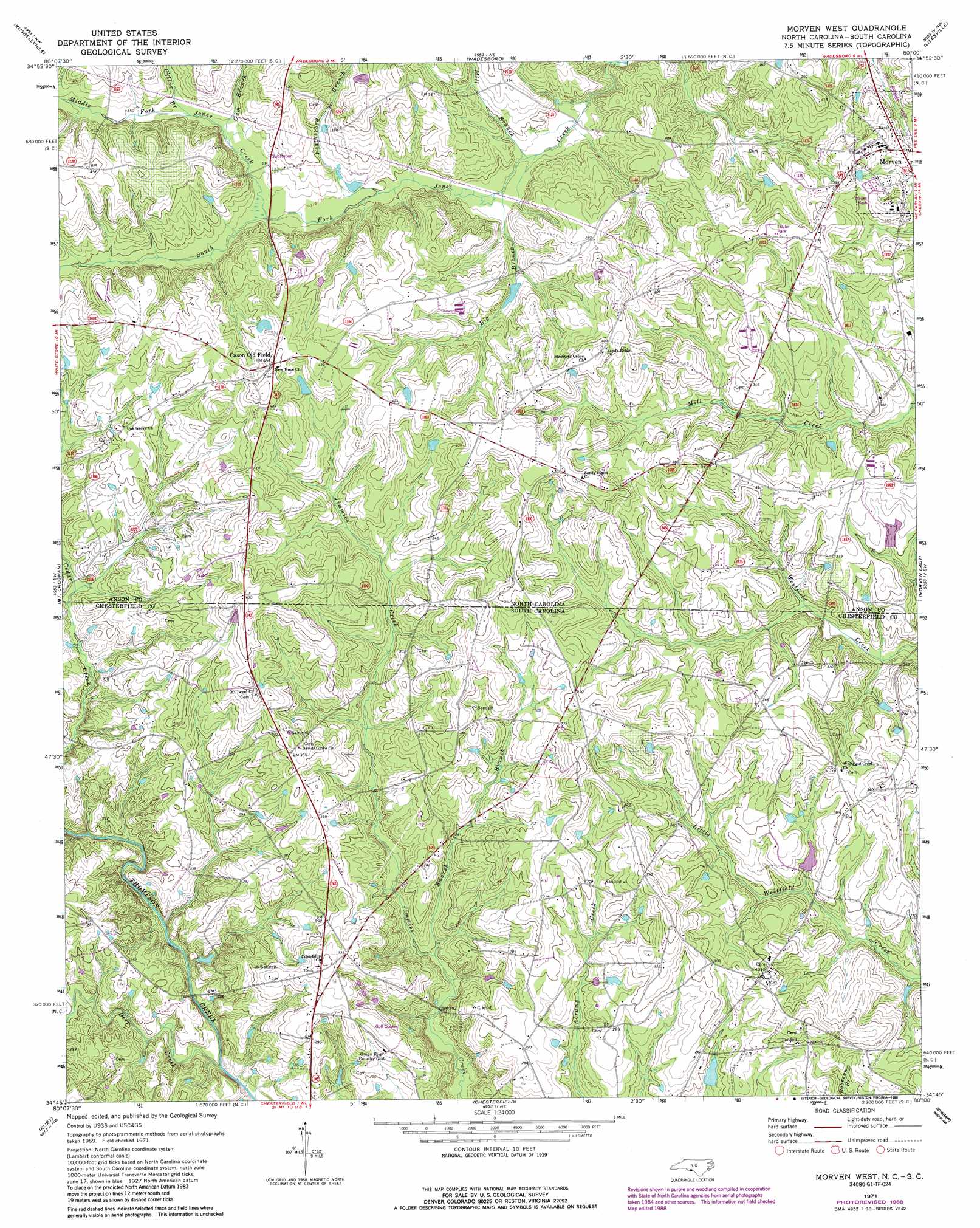
Morven West Topo Map North Carolina
To zoom in, hover over the map of Morven West
USGS Topo Quad 34080g1 - 1:24,000 scale
| Topo Map Name: | Morven West |
| USGS Topo Quad ID: | 34080g1 |
| Print Size: | ca. 21 1/4" wide x 27" high |
| Southeast Coordinates: | 34.75° N latitude / 80° W longitude |
| Map Center Coordinates: | 34.8125° N latitude / 80.0625° W longitude |
| U.S. States: | NC, SC |
| Filename: | o34080g1.jpg |
| Download Map JPG Image: | Morven West topo map 1:24,000 scale |
| Map Type: | Topographic |
| Topo Series: | 7.5´ |
| Map Scale: | 1:24,000 |
| Source of Map Images: | United States Geological Survey (USGS) |
| Alternate Map Versions: |
Morven West NC 1971, updated 1973 Download PDF Buy paper map Morven West NC 1971, updated 1988 Download PDF Buy paper map Morven West NC 2011 Download PDF Buy paper map Morven West NC 2013 Download PDF Buy paper map Morven West NC 2016 Download PDF Buy paper map |
1:24,000 Topo Quads surrounding Morven West
Olive Branch |
Polkton |
Ansonville |
Mangum |
Ellerbe |
Marshville |
Russellville |
Wadesboro |
Lilesville |
Rockingham |
Hornsboro |
Mount Croghan |
Morven West |
Morven East |
Diggs |
Jefferson Ne |
Ruby |
Chesterfield |
Cheraw |
Wallace |
Angelus |
Middendorf |
Patrick |
Cash |
Society Hill |
> Back to 34080e1 at 1:100,000 scale
> Back to 34080a1 at 1:250,000 scale
> Back to U.S. Topo Maps home
Morven West topo map: Gazetteer
Morven West: Dams
Crawford Lake Dam elevation 93m 305′Moran McLendon Pond Dam elevation 96m 314′
Teals Pond Dam D-3203 elevation 73m 239′
Morven West: Populated Places
Cason Old Field elevation 139m 456′Jones Creek (historical) elevation 97m 318′
Morven elevation 109m 357′
Morven West: Reservoirs
Crawford Lake elevation 93m 305′Moran McLendon Pond elevation 96m 314′
Morven West: Streams
Big Branch elevation 84m 275′Childs Branch elevation 101m 331′
Deep Creek elevation 64m 209′
Featherbed Branch elevation 91m 298′
Gum Branch elevation 99m 324′
Little Cedar Creek elevation 55m 180′
Middle Fork Jones Creek elevation 97m 318′
Mill Branch elevation 82m 269′
Smarsh Branch elevation 65m 213′
Morven West digital topo map on disk
Buy this Morven West topo map showing relief, roads, GPS coordinates and other geographical features, as a high-resolution digital map file on DVD:
South Carolina, Western North Carolina & Northeastern Georgia
Buy digital topo maps: South Carolina, Western North Carolina & Northeastern Georgia