Hornsboro Topo Map South Carolina
To zoom in, hover over the map of Hornsboro
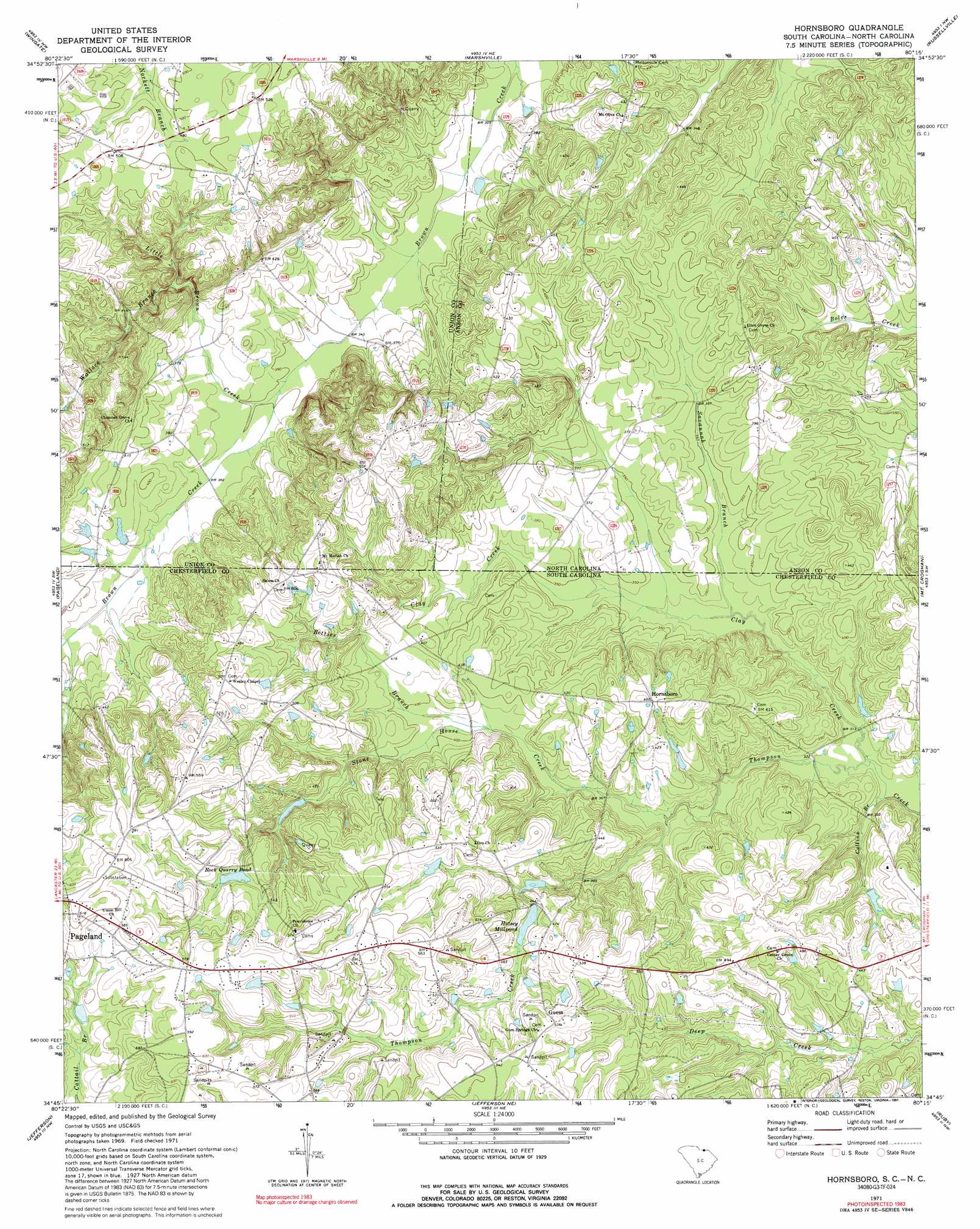
USGS Topo Quad 34080g3 - 1:24,000 scale
| Topo Map Name: | Hornsboro |
| USGS Topo Quad ID: | 34080g3 |
| Print Size: | ca. 21 1/4" wide x 27" high |
| Southeast Coordinates: | 34.75° N latitude / 80.25° W longitude |
| Map Center Coordinates: | 34.8125° N latitude / 80.3125° W longitude |
| U.S. States: | SC, NC |
| Filename: | o34080g3.jpg |
| Download Map JPG Image: | Hornsboro topo map 1:24,000 scale |
| Map Type: | Topographic |
| Topo Series: | 7.5´ |
| Map Scale: | 1:24,000 |
| Source of Map Images: | United States Geological Survey (USGS) |
| Alternate Map Versions: |
Hornsboro SC 1971, updated 1973 Download PDF Buy paper map Hornsboro SC 1971, updated 1991 Download PDF Buy paper map Hornsboro SC 2011 Download PDF Buy paper map Hornsboro SC 2014 Download PDF Buy paper map |
1:24,000 Topo Quads surrounding Hornsboro
Bakers |
Watson |
Olive Branch |
Polkton |
Ansonville |
Monroe |
Wingate |
Marshville |
Russellville |
Wadesboro |
Tradesville |
Pageland |
Hornsboro |
Mount Croghan |
Morven West |
Taxahaw |
Jefferson |
Jefferson Ne |
Ruby |
Chesterfield |
Kershaw |
Mount Pisgah |
Angelus |
Middendorf |
Patrick |
> Back to 34080e1 at 1:100,000 scale
> Back to 34080a1 at 1:250,000 scale
> Back to U.S. Topo Maps home
Hornsboro topo map: Gazetteer
Hornsboro: Dams
Hursey Millpond Dam D-3173 elevation 136m 446′Jordan Pond Dam D-1820 elevation 133m 436′
Rivers Pond Dam D-3174 elevation 114m 374′
Hornsboro: Populated Places
Hornsboro elevation 137m 449′Mangums (historical) elevation 168m 551′
Maynards elevation 140m 459′
Hornsboro: Reservoirs
Hutsey Millpond elevation 134m 439′Rock Quarry Pond elevation 153m 501′
Hornsboro: Streams
Betties Branch elevation 117m 383′Clay Creek elevation 94m 308′
Clay Creek elevation 94m 308′
Collins Branch elevation 92m 301′
Little Brown Creek elevation 105m 344′
Savannah Branch elevation 97m 318′
Savannah Branch elevation 97m 318′
Stone House Creek elevation 106m 347′
Wallace Branch elevation 119m 390′
Hornsboro digital topo map on disk
Buy this Hornsboro topo map showing relief, roads, GPS coordinates and other geographical features, as a high-resolution digital map file on DVD:
South Carolina, Western North Carolina & Northeastern Georgia
Buy digital topo maps: South Carolina, Western North Carolina & Northeastern Georgia