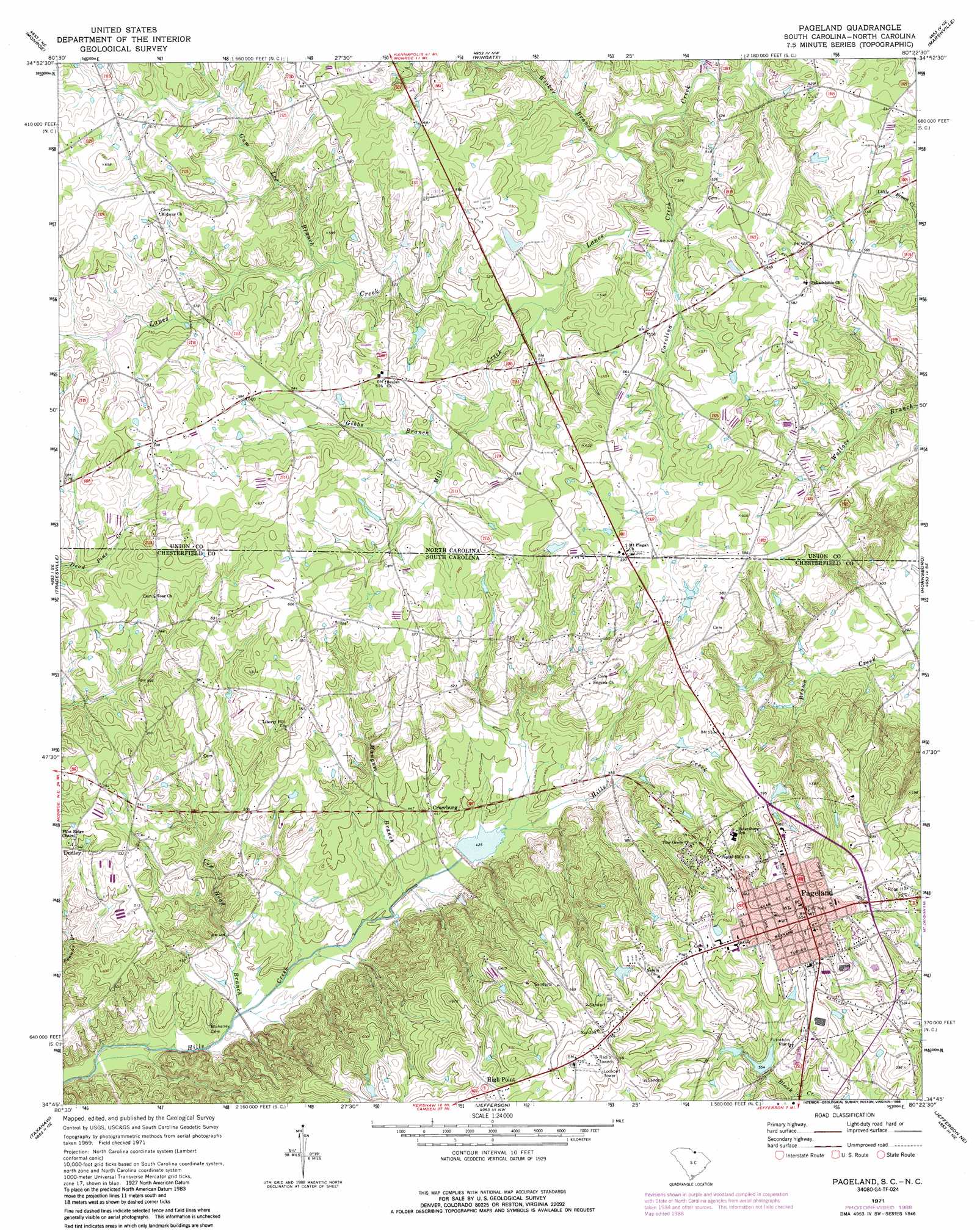
Pageland Topo Map South Carolina
To zoom in, hover over the map of Pageland
USGS Topo Quad 34080g4 - 1:24,000 scale
| Topo Map Name: | Pageland |
| USGS Topo Quad ID: | 34080g4 |
| Print Size: | ca. 21 1/4" wide x 27" high |
| Southeast Coordinates: | 34.75° N latitude / 80.375° W longitude |
| Map Center Coordinates: | 34.8125° N latitude / 80.4375° W longitude |
| U.S. States: | SC, NC |
| Filename: | o34080g4.jpg |
| Download Map JPG Image: | Pageland topo map 1:24,000 scale |
| Map Type: | Topographic |
| Topo Series: | 7.5´ |
| Map Scale: | 1:24,000 |
| Source of Map Images: | United States Geological Survey (USGS) |
| Alternate Map Versions: |
Pageland SC 1971, updated 1973 Download PDF Buy paper map Pageland SC 1971, updated 1988 Download PDF Buy paper map Pageland SC 2011 Download PDF Buy paper map Pageland SC 2014 Download PDF Buy paper map |
1:24,000 Topo Quads surrounding Pageland
Matthews |
Bakers |
Watson |
Olive Branch |
Polkton |
Waxhaw |
Monroe |
Wingate |
Marshville |
Russellville |
Unity |
Tradesville |
Pageland |
Hornsboro |
Mount Croghan |
Antioch |
Taxahaw |
Jefferson |
Jefferson Ne |
Ruby |
Heath Springs |
Kershaw |
Mount Pisgah |
Angelus |
Middendorf |
> Back to 34080e1 at 1:100,000 scale
> Back to 34080a1 at 1:250,000 scale
> Back to U.S. Topo Maps home
Pageland topo map: Gazetteer
Pageland: Dams
Collins Lake Dam elevation 164m 538′George Plyler Pond Dam D-1802 elevation 162m 531′
South Carolina Noname 13052 D-3168 Dam elevation 131m 429′
Town Pond Dam D-3170 elevation 168m 551′
Tuckers Pond Dam D-3169 elevation 170m 557′
Pageland: Populated Places
Crowburg elevation 135m 442′Dudley elevation 166m 544′
High Point elevation 209m 685′
Pageland elevation 198m 649′
Pageland: Post Offices
Pageland Post Office elevation 198m 649′Pageland: Reservoirs
Collins Lake elevation 164m 538′Hill Creek Watershed One Reservoir elevation 131m 429′
Pageland: Streams
Carolina Creek elevation 141m 462′Cow Head Branch elevation 115m 377′
Gibbs Branch elevation 156m 511′
Gum Log Branch elevation 158m 518′
Mangum Branch elevation 122m 400′
Mill Creek elevation 149m 488′
Wicker Branch elevation 144m 472′
Pageland digital topo map on disk
Buy this Pageland topo map showing relief, roads, GPS coordinates and other geographical features, as a high-resolution digital map file on DVD:
South Carolina, Western North Carolina & Northeastern Georgia
Buy digital topo maps: South Carolina, Western North Carolina & Northeastern Georgia