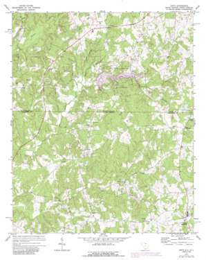
Unity Topo Map South Carolina
To zoom in, hover over the map of Unity
USGS Topo Quad 34080g6 - 1:24,000 scale
| Topo Map Name: | Unity |
| USGS Topo Quad ID: | 34080g6 |
| Print Size: | ca. 21 1/4" wide x 27" high |
| Southeast Coordinates: | 34.75° N latitude / 80.625° W longitude |
| Map Center Coordinates: | 34.8125° N latitude / 80.6875° W longitude |
| U.S. States: | SC, NC |
| Filename: | o34080g6.jpg |
| Download Map JPG Image: | Unity topo map 1:24,000 scale |
| Map Type: | Topographic |
| Topo Series: | 7.5´ |
| Map Scale: | 1:24,000 |
| Source of Map Images: | United States Geological Survey (USGS) |
| Alternate Map Versions: |
Unity SC 1971, updated 1973 Download PDF Buy paper map Unity SC 1971, updated 1988 Download PDF Buy paper map Unity SC 1971, updated 1988 Download PDF Buy paper map Unity SC 2011 Download PDF Buy paper map Unity SC 2014 Download PDF Buy paper map |
1:24,000 Topo Quads surrounding Unity
> Back to 34080e1 at 1:100,000 scale
> Back to 34080a1 at 1:250,000 scale
> Back to U.S. Topo Maps home
Unity topo map: Gazetteer
Unity: Airports
Jaars-Townsend Airport elevation 176m 577′Unity Aerodrome elevation 195m 639′
Unity: Dams
Belks Pond D-1766 Dam elevation 171m 561′Cane Creek Lake Dam elevation 165m 541′
Carnes Lake D-1768 Dam elevation 193m 633′
Cheek Lake Dam elevation 201m 659′
Lasley Pond Dam D-1765 elevation 153m 501′
Rowell Pond Dam D-1767 elevation 194m 636′
Unity: Parks
Cane Creek Park elevation 158m 518′Unity: Populated Places
Camp Creek elevation 191m 626′Doctor Sapps Crossroads elevation 199m 652′
Jaars elevation 173m 567′
Jackson elevation 195m 639′
Lingles Crossroads elevation 211m 692′
New Cut elevation 182m 597′
Sapps Crossroads elevation 201m 659′
Unity elevation 191m 626′
Walkersville (historical) elevation 172m 564′
Unity: Reservoirs
Belks Pond elevation 171m 561′Cane Creek Lake elevation 165m 541′
Cane Creek Watershed Site 16 elevation 177m 580′
Cane Creek Watershed Site Seven elevation 157m 515′
Carnes Lake elevation 193m 633′
Cheek Lake elevation 201m 659′
Rowells Pond elevation 194m 636′
Unity: Streams
Blue Branch elevation 155m 508′Booger Branch elevation 155m 508′
Missouri Branch elevation 161m 528′
North Prong Camp Creek elevation 155m 508′
Robin Branch elevation 158m 518′
Simpson Branch elevation 149m 488′
Simpson Branch elevation 152m 498′
South Prong Camp Creek elevation 152m 498′
Stewart Branch elevation 167m 547′
Unity Branch elevation 148m 485′
Unity digital topo map on disk
Buy this Unity topo map showing relief, roads, GPS coordinates and other geographical features, as a high-resolution digital map file on DVD:
South Carolina, Western North Carolina & Northeastern Georgia
Buy digital topo maps: South Carolina, Western North Carolina & Northeastern Georgia


