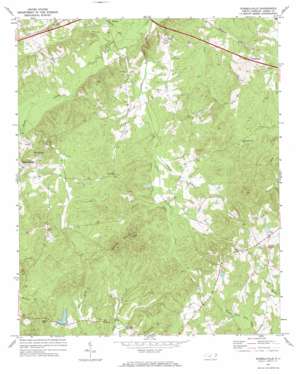
Russellville Topo Map North Carolina
To zoom in, hover over the map of Russellville
USGS Topo Quad 34080h2 - 1:24,000 scale
| Topo Map Name: | Russellville |
| USGS Topo Quad ID: | 34080h2 |
| Print Size: | ca. 21 1/4" wide x 27" high |
| Southeast Coordinates: | 34.875° N latitude / 80.125° W longitude |
| Map Center Coordinates: | 34.9375° N latitude / 80.1875° W longitude |
| U.S. State: | NC |
| Filename: | o34080h2.jpg |
| Download Map JPG Image: | Russellville topo map 1:24,000 scale |
| Map Type: | Topographic |
| Topo Series: | 7.5´ |
| Map Scale: | 1:24,000 |
| Source of Map Images: | United States Geological Survey (USGS) |
| Alternate Map Versions: |
Russellville NC 1971, updated 1973 Download PDF Buy paper map Russellville NC 2002, updated 2003 Download PDF Buy paper map Russellville NC 2010 Download PDF Buy paper map Russellville NC 2013 Download PDF Buy paper map Russellville NC 2016 Download PDF Buy paper map |
1:24,000 Topo Quads surrounding Russellville
> Back to 34080e1 at 1:100,000 scale
> Back to 34080a1 at 1:250,000 scale
> Back to U.S. Topo Maps home
Russellville topo map: Gazetteer
Russellville: Dams
Frank Little Pond Dam elevation 137m 449′Gaddys Pond Dam elevation 163m 534′
White Store Dam elevation 129m 423′
Russellville: Populated Places
Mineral Springs elevation 129m 423′Poplar Hill (historical) elevation 112m 367′
Russellville elevation 104m 341′
Travis elevation 145m 475′
Russellville: Reservoirs
Frank Little Pond elevation 137m 449′Gaddys Pond elevation 163m 534′
White Store Lake elevation 129m 423′
Russellville: Streams
Kelly Branch elevation 82m 269′Ledbetter Branch elevation 75m 246′
Leggett Branch elevation 94m 308′
Lick Creek elevation 82m 269′
Swans Branch elevation 76m 249′
Russellville: Summits
Becky Hill elevation 143m 469′Gordon Mountain elevation 190m 623′
Russellville digital topo map on disk
Buy this Russellville topo map showing relief, roads, GPS coordinates and other geographical features, as a high-resolution digital map file on DVD:
South Carolina, Western North Carolina & Northeastern Georgia
Buy digital topo maps: South Carolina, Western North Carolina & Northeastern Georgia


