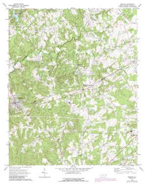
Waxhaw Topo Map North Carolina
To zoom in, hover over the map of Waxhaw
USGS Topo Quad 34080h6 - 1:24,000 scale
| Topo Map Name: | Waxhaw |
| USGS Topo Quad ID: | 34080h6 |
| Print Size: | ca. 21 1/4" wide x 27" high |
| Southeast Coordinates: | 34.875° N latitude / 80.625° W longitude |
| Map Center Coordinates: | 34.9375° N latitude / 80.6875° W longitude |
| U.S. State: | NC |
| Filename: | o34080h6.jpg |
| Download Map JPG Image: | Waxhaw topo map 1:24,000 scale |
| Map Type: | Topographic |
| Topo Series: | 7.5´ |
| Map Scale: | 1:24,000 |
| Source of Map Images: | United States Geological Survey (USGS) |
| Alternate Map Versions: |
Waxhaw NC 1970, updated 1973 Download PDF Buy paper map Waxhaw NC 1970, updated 1988 Download PDF Buy paper map Waxhaw NC 1970, updated 1988 Download PDF Buy paper map Waxhaw NC 2010 Download PDF Buy paper map Waxhaw NC 2013 Download PDF Buy paper map Waxhaw NC 2016 Download PDF Buy paper map |
1:24,000 Topo Quads surrounding Waxhaw
> Back to 34080e1 at 1:100,000 scale
> Back to 34080a1 at 1:250,000 scale
> Back to U.S. Topo Maps home
Waxhaw topo map: Gazetteer
Waxhaw: Airports
Aero Plantation Airport elevation 186m 610′Waxhaw: Dams
Aero Plantation Lake Dam Number One elevation 172m 564′Aero Plantation Lake Dam Number Two elevation 170m 557′
Efirds Lake Dam elevation 181m 593′
Waxhaw: Populated Places
Houston elevation 201m 659′Mineral Springs elevation 193m 633′
Union elevation 190m 623′
Waxhaw elevation 202m 662′
Waxhaw: Reservoirs
Aero Plantation Lake Number One elevation 172m 564′Aero Plantation Lake Number Two elevation 170m 557′
Efirds Lake elevation 181m 593′
Waxhaw: Streams
Bates Branch elevation 158m 518′Blythe Creek elevation 169m 554′
Culvert Branch elevation 168m 551′
Glen Branch elevation 180m 590′
Lee Branch elevation 182m 597′
Little Twelvemile Creek elevation 160m 524′
Machine Branch elevation 154m 505′
McNeely Branch elevation 171m 561′
Molly Branch elevation 165m 541′
Mundys Run elevation 160m 524′
Price Mill Creek elevation 164m 538′
Underwood Creek elevation 165m 541′
Waxhaw digital topo map on disk
Buy this Waxhaw topo map showing relief, roads, GPS coordinates and other geographical features, as a high-resolution digital map file on DVD:
South Carolina, Western North Carolina & Northeastern Georgia
Buy digital topo maps: South Carolina, Western North Carolina & Northeastern Georgia


