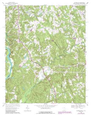
Catawba Ne Topo Map South Carolina
To zoom in, hover over the map of Catawba Ne
USGS Topo Quad 34080h7 - 1:24,000 scale
| Topo Map Name: | Catawba Ne |
| USGS Topo Quad ID: | 34080h7 |
| Print Size: | ca. 21 1/4" wide x 27" high |
| Southeast Coordinates: | 34.875° N latitude / 80.75° W longitude |
| Map Center Coordinates: | 34.9375° N latitude / 80.8125° W longitude |
| U.S. States: | SC, NC |
| Filename: | o34080h7.jpg |
| Download Map JPG Image: | Catawba Ne topo map 1:24,000 scale |
| Map Type: | Topographic |
| Topo Series: | 7.5´ |
| Map Scale: | 1:24,000 |
| Source of Map Images: | United States Geological Survey (USGS) |
| Alternate Map Versions: |
Catawba NE SC 1968, updated 1970 Download PDF Buy paper map Catawba NE SC 1968, updated 1975 Download PDF Buy paper map Catawba NE SC 1968, updated 1988 Download PDF Buy paper map Catawba NE SC 1968, updated 1989 Download PDF Buy paper map Catawba NE SC 2011 Download PDF Buy paper map Catawba NE SC 2014 Download PDF Buy paper map |
1:24,000 Topo Quads surrounding Catawba Ne
> Back to 34080e1 at 1:100,000 scale
> Back to 34080a1 at 1:250,000 scale
> Back to U.S. Topo Maps home
Catawba Ne topo map: Gazetteer
Catawba Ne: Bridges
Dobys Bridge elevation 145m 475′Catawba Ne: Dams
Bowers Pond D-1745 Dam elevation 168m 551′Jackson Pond Dam D-1751 elevation 198m 649′
Johnston Pond D-1746 Dam elevation 168m 551′
Nesbit Farms Incorporated Pond Number One D-1747 Dam elevation 152m 498′
Nesbit Farms Incorporated Pond Number Two D-1749 Dam elevation 145m 475′
Schewzyk Pond Dam D-1750 elevation 180m 590′
Wikoff Pond Dam D-1748 elevation 151m 495′
Catawba Ne: Populated Places
Belair elevation 193m 633′Black Horse Run elevation 192m 629′
Hancock elevation 168m 551′
Marvin elevation 208m 682′
Wolfville (historical) elevation 153m 501′
Catawba Ne: Reservoirs
Bowers Pond elevation 168m 551′Catawba Ne: Streams
Cow Branch elevation 167m 547′Cow Branch elevation 167m 547′
Cowhorn Branch elevation 168m 551′
East Fork Twelvemile Creek elevation 152m 498′
Long Branch elevation 157m 515′
Millstone Branch elevation 145m 475′
Morrison Branch elevation 143m 469′
Rone Branch elevation 142m 465′
Rone Branch elevation 142m 465′
Sixmile Creek elevation 147m 482′
Sugar Creek elevation 147m 482′
Tar Kiln Branch elevation 149m 488′
Tar Kiln Branch elevation 148m 485′
West Fork Twelvemile Creek elevation 151m 495′
Catawba Ne digital topo map on disk
Buy this Catawba Ne topo map showing relief, roads, GPS coordinates and other geographical features, as a high-resolution digital map file on DVD:
South Carolina, Western North Carolina & Northeastern Georgia
Buy digital topo maps: South Carolina, Western North Carolina & Northeastern Georgia


