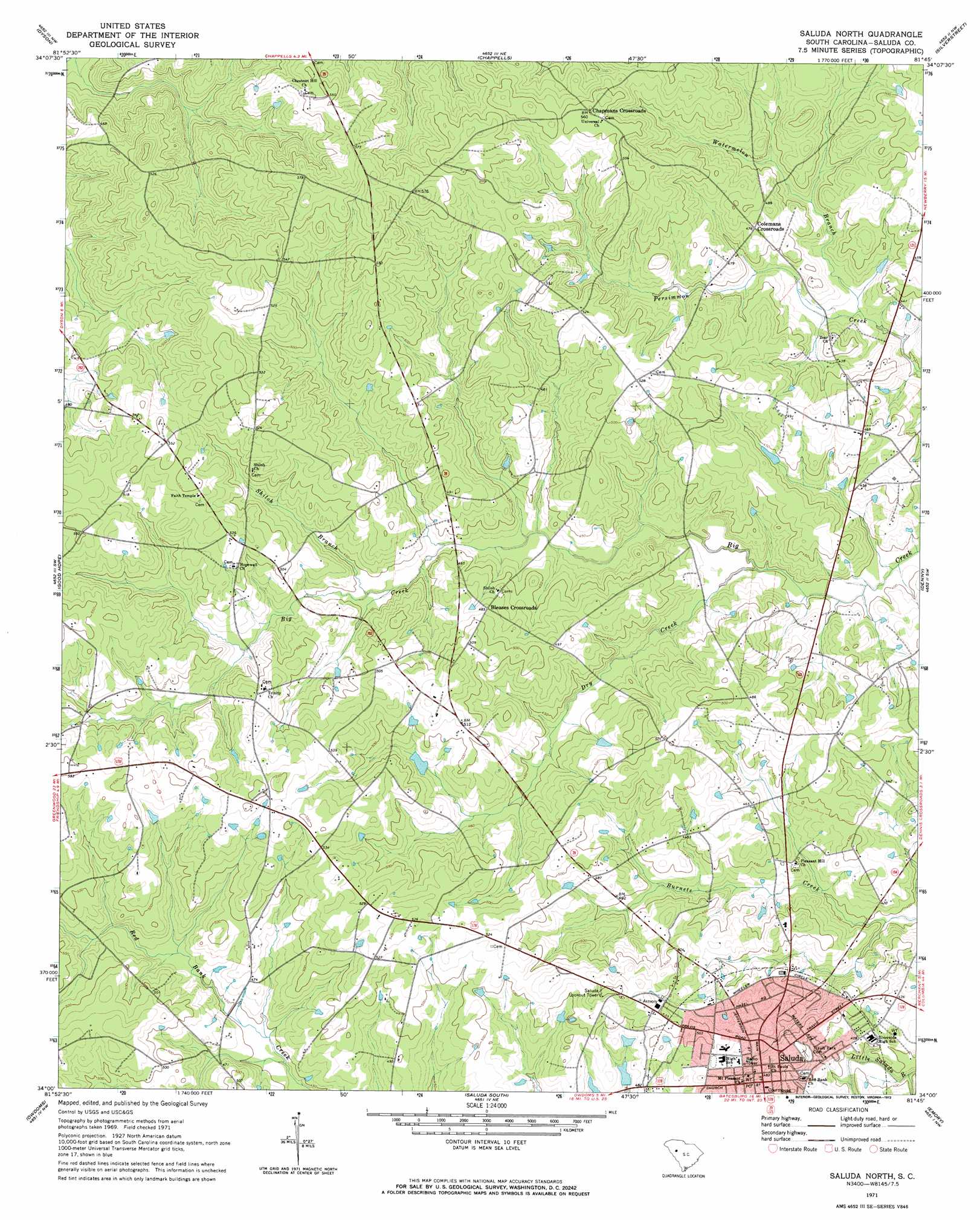
Saluda North Topo Map South Carolina
To zoom in, hover over the map of Saluda North
USGS Topo Quad 34081a7 - 1:24,000 scale
| Topo Map Name: | Saluda North |
| USGS Topo Quad ID: | 34081a7 |
| Print Size: | ca. 21 1/4" wide x 27" high |
| Southeast Coordinates: | 34° N latitude / 81.75° W longitude |
| Map Center Coordinates: | 34.0625° N latitude / 81.8125° W longitude |
| U.S. State: | SC |
| Filename: | o34081a7.jpg |
| Download Map JPG Image: | Saluda North topo map 1:24,000 scale |
| Map Type: | Topographic |
| Topo Series: | 7.5´ |
| Map Scale: | 1:24,000 |
| Source of Map Images: | United States Geological Survey (USGS) |
| Alternate Map Versions: |
Saluda North SC 1971, updated 1973 Download PDF Buy paper map Saluda North SC 2011 Download PDF Buy paper map Saluda North SC 2014 Download PDF Buy paper map |
1:24,000 Topo Quads surrounding Saluda North
Waterloo |
Cross Hill |
Bush River |
Newberry West |
Newberry East |
Ninety Six |
Dyson |
Chappells |
Silverstreet |
Prosperity |
Kirksey |
Good Hope |
Saluda North |
Denny |
Delmar |
Limestone |
Owdoms |
Saluda South |
Emory |
Batesburg |
Red Hill |
Edgefield |
Johnston |
Ridge Spring |
Monetta |
> Back to 34081a1 at 1:100,000 scale
> Back to 34080a1 at 1:250,000 scale
> Back to U.S. Topo Maps home
Saluda North topo map: Gazetteer
Saluda North: Airports
Scurry Airport elevation 133m 436′Saluda North: Dams
Felkels Pond Dam D-1149 elevation 139m 456′Wheelers Pond Dam D-1594 elevation 144m 472′
Saluda North: Populated Places
Big Creek elevation 156m 511′Bleases Crossroads elevation 147m 482′
Chapmans Crossroads elevation 170m 557′
Colemans Crossroads elevation 146m 479′
Saluda elevation 146m 479′
Saluda North: Post Offices
Saluda Post Office elevation 147m 482′Saluda North: Reservoirs
Felkels Pond elevation 139m 456′Wheelers Pond elevation 144m 472′
Saluda North: Streams
Dry Creek elevation 121m 396′Shiloh Branch elevation 134m 439′
Watermelon Branch elevation 124m 406′
Saluda North digital topo map on disk
Buy this Saluda North topo map showing relief, roads, GPS coordinates and other geographical features, as a high-resolution digital map file on DVD:
South Carolina, Western North Carolina & Northeastern Georgia
Buy digital topo maps: South Carolina, Western North Carolina & Northeastern Georgia