Little Mountain Topo Map South Carolina
To zoom in, hover over the map of Little Mountain
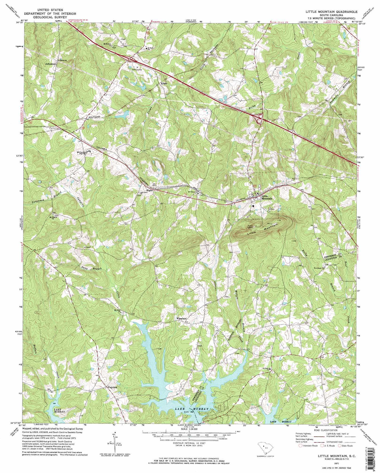
USGS Topo Quad 34081b4 - 1:24,000 scale
| Topo Map Name: | Little Mountain |
| USGS Topo Quad ID: | 34081b4 |
| Print Size: | ca. 21 1/4" wide x 27" high |
| Southeast Coordinates: | 34.125° N latitude / 81.375° W longitude |
| Map Center Coordinates: | 34.1875° N latitude / 81.4375° W longitude |
| U.S. State: | SC |
| Filename: | o34081b4.jpg |
| Download Map JPG Image: | Little Mountain topo map 1:24,000 scale |
| Map Type: | Topographic |
| Topo Series: | 7.5´ |
| Map Scale: | 1:24,000 |
| Source of Map Images: | United States Geological Survey (USGS) |
| Alternate Map Versions: |
Little Mountain SC 1971, updated 1974 Download PDF Buy paper map Little Mountain SC 1971, updated 1974 Download PDF Buy paper map Little Mountain SC 2011 Download PDF Buy paper map Little Mountain SC 2014 Download PDF Buy paper map |
1:24,000 Topo Quads surrounding Little Mountain
Newberry Nw |
Whitmire South |
Blair |
Salem Crossroads |
Lebanon |
Newberry West |
Newberry East |
Pomaria |
Jenkinsville |
Rion |
Silverstreet |
Prosperity |
Little Mountain |
Chapin |
Richtex |
Denny |
Delmar |
Lake Murray West |
Lake Murray East |
Irmo |
Emory |
Batesburg |
Gilbert |
Barr Lake |
Lexington |
> Back to 34081a1 at 1:100,000 scale
> Back to 34080a1 at 1:250,000 scale
> Back to U.S. Topo Maps home
Little Mountain topo map: Gazetteer
Little Mountain: Crossings
Interchange 82 elevation 150m 492′Interchange 85 elevation 127m 416′
Little Mountain: Dams
Eptings Pond D-1477 Dam elevation 133m 436′Little Mountain: Populated Places
Boland Crossroads (historical) elevation 133m 436′Fairview elevation 136m 446′
Kibler elevation 134m 439′
Little Mountain elevation 187m 613′
Slighs elevation 180m 590′
Wheeland elevation 126m 413′
Little Mountain: Reservoirs
Eptings Pond elevation 133m 436′Little Mountain: Streams
Millers Branch elevation 113m 370′Rocky Branch elevation 121m 396′
Snap Branch elevation 116m 380′
Stevens Creek elevation 111m 364′
Summers Branch elevation 83m 272′
Susannah Branch elevation 131m 429′
Little Mountain: Summits
Little Mountain elevation 244m 800′Little Mountain digital topo map on disk
Buy this Little Mountain topo map showing relief, roads, GPS coordinates and other geographical features, as a high-resolution digital map file on DVD:
South Carolina, Western North Carolina & Northeastern Georgia
Buy digital topo maps: South Carolina, Western North Carolina & Northeastern Georgia