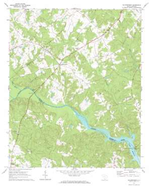
Silverstreet Topo Map South Carolina
To zoom in, hover over the map of Silverstreet
USGS Topo Quad 34081b6 - 1:24,000 scale
| Topo Map Name: | Silverstreet |
| USGS Topo Quad ID: | 34081b6 |
| Print Size: | ca. 21 1/4" wide x 27" high |
| Southeast Coordinates: | 34.125° N latitude / 81.625° W longitude |
| Map Center Coordinates: | 34.1875° N latitude / 81.6875° W longitude |
| U.S. State: | SC |
| Filename: | o34081b6.jpg |
| Download Map JPG Image: | Silverstreet topo map 1:24,000 scale |
| Map Type: | Topographic |
| Topo Series: | 7.5´ |
| Map Scale: | 1:24,000 |
| Source of Map Images: | United States Geological Survey (USGS) |
| Alternate Map Versions: |
Silverstreet SC 1971, updated 1973 Download PDF Buy paper map Silverstreet SC 2011 Download PDF Buy paper map Silverstreet SC 2014 Download PDF Buy paper map |
1:24,000 Topo Quads surrounding Silverstreet
> Back to 34081a1 at 1:100,000 scale
> Back to 34080a1 at 1:250,000 scale
> Back to U.S. Topo Maps home
Silverstreet topo map: Gazetteer
Silverstreet: Bridges
Higgins Bridge elevation 114m 374′Kempsons Ferry Bridge elevation 111m 364′
Silverstreet: Crossings
Bauknight Ferry (historical) elevation 110m 360′Kempsons Ferry (historical) elevation 111m 364′
Silverstreet: Dams
Cherokee Golf Pond Dam Number One D-3404 elevation 151m 495′Hendersons Pond D-1475 Dam elevation 139m 456′
R Colemans Pond Dam D=1203 elevation 152m 498′
South Carolina Noname 36001 D-1476 Dam elevation 133m 436′
W Colemans Pond Dam D-1204 elevation 125m 410′
Waldrops Pond D-1474 Dam elevation 139m 456′
Silverstreet: Populated Places
Deadfall Crossroads elevation 158m 518′Higgins elevation 162m 531′
Silverstreet elevation 150m 492′
Spearman (historical) elevation 157m 515′
Trinity elevation 165m 541′
Silverstreet: Reservoirs
R Colemans Pond elevation 152m 498′W Colemans Pond elevation 125m 410′
Silverstreet: Streams
Beaverdam Creek elevation 111m 364′Little River elevation 111m 364′
Rocky Branch elevation 112m 367′
Scott Creek elevation 118m 387′
Tosity Creek elevation 111m 364′
Welch Creek elevation 126m 413′
Silverstreet digital topo map on disk
Buy this Silverstreet topo map showing relief, roads, GPS coordinates and other geographical features, as a high-resolution digital map file on DVD:
South Carolina, Western North Carolina & Northeastern Georgia
Buy digital topo maps: South Carolina, Western North Carolina & Northeastern Georgia


