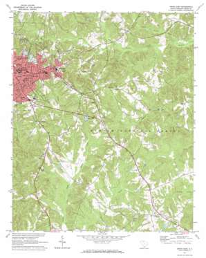
Union East Topo Map South Carolina
To zoom in, hover over the map of Union East
USGS Topo Quad 34081f5 - 1:24,000 scale
| Topo Map Name: | Union East |
| USGS Topo Quad ID: | 34081f5 |
| Print Size: | ca. 21 1/4" wide x 27" high |
| Southeast Coordinates: | 34.625° N latitude / 81.5° W longitude |
| Map Center Coordinates: | 34.6875° N latitude / 81.5625° W longitude |
| U.S. State: | SC |
| Filename: | o34081f5.jpg |
| Download Map JPG Image: | Union East topo map 1:24,000 scale |
| Map Type: | Topographic |
| Topo Series: | 7.5´ |
| Map Scale: | 1:24,000 |
| Source of Map Images: | United States Geological Survey (USGS) |
| Alternate Map Versions: |
Union East SC 1971, updated 1974 Download PDF Buy paper map Union East SC 2011 Download PDF Buy paper map Union East SC 2014 Download PDF Buy paper map |
| FStopo: | US Forest Service topo Union East is available: Download FStopo PDF Download FStopo TIF |
1:24,000 Topo Quads surrounding Union East
> Back to 34081e1 at 1:100,000 scale
> Back to 34080a1 at 1:250,000 scale
> Back to U.S. Topo Maps home
Union East topo map: Gazetteer
Union East: Dams
Foster Park Lake Dam D-2155 elevation 163m 534′Renumber Lake Dam D-2156 elevation 151m 495′
Union Water Works Pond Dam D-2154 elevation 169m 554′
Union East: Parks
East Main Street-Douglass Heights Historic District elevation 192m 629′Union Downtown Historic District elevation 187m 613′
Veterans Memorial park elevation 164m 538′
Union East: Populated Places
Carem elevation 178m 583′Gregory (historical) elevation 164m 538′
Meador (historical) elevation 125m 410′
Monarch elevation 191m 626′
New Hill elevation 171m 561′
Santuc elevation 161m 528′
South Hills elevation 193m 633′
Union elevation 196m 643′
Union East: Reservoirs
Foster Park Lake elevation 163m 534′Morres Lake elevation 151m 495′
Reno Lake elevation 150m 492′
Union Water Works Pond elevation 169m 554′
Union East: Streams
Big Browns Creek elevation 108m 354′Henry Creek elevation 123m 403′
Little Browns Creek elevation 108m 354′
Meng Creek elevation 122m 400′
Union East digital topo map on disk
Buy this Union East topo map showing relief, roads, GPS coordinates and other geographical features, as a high-resolution digital map file on DVD:
South Carolina, Western North Carolina & Northeastern Georgia
Buy digital topo maps: South Carolina, Western North Carolina & Northeastern Georgia


