Tirzah Topo Map South Carolina
To zoom in, hover over the map of Tirzah
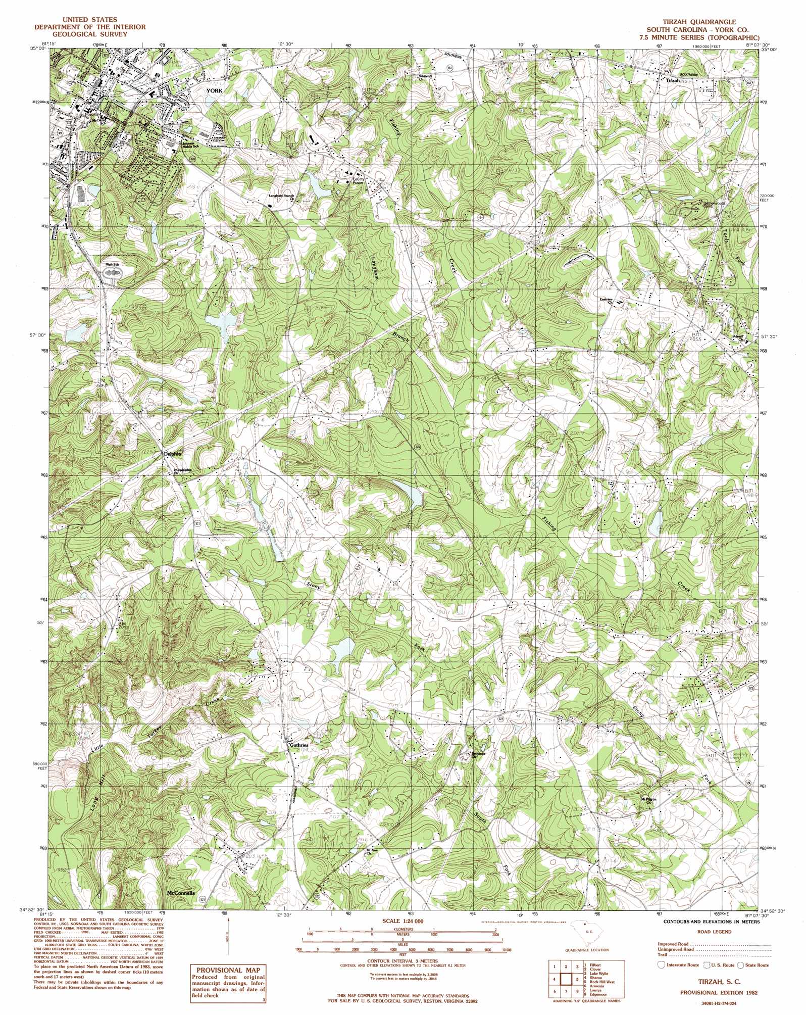
USGS Topo Quad 34081h2 - 1:24,000 scale
| Topo Map Name: | Tirzah |
| USGS Topo Quad ID: | 34081h2 |
| Print Size: | ca. 21 1/4" wide x 27" high |
| Southeast Coordinates: | 34.875° N latitude / 81.125° W longitude |
| Map Center Coordinates: | 34.9375° N latitude / 81.1875° W longitude |
| U.S. State: | SC |
| Filename: | o34081h2.jpg |
| Download Map JPG Image: | Tirzah topo map 1:24,000 scale |
| Map Type: | Topographic |
| Topo Series: | 7.5´ |
| Map Scale: | 1:24,000 |
| Source of Map Images: | United States Geological Survey (USGS) |
| Alternate Map Versions: |
Tirzah SC 1982, updated 1983 Download PDF Buy paper map Tirzah SC 2011 Download PDF Buy paper map Tirzah SC 2014 Download PDF Buy paper map |
1:24,000 Topo Quads surrounding Tirzah
Grover |
Kings Mountain |
Gastonia South |
Belmont |
Charlotte West |
Kings Creek |
Filbert |
Clover |
Lake Wylie |
Fort Mill |
Hickory Grove |
Sharon |
Tirzah |
Rock Hill West |
Rock Hill East |
Lockhart |
Armenia |
Lowrys |
Edgemoor |
Catawba |
Leeds |
Baton Rouge |
Chester |
Richburg |
Fort Lawn |
> Back to 34081e1 at 1:100,000 scale
> Back to 34080a1 at 1:250,000 scale
> Back to U.S. Topo Maps home
Tirzah topo map: Gazetteer
Tirzah: Dams
Daves Pond Dam D-3674 elevation 199m 652′South Carolina Noname 46009 D-3662 Dam elevation 195m 639′
South Carolina Noname 46010 D-3663 Dam elevation 195m 639′
South Carolina Noname 46011 D-3665 Dam elevation 188m 616′
South Carolina Noname 46012 D-3673 Dam elevation 181m 593′
South Carolina Noname 46013 D-3668 Dam elevation 170m 557′
South Carolina Noname 46021 D-3664 Dam elevation 201m 659′
South Carolina Noname 46026 D-3661 Dam elevation 197m 646′
Tirzah: Parks
York Historic District elevation 232m 761′Tirzah: Populated Places
Delphia elevation 225m 738′Forest Hills elevation 210m 688′
Guthries elevation 204m 669′
Musical Heights elevation 214m 702′
Pineview elevation 221m 725′
Tirzah elevation 213m 698′
Wooded Valley elevation 217m 711′
York elevation 232m 761′
Tirzah: Post Offices
York Post Office elevation 229m 751′Tirzah: Reservoirs
Cammeron Pond elevation 171m 561′Fishing Creek WCD Dam Number 50 elevation 181m 593′
Fishing Creek WCD Site Number Four elevation 170m 557′
Fishing Creek WCD Site Number Two elevation 195m 639′
Tirzah: Streams
Langham Branch elevation 173m 567′Tirzah: Summits
Long Hill elevation 184m 603′Tirzah digital topo map on disk
Buy this Tirzah topo map showing relief, roads, GPS coordinates and other geographical features, as a high-resolution digital map file on DVD:
South Carolina, Western North Carolina & Northeastern Georgia
Buy digital topo maps: South Carolina, Western North Carolina & Northeastern Georgia