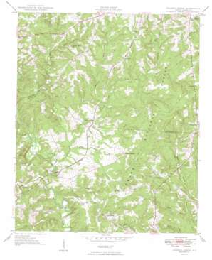
Calhoun Creek Topo Map South Carolina
To zoom in, hover over the map of Calhoun Creek
USGS Topo Quad 34082a4 - 1:24,000 scale
| Topo Map Name: | Calhoun Creek |
| USGS Topo Quad ID: | 34082a4 |
| Print Size: | ca. 21 1/4" wide x 27" high |
| Southeast Coordinates: | 34° N latitude / 82.375° W longitude |
| Map Center Coordinates: | 34.0625° N latitude / 82.4375° W longitude |
| U.S. State: | SC |
| Filename: | o34082a4.jpg |
| Download Map JPG Image: | Calhoun Creek topo map 1:24,000 scale |
| Map Type: | Topographic |
| Topo Series: | 7.5´ |
| Map Scale: | 1:24,000 |
| Source of Map Images: | United States Geological Survey (USGS) |
| Alternate Map Versions: |
Calhoun Creek SC 1949 Download PDF Buy paper map Calhoun Creek SC 2011 Download PDF Buy paper map Calhoun Creek SC 2014 Download PDF Buy paper map |
| FStopo: | US Forest Service topo Calhoun Creek is available: Download FStopo PDF Download FStopo TIF |
1:24,000 Topo Quads surrounding Calhoun Creek
> Back to 34082a1 at 1:100,000 scale
> Back to 34082a1 at 1:250,000 scale
> Back to U.S. Topo Maps home
Calhoun Creek topo map: Gazetteer
Calhoun Creek: Bridges
Mars Bridge elevation 105m 344′Calhoun Creek: Populated Places
Belcher Crossroads elevation 155m 508′Bethel elevation 185m 606′
Bethiah elevation 171m 561′
Calhoun Mill elevation 128m 419′
Charleston Crossroads elevation 143m 469′
Calhoun Creek: Streams
Bell Creek elevation 102m 334′Bowie Branch elevation 112m 367′
Calhoun Creek elevation 107m 351′
Hammond Branch elevation 131m 429′
Hartzog Branch elevation 107m 351′
Hillbern Creek elevation 112m 367′
Horton Branch elevation 117m 383′
Jim Knox Branch elevation 125m 410′
Lee Creek elevation 105m 344′
Lott Creek elevation 105m 344′
Morrah Branch elevation 118m 387′
Sawney Creek elevation 109m 357′
Tanyard Branch elevation 117m 383′
White Creek elevation 108m 354′
Calhoun Creek digital topo map on disk
Buy this Calhoun Creek topo map showing relief, roads, GPS coordinates and other geographical features, as a high-resolution digital map file on DVD:
South Carolina, Western North Carolina & Northeastern Georgia
Buy digital topo maps: South Carolina, Western North Carolina & Northeastern Georgia


