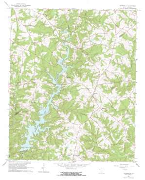
Antreville Topo Map South Carolina
To zoom in, hover over the map of Antreville
USGS Topo Quad 34082c5 - 1:24,000 scale
| Topo Map Name: | Antreville |
| USGS Topo Quad ID: | 34082c5 |
| Print Size: | ca. 21 1/4" wide x 27" high |
| Southeast Coordinates: | 34.25° N latitude / 82.5° W longitude |
| Map Center Coordinates: | 34.3125° N latitude / 82.5625° W longitude |
| U.S. State: | SC |
| Filename: | o34082c5.jpg |
| Download Map JPG Image: | Antreville topo map 1:24,000 scale |
| Map Type: | Topographic |
| Topo Series: | 7.5´ |
| Map Scale: | 1:24,000 |
| Source of Map Images: | United States Geological Survey (USGS) |
| Alternate Map Versions: |
Antreville SC 1964, updated 1965 Download PDF Buy paper map Antreville SC 2011 Download PDF Buy paper map Antreville SC 2014 Download PDF Buy paper map |
1:24,000 Topo Quads surrounding Antreville
> Back to 34082a1 at 1:100,000 scale
> Back to 34082a1 at 1:250,000 scale
> Back to U.S. Topo Maps home
Antreville topo map: Gazetteer
Antreville: Dams
H Patterson Pond Dam D-3030 elevation 196m 643′Hall Pond Dam D-3136 elevation 206m 675′
J W Wilson Pond Dam D-3031 elevation 190m 623′
R Watson Pond Dam D-3129 elevation 191m 626′
South Carolina Noname 01007 Dam elevation 171m 561′
W T Wilson Pond Dam D-3032 elevation 205m 672′
Antreville: Populated Places
Antreville elevation 220m 721′Lake Secession elevation 168m 551′
Storeville (historical) elevation 192m 629′
Antreville: Post Offices
Storeville Post Office (historical) elevation 192m 629′Antreville: Rapids
Lees Shoals elevation 166m 544′Antreville: Reservoirs
Secession Lake elevation 171m 561′Antreville: Streams
Bear Creek elevation 166m 544′Beaver Creek elevation 167m 547′
First Creek elevation 165m 541′
Governors Creek elevation 167m 547′
Hencoop Creek elevation 167m 547′
Jordan Creek elevation 171m 561′
Mulberry Creek elevation 167m 547′
Antreville digital topo map on disk
Buy this Antreville topo map showing relief, roads, GPS coordinates and other geographical features, as a high-resolution digital map file on DVD:
South Carolina, Western North Carolina & Northeastern Georgia
Buy digital topo maps: South Carolina, Western North Carolina & Northeastern Georgia


