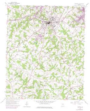
Hartwell Topo Map Georgia
To zoom in, hover over the map of Hartwell
USGS Topo Quad 34082c8 - 1:24,000 scale
| Topo Map Name: | Hartwell |
| USGS Topo Quad ID: | 34082c8 |
| Print Size: | ca. 21 1/4" wide x 27" high |
| Southeast Coordinates: | 34.25° N latitude / 82.875° W longitude |
| Map Center Coordinates: | 34.3125° N latitude / 82.9375° W longitude |
| U.S. State: | GA |
| Filename: | o34082c8.jpg |
| Download Map JPG Image: | Hartwell topo map 1:24,000 scale |
| Map Type: | Topographic |
| Topo Series: | 7.5´ |
| Map Scale: | 1:24,000 |
| Source of Map Images: | United States Geological Survey (USGS) |
| Alternate Map Versions: |
Hartwell GA 1959, updated 1961 Download PDF Buy paper map Hartwell GA 1959, updated 1975 Download PDF Buy paper map Hartwell GA 2011 Download PDF Buy paper map Hartwell GA 2014 Download PDF Buy paper map |
1:24,000 Topo Quads surrounding Hartwell
> Back to 34082a1 at 1:100,000 scale
> Back to 34082a1 at 1:250,000 scale
> Back to U.S. Topo Maps home
Hartwell topo map: Gazetteer
Hartwell: Dams
Hartwell Mica Mine Dam elevation 220m 721′Hartwell: Parks
Benson Street-Forest Avenue Residential Historic District elevation 244m 800′Cherokee Memorial elevation 256m 839′
Franklin Street-College Avenue Residential Historic District elevation 244m 800′
Hart Monument elevation 232m 761′
Hartwell Commercial Historic District elevation 244m 800′
Hartwell: Populated Places
Bio elevation 226m 741′Flat Shoals elevation 246m 807′
Hartwell elevation 244m 800′
Nuberg elevation 219m 718′
Hartwell: Post Offices
Hartwell Post Office elevation 244m 800′Hartwell: Reservoirs
Hartwell Mica Mine Lake elevation 220m 721′Rays Lake elevation 226m 741′
Hartwell: Streams
Boyds Creek elevation 195m 639′Flat Shoals Creek elevation 201m 659′
Hartwell digital topo map on disk
Buy this Hartwell topo map showing relief, roads, GPS coordinates and other geographical features, as a high-resolution digital map file on DVD:
South Carolina, Western North Carolina & Northeastern Georgia
Buy digital topo maps: South Carolina, Western North Carolina & Northeastern Georgia


