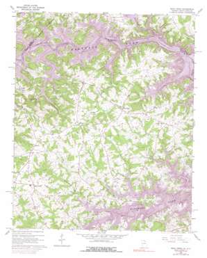
Reed Creek Topo Map Georgia
To zoom in, hover over the map of Reed Creek
USGS Topo Quad 34082d8 - 1:24,000 scale
| Topo Map Name: | Reed Creek |
| USGS Topo Quad ID: | 34082d8 |
| Print Size: | ca. 21 1/4" wide x 27" high |
| Southeast Coordinates: | 34.375° N latitude / 82.875° W longitude |
| Map Center Coordinates: | 34.4375° N latitude / 82.9375° W longitude |
| U.S. States: | GA, SC |
| Filename: | o34082d8.jpg |
| Download Map JPG Image: | Reed Creek topo map 1:24,000 scale |
| Map Type: | Topographic |
| Topo Series: | 7.5´ |
| Map Scale: | 1:24,000 |
| Source of Map Images: | United States Geological Survey (USGS) |
| Alternate Map Versions: |
Reed Creek GA 1960, updated 1963 Download PDF Buy paper map Reed Creek GA 1960, updated 1975 Download PDF Buy paper map Reed Creek GA 1960, updated 1975 Download PDF Buy paper map Reed Creek GA 2011 Download PDF Buy paper map Reed Creek GA 2014 Download PDF Buy paper map |
1:24,000 Topo Quads surrounding Reed Creek
> Back to 34082a1 at 1:100,000 scale
> Back to 34082a1 at 1:250,000 scale
> Back to U.S. Topo Maps home
Reed Creek topo map: Gazetteer
Reed Creek: Airports
Airnautique Incorporated Airport elevation 201m 659′Mustang Field elevation 221m 725′
Reed Creek: Bars
Hatton Shoals (historical) elevation 201m 659′Hatton Shoals (historical) elevation 201m 659′
Reed Creek: Crossings
Averys Ferry (historical) elevation 201m 659′Averys Ferry (historical) elevation 201m 659′
Chandlers Ferry (historical) elevation 201m 659′
Chandlers Ferry (historical) elevation 201m 659′
Coles Ferry (historical) elevation 201m 659′
Coles Ferry (historical) elevation 201m 659′
Reed Creek: Islands
Weldon Island (historical) elevation 201m 659′Reed Creek: Parks
Hart State Park elevation 218m 715′Reed Creek: Populated Places
Maretts elevation 250m 820′Mount Olivet elevation 260m 853′
Reed Creek elevation 250m 820′
Reed Creek: Streams
Beaverdam Creek elevation 201m 659′Fair Play Creek elevation 201m 659′
Gum Branch elevation 202m 662′
Hurricane Creek elevation 201m 659′
Little Lightwood Log Creek elevation 204m 669′
Paynes Creek elevation 201m 659′
Reed Creek elevation 211m 692′
Wolf Creek elevation 201m 659′
Reed Creek digital topo map on disk
Buy this Reed Creek topo map showing relief, roads, GPS coordinates and other geographical features, as a high-resolution digital map file on DVD:
South Carolina, Western North Carolina & Northeastern Georgia
Buy digital topo maps: South Carolina, Western North Carolina & Northeastern Georgia


