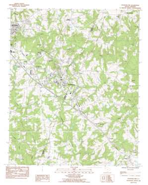
Fountain Inn Topo Map South Carolina
To zoom in, hover over the map of Fountain Inn
USGS Topo Quad 34082f2 - 1:24,000 scale
| Topo Map Name: | Fountain Inn |
| USGS Topo Quad ID: | 34082f2 |
| Print Size: | ca. 21 1/4" wide x 27" high |
| Southeast Coordinates: | 34.625° N latitude / 82.125° W longitude |
| Map Center Coordinates: | 34.6875° N latitude / 82.1875° W longitude |
| U.S. State: | SC |
| Filename: | o34082f2.jpg |
| Download Map JPG Image: | Fountain Inn topo map 1:24,000 scale |
| Map Type: | Topographic |
| Topo Series: | 7.5´ |
| Map Scale: | 1:24,000 |
| Source of Map Images: | United States Geological Survey (USGS) |
| Alternate Map Versions: |
Fountain Inn SC 1983, updated 1983 Download PDF Buy paper map Fountain Inn SC 2011 Download PDF Buy paper map Fountain Inn SC 2014 Download PDF Buy paper map |
1:24,000 Topo Quads surrounding Fountain Inn
> Back to 34082e1 at 1:100,000 scale
> Back to 34082a1 at 1:250,000 scale
> Back to U.S. Topo Maps home
Fountain Inn topo map: Gazetteer
Fountain Inn: Crossings
Interchange 19 elevation 242m 793′Interchange 22 elevation 257m 843′
Interchange 23 elevation 240m 787′
Interchange 24 elevation 266m 872′
Interchange 26 elevation 264m 866′
Fountain Inn: Dams
Coopers Large Pond Dam D-3020 elevation 244m 800′Ed Dohar Pond Dam D-3007 elevation 232m 761′
Jays Lake Dam D-2912 elevation 247m 810′
Martin Pond Dam D-2906 elevation 250m 820′
Nannies Pond Dam D-2913 elevation 237m 777′
Riddle Pond Dam D-2966 elevation 221m 725′
Thads Pond Dam D-2905 elevation 259m 849′
Fountain Inn: Populated Places
Cooks Crossroads elevation 236m 774′Fountain Inn elevation 264m 866′
Gaylords Crossroads elevation 263m 862′
Owings elevation 257m 843′
Poinsetta elevation 246m 807′
Powderhorn elevation 258m 846′
Powers Shop (historical) elevation 244m 800′
The Cedars elevation 256m 839′
Fountain Inn: Reservoirs
Coopers Large Pond elevation 244m 800′Ed Dohar Pond elevation 232m 761′
Jays Lake elevation 247m 810′
Martin Pond elevation 250m 820′
Nannies Pond elevation 237m 777′
Thads Pond elevation 259m 849′
Fountain Inn: Streams
Howard Branch elevation 210m 688′Reedy Creek elevation 191m 626′
Wilson Creek elevation 209m 685′
Fountain Inn digital topo map on disk
Buy this Fountain Inn topo map showing relief, roads, GPS coordinates and other geographical features, as a high-resolution digital map file on DVD:
South Carolina, Western North Carolina & Northeastern Georgia
Buy digital topo maps: South Carolina, Western North Carolina & Northeastern Georgia


