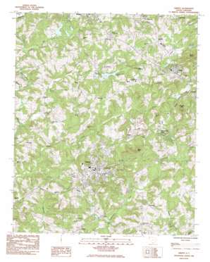
Liberty Topo Map South Carolina
To zoom in, hover over the map of Liberty
USGS Topo Quad 34082g6 - 1:24,000 scale
| Topo Map Name: | Liberty |
| USGS Topo Quad ID: | 34082g6 |
| Print Size: | ca. 21 1/4" wide x 27" high |
| Southeast Coordinates: | 34.75° N latitude / 82.625° W longitude |
| Map Center Coordinates: | 34.8125° N latitude / 82.6875° W longitude |
| U.S. State: | SC |
| Filename: | o34082g6.jpg |
| Download Map JPG Image: | Liberty topo map 1:24,000 scale |
| Map Type: | Topographic |
| Topo Series: | 7.5´ |
| Map Scale: | 1:24,000 |
| Source of Map Images: | United States Geological Survey (USGS) |
| Alternate Map Versions: |
Liberty SC 1983, updated 1983 Download PDF Buy paper map Liberty SC 1983, updated 1983 Download PDF Buy paper map Liberty SC 2011 Download PDF Buy paper map Liberty SC 2014 Download PDF Buy paper map |
1:24,000 Topo Quads surrounding Liberty
> Back to 34082e1 at 1:100,000 scale
> Back to 34082a1 at 1:250,000 scale
> Back to U.S. Topo Maps home
Liberty topo map: Gazetteer
Liberty: Airports
Pickens County Airport elevation 309m 1013′Liberty: Bridges
Hopkins Bridge elevation 262m 859′Liberty: Dams
Hamby Pond Dam D-1944 elevation 264m 866′Holden Pond Dam D-1958 elevation 309m 1013′
South Carolina Noname 39010 D-1957 Dam elevation 292m 958′
South Carolina Noname 39027 D-1940 Dam elevation 335m 1099′
Liberty: Mines
Liberty Quarry elevation 304m 997′Liberty: Parks
Liberty Athletic Complex elevation 307m 1007′Liberty High School Football Stadium elevation 311m 1020′
Liberty: Populated Places
Arial elevation 329m 1079′Beverly elevation 316m 1036′
Cedar Rock elevation 329m 1079′
Five Forks elevation 293m 961′
Hillwood elevation 309m 1013′
Liberty elevation 311m 1020′
Rosewood Heights elevation 301m 987′
Shady Grove elevation 311m 1020′
Traber elevation 298m 977′
Whispering Pines elevation 317m 1040′
Liberty: Post Offices
Liberty Post Office elevation 316m 1036′Liberty: Reservoirs
Country Club Lake elevation 283m 928′Hamby Pond elevation 264m 866′
Holden Pond elevation 309m 1013′
Twelvemile River Watershed 12 Reservoir elevation 335m 1099′
Liberty: Streams
Praters Creek elevation 281m 921′Rices Creek elevation 270m 885′
Wolf Creek elevation 272m 892′
Liberty: Summits
Arial Mountain elevation 403m 1322′Bogg Mountain elevation 374m 1227′
Mauldin Mountain elevation 401m 1315′
Liberty digital topo map on disk
Buy this Liberty topo map showing relief, roads, GPS coordinates and other geographical features, as a high-resolution digital map file on DVD:
South Carolina, Western North Carolina & Northeastern Georgia
Buy digital topo maps: South Carolina, Western North Carolina & Northeastern Georgia


