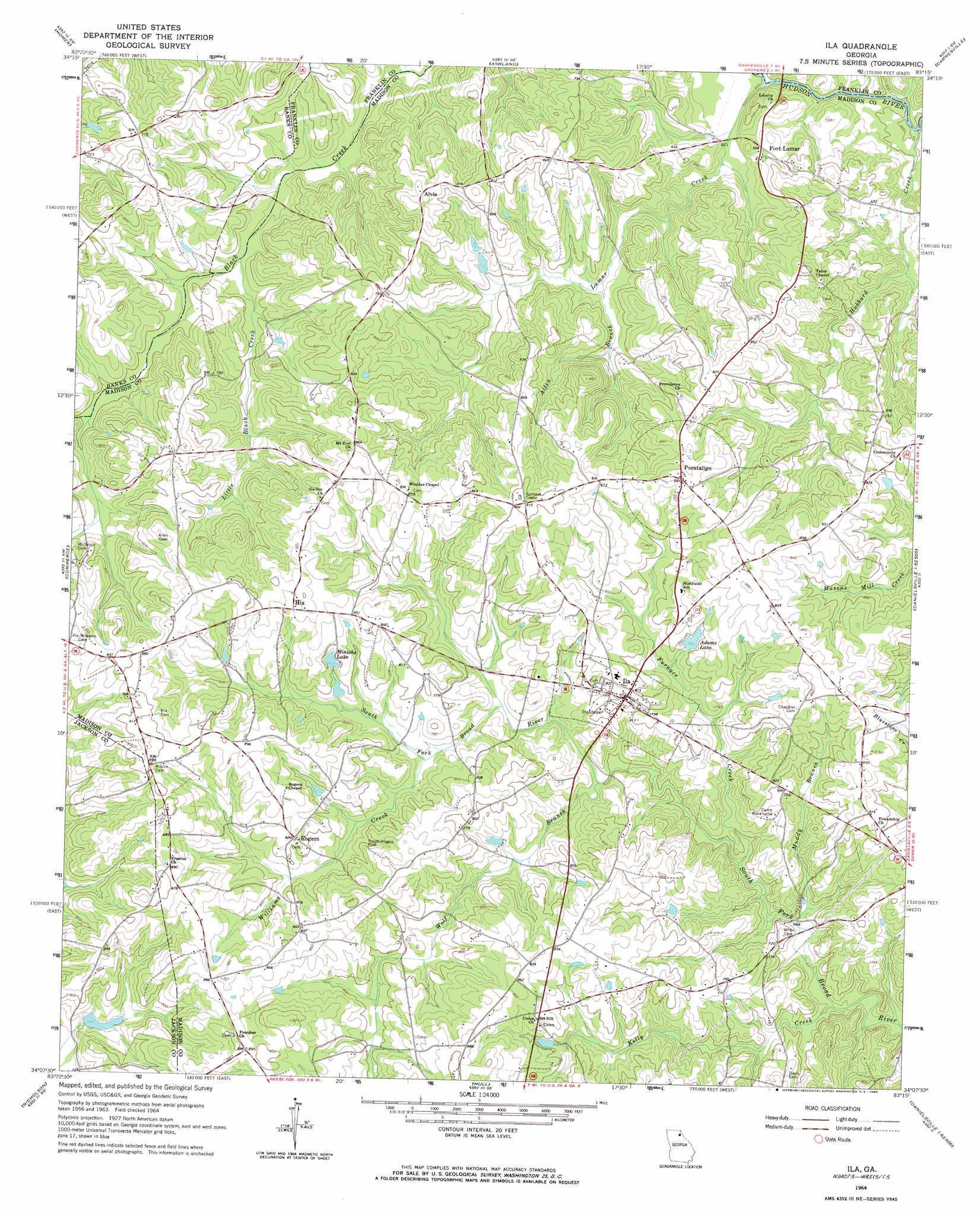
Ila Topo Map Georgia
To zoom in, hover over the map of Ila
USGS Topo Quad 34083b3 - 1:24,000 scale
| Topo Map Name: | Ila |
| USGS Topo Quad ID: | 34083b3 |
| Print Size: | ca. 21 1/4" wide x 27" high |
| Southeast Coordinates: | 34.125° N latitude / 83.25° W longitude |
| Map Center Coordinates: | 34.1875° N latitude / 83.3125° W longitude |
| U.S. State: | GA |
| Filename: | o34083b3.jpg |
| Download Map JPG Image: | Ila topo map 1:24,000 scale |
| Map Type: | Topographic |
| Topo Series: | 7.5´ |
| Map Scale: | 1:24,000 |
| Source of Map Images: | United States Geological Survey (USGS) |
| Alternate Map Versions: |
Ila GA 1964, updated 1965 Download PDF Buy paper map Ila GA 2011 Download PDF Buy paper map Ila GA 2014 Download PDF Buy paper map |
1:24,000 Topo Quads surrounding Ila
Baldwin |
Russell Lake |
Red Hill |
Martin |
Lavonia |
Maysville |
Homer |
Ashland |
Carnesville |
Royston |
Apple Valley |
Commerce |
Ila |
Danielsville North |
Bowman |
Jefferson |
Nicholson |
Hull |
Danielsville South |
Carlton |
Statham |
Athens West |
Athens East |
Crawford |
Sandy Cross |
> Back to 34083a1 at 1:100,000 scale
> Back to 34082a1 at 1:250,000 scale
> Back to U.S. Topo Maps home
Ila topo map: Gazetteer
Ila: Dams
Adams Lake Dam elevation 238m 780′Evans Lake Dam elevation 242m 793′
Irwin Lake Dam elevation 219m 718′
Sandy Creek Structure 14 Dam elevation 225m 738′
South Fork Braod River Structure 51 Dam elevation 207m 679′
South Fork Broad River Structure 27 Dam elevation 207m 679′
South Fork Broad River Structure 46 Dam elevation 242m 793′
Ila: Populated Places
Alvin elevation 256m 839′Fort Lamar elevation 203m 666′
Hix elevation 263m 862′
Ila elevation 244m 800′
Minish elevation 274m 898′
Pocataligo elevation 268m 879′
Rogers elevation 250m 820′
Ila: Reservoirs
Adams Lake elevation 238m 780′Irwin Lake elevation 219m 718′
Minishs Lake elevation 246m 807′
Reservoir 14 elevation 225m 738′
Reservoir 27 elevation 207m 679′
Reservoir 51 elevation 207m 679′
Reservoir Four elevation 250m 820′
Ila: Streams
Allen Branch elevation 201m 659′Furnace Creek elevation 207m 679′
Hubbard Creek elevation 184m 603′
Kelly Creek elevation 201m 659′
Lamar Creek elevation 184m 603′
Little Black Creek elevation 250m 820′
Muddy Branch elevation 206m 675′
Williams Creek elevation 226m 741′
Wolf Branch elevation 219m 718′
Ila digital topo map on disk
Buy this Ila topo map showing relief, roads, GPS coordinates and other geographical features, as a high-resolution digital map file on DVD:
South Carolina, Western North Carolina & Northeastern Georgia
Buy digital topo maps: South Carolina, Western North Carolina & Northeastern Georgia