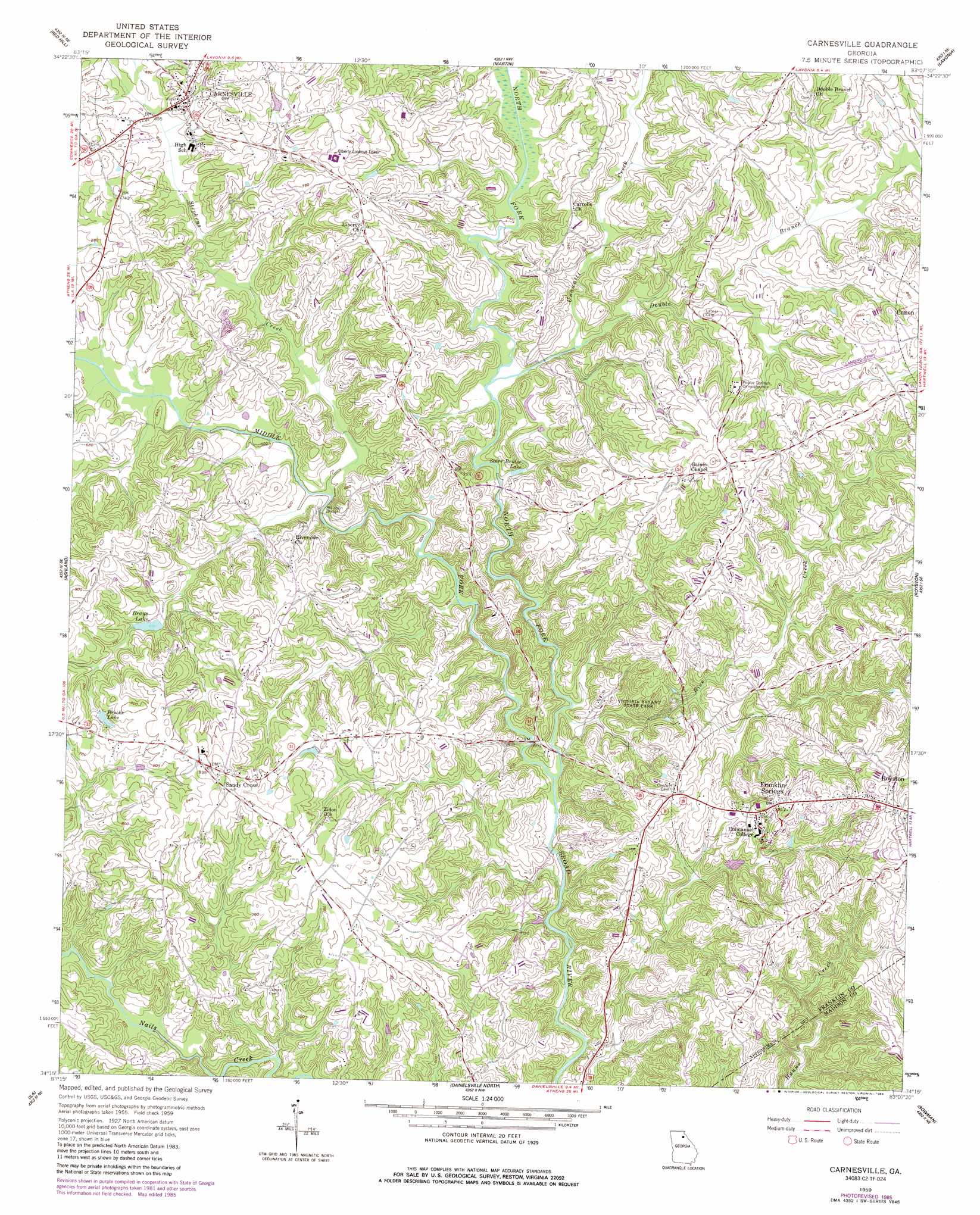
Carnesville Topo Map Georgia
To zoom in, hover over the map of Carnesville
USGS Topo Quad 34083c2 - 1:24,000 scale
| Topo Map Name: | Carnesville |
| USGS Topo Quad ID: | 34083c2 |
| Print Size: | ca. 21 1/4" wide x 27" high |
| Southeast Coordinates: | 34.25° N latitude / 83.125° W longitude |
| Map Center Coordinates: | 34.3125° N latitude / 83.1875° W longitude |
| U.S. State: | GA |
| Filename: | o34083c2.jpg |
| Download Map JPG Image: | Carnesville topo map 1:24,000 scale |
| Map Type: | Topographic |
| Topo Series: | 7.5´ |
| Map Scale: | 1:24,000 |
| Source of Map Images: | United States Geological Survey (USGS) |
| Alternate Map Versions: |
Carnesville GA 1959, updated 1961 Download PDF Buy paper map Carnesville GA 1959, updated 1974 Download PDF Buy paper map Carnesville GA 1959, updated 1986 Download PDF Buy paper map Carnesville GA 2011 Download PDF Buy paper map Carnesville GA 2014 Download PDF Buy paper map |
1:24,000 Topo Quads surrounding Carnesville
Ayersville |
Toccoa |
Avalon |
Oakway |
Fair Play |
Russell Lake |
Red Hill |
Martin |
Lavonia |
Reed Creek |
Homer |
Ashland |
Carnesville |
Royston |
Hartwell |
Commerce |
Ila |
Danielsville North |
Bowman |
Dewy Rose |
Nicholson |
Hull |
Danielsville South |
Carlton |
Elberton West |
> Back to 34083a1 at 1:100,000 scale
> Back to 34082a1 at 1:250,000 scale
> Back to U.S. Topo Maps home
Carnesville topo map: Gazetteer
Carnesville: Airports
Franklin County Airport elevation 256m 839′Carnesville: Bridges
Atkinson Bridge elevation 183m 600′Carnesville: Dams
Brays Lake Dam elevation 201m 659′Carnesville: Parks
R M Star Memorial elevation 233m 764′Victoria Bryant State Park elevation 186m 610′
Carnesville: Populated Places
Carnesville elevation 216m 708′Franklin Springs elevation 249m 816′
Sandy Cross elevation 256m 839′
Zidon (historical) elevation 201m 659′
Carnesville: Reservoirs
Brays Lake elevation 201m 659′Brooks Lake elevation 227m 744′
Starr Bridge Lake elevation 189m 620′
Carnesville: Streams
Double Branch elevation 191m 626′Middle Fork Broad River elevation 177m 580′
North Fork Broad River elevation 177m 580′
Rice Creek elevation 177m 580′
Stephens Creek elevation 183m 600′
Unawatti Creek elevation 189m 620′
Carnesville digital topo map on disk
Buy this Carnesville topo map showing relief, roads, GPS coordinates and other geographical features, as a high-resolution digital map file on DVD:
South Carolina, Western North Carolina & Northeastern Georgia
Buy digital topo maps: South Carolina, Western North Carolina & Northeastern Georgia