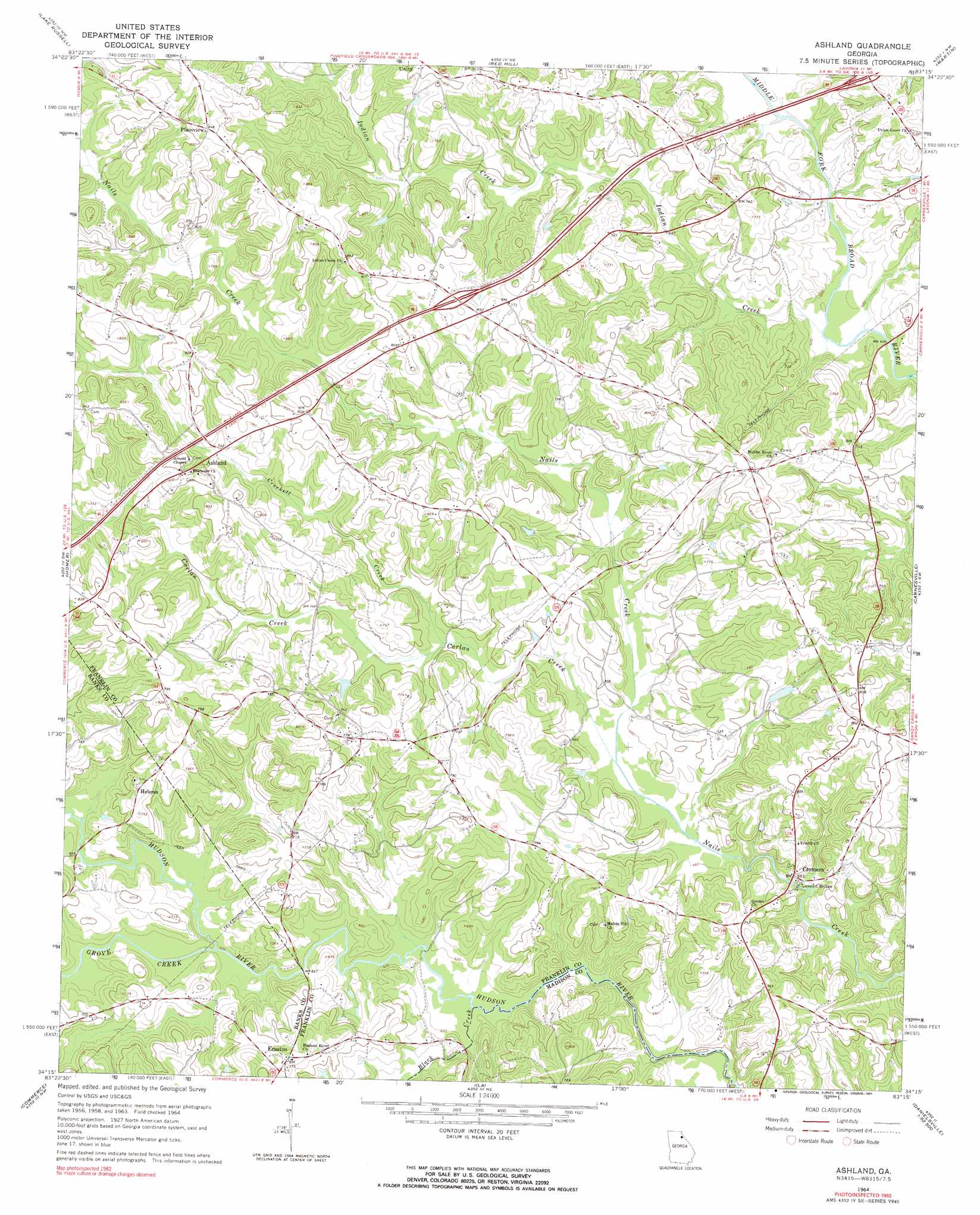
Ashland Topo Map Georgia
To zoom in, hover over the map of Ashland
USGS Topo Quad 34083c3 - 1:24,000 scale
| Topo Map Name: | Ashland |
| USGS Topo Quad ID: | 34083c3 |
| Print Size: | ca. 21 1/4" wide x 27" high |
| Southeast Coordinates: | 34.25° N latitude / 83.25° W longitude |
| Map Center Coordinates: | 34.3125° N latitude / 83.3125° W longitude |
| U.S. State: | GA |
| Filename: | o34083c3.jpg |
| Download Map JPG Image: | Ashland topo map 1:24,000 scale |
| Map Type: | Topographic |
| Topo Series: | 7.5´ |
| Map Scale: | 1:24,000 |
| Source of Map Images: | United States Geological Survey (USGS) |
| Alternate Map Versions: |
Ashland GA 1964, updated 1965 Download PDF Buy paper map Ashland GA 1964, updated 1991 Download PDF Buy paper map Ashland GA 2011 Download PDF Buy paper map Ashland GA 2014 Download PDF Buy paper map |
1:24,000 Topo Quads surrounding Ashland
Clarkesville |
Ayersville |
Toccoa |
Avalon |
Oakway |
Baldwin |
Russell Lake |
Red Hill |
Martin |
Lavonia |
Maysville |
Homer |
Ashland |
Carnesville |
Royston |
Apple Valley |
Commerce |
Ila |
Danielsville North |
Bowman |
Jefferson |
Nicholson |
Hull |
Danielsville South |
Carlton |
> Back to 34083a1 at 1:100,000 scale
> Back to 34082a1 at 1:250,000 scale
> Back to U.S. Topo Maps home
Ashland topo map: Gazetteer
Ashland: Bridges
Cromers Mill Covered Bridge elevation 195m 639′McIntires Bridge elevation 189m 620′
Wrights Bridge elevation 195m 639′
Ashland: Crossings
Exit 55 elevation 238m 780′Exit 56 elevation 221m 725′
Ashland: Dams
Alston Dam elevation 208m 682′Alston Lake Dam elevation 216m 708′
Ashland: Populated Places
Ashland elevation 226m 741′Cromers elevation 201m 659′
Erastus elevation 234m 767′
Hebron elevation 225m 738′
Plainview elevation 258m 846′
Walnut Hill (historical) elevation 256m 839′
Ashland: Reservoirs
Alston Lake elevation 216m 708′Alston Lake elevation 208m 682′
Ashland: Streams
Black Creek elevation 187m 613′Carlan Creek elevation 201m 659′
Crockett Creek elevation 207m 679′
Grove Creek elevation 189m 620′
Indian Creek elevation 188m 616′
Ragsdale Creek elevation 226m 741′
Ashland digital topo map on disk
Buy this Ashland topo map showing relief, roads, GPS coordinates and other geographical features, as a high-resolution digital map file on DVD:
South Carolina, Western North Carolina & Northeastern Georgia
Buy digital topo maps: South Carolina, Western North Carolina & Northeastern Georgia