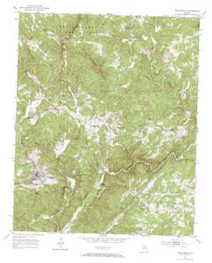
Dahlonega Topo Map Georgia
To zoom in, hover over the map of Dahlonega
USGS Topo Quad 34083e8 - 1:24,000 scale
| Topo Map Name: | Dahlonega |
| USGS Topo Quad ID: | 34083e8 |
| Print Size: | ca. 21 1/4" wide x 27" high |
| Southeast Coordinates: | 34.5° N latitude / 83.875° W longitude |
| Map Center Coordinates: | 34.5625° N latitude / 83.9375° W longitude |
| U.S. State: | GA |
| Filename: | o34083e8.jpg |
| Download Map JPG Image: | Dahlonega topo map 1:24,000 scale |
| Map Type: | Topographic |
| Topo Series: | 7.5´ |
| Map Scale: | 1:24,000 |
| Source of Map Images: | United States Geological Survey (USGS) |
| Alternate Map Versions: |
Dahlonega GA 1951, updated 1953 Download PDF Buy paper map Dahlonega GA 1951, updated 1967 Download PDF Buy paper map Dahlonega GA 2011 Download PDF Buy paper map Dahlonega GA 2014 Download PDF Buy paper map |
| FStopo: | US Forest Service topo Dahlonega is available: Download FStopo PDF Download FStopo TIF |
1:24,000 Topo Quads surrounding Dahlonega
> Back to 34083e1 at 1:100,000 scale
> Back to 34082a1 at 1:250,000 scale
> Back to U.S. Topo Maps home
Dahlonega topo map: Gazetteer
Dahlonega: Bridges
Beardons Bridge elevation 346m 1135′Chestatee Bridge (historical) elevation 339m 1112′
Dahlonega: Dams
Burgess Lake Dam elevation 406m 1332′Gorge Dam (historical) elevation 351m 1151′
Moose Dam elevation 499m 1637′
Ricketts Lake Dam elevation 432m 1417′
Rodgers Lake Dam elevation 507m 1663′
Whitners Lake Dam elevation 492m 1614′
Dahlonega: Mines
Bast Cut elevation 446m 1463′Benning Lot Mine elevation 421m 1381′
Bowmen Cut elevation 473m 1551′
Capps Prospect elevation 471m 1545′
Cavender Creek Mine elevation 429m 1407′
Chestatee Mine elevation 387m 1269′
Columbia Cut elevation 461m 1512′
Consolidated Mine elevation 364m 1194′
Crown Mountain Cuts elevation 490m 1607′
Dead Horse Shaft elevation 458m 1502′
Findley Mine elevation 458m 1502′
Fishtrap Cuts elevation 435m 1427′
Garnet Mine elevation 450m 1476′
Hand Cut elevation 413m 1354′
Ivy Cut elevation 417m 1368′
Jumbo Mine elevation 451m 1479′
Preacher Cut elevation 458m 1502′
Singleton Cut elevation 409m 1341′
Tahloneka Mine elevation 378m 1240′
Yahoola Cuts elevation 371m 1217′
Dahlonega: Populated Places
Dahlonega elevation 442m 1450′Garland elevation 432m 1417′
Stay (historical) elevation 479m 1571′
Tube (historical) elevation 434m 1423′
Wild (historical) elevation 386m 1266′
Dahlonega: Post Offices
Dahlonega Post Office elevation 445m 1459′Dahlonega: Reservoirs
Burgess Lake elevation 406m 1332′Ricketts Lake elevation 432m 1417′
Rodgers Lake elevation 507m 1663′
Whitners Lake elevation 492m 1614′
Dahlonega: Ridges
Findley Ridge elevation 474m 1555′Dahlonega: Streams
Bryant Creek elevation 451m 1479′Cavenders Creek elevation 351m 1151′
Jarrard Creek elevation 470m 1541′
Left Fork Cavenders Creek elevation 388m 1272′
Moose Creek elevation 460m 1509′
Pecks Mill Creek elevation 364m 1194′
Tanyard Branch elevation 350m 1148′
Tate Creek elevation 435m 1427′
Ward Creek elevation 371m 1217′
Woody Creek elevation 474m 1555′
Yahoola Creek elevation 340m 1115′
Dahlonega: Summits
Crown Mountain elevation 524m 1719′Three Sisters Mountain elevation 645m 2116′
Dahlonega digital topo map on disk
Buy this Dahlonega topo map showing relief, roads, GPS coordinates and other geographical features, as a high-resolution digital map file on DVD:
South Carolina, Western North Carolina & Northeastern Georgia
Buy digital topo maps: South Carolina, Western North Carolina & Northeastern Georgia


