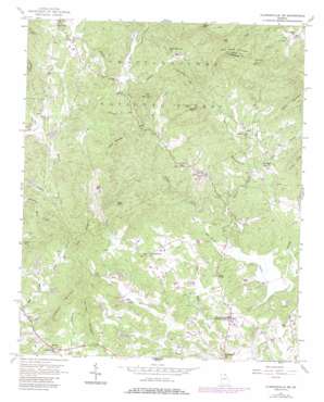
Clarkesville Ne Topo Map Georgia
To zoom in, hover over the map of Clarkesville Ne
USGS Topo Quad 34083f5 - 1:24,000 scale
| Topo Map Name: | Clarkesville Ne |
| USGS Topo Quad ID: | 34083f5 |
| Print Size: | ca. 21 1/4" wide x 27" high |
| Southeast Coordinates: | 34.625° N latitude / 83.5° W longitude |
| Map Center Coordinates: | 34.6875° N latitude / 83.5625° W longitude |
| U.S. State: | GA |
| Filename: | o34083f5.jpg |
| Download Map JPG Image: | Clarkesville Ne topo map 1:24,000 scale |
| Map Type: | Topographic |
| Topo Series: | 7.5´ |
| Map Scale: | 1:24,000 |
| Source of Map Images: | United States Geological Survey (USGS) |
| Alternate Map Versions: |
Clarkesville NE GA 1957, updated 1958 Download PDF Buy paper map Clarkesville NE GA 1957, updated 1968 Download PDF Buy paper map Clarkesville NE GA 1957, updated 1986 Download PDF Buy paper map Clarkesville NE GA 2011 Download PDF Buy paper map Clarkesville NE GA 2014 Download PDF Buy paper map |
| FStopo: | US Forest Service topo Clarkesville NE is available: Download FStopo PDF Download FStopo TIF |
1:24,000 Topo Quads surrounding Clarkesville Ne
> Back to 34083e1 at 1:100,000 scale
> Back to 34082a1 at 1:250,000 scale
> Back to U.S. Topo Maps home
Clarkesville Ne topo map: Gazetteer
Clarkesville Ne: Bridges
Emma Griffin Hardman Bridge elevation 408m 1338′Clarkesville Ne: Dams
Beaverdam Creek Structure 42 Dam elevation 411m 1348′Sautee Creek Structure 18 Dam elevation 424m 1391′
Sautee Creek Structure 22 Dam elevation 461m 1512′
Soque Creek Structure 13 Dam elevation 411m 1348′
Yoemans Dam elevation 439m 1440′
Clarkesville Ne: Gaps
Ann Gap elevation 787m 2582′Low Gap elevation 731m 2398′
Clarkesville Ne: Populated Places
Batesville elevation 520m 1706′College Park elevation 452m 1482′
Harvest elevation 439m 1440′
Clarkesville Ne: Reservoirs
Reservoir 13 elevation 411m 1348′Reservoir 18 elevation 424m 1391′
Reservoir 22 elevation 461m 1512′
Reservoir 42 elevation 411m 1348′
Yoemans Lake elevation 439m 1440′
Clarkesville Ne: Streams
Alley Creek elevation 462m 1515′Amos Creek elevation 420m 1377′
Ben Tatum Branch elevation 412m 1351′
Black Bear Creek elevation 463m 1519′
Cove Branch elevation 439m 1440′
Deep Creek elevation 399m 1309′
Ivy Branch elevation 427m 1400′
Long Branch elevation 458m 1502′
Moates Branch elevation 470m 1541′
Nerve Branch elevation 446m 1463′
Oakey Creek elevation 461m 1512′
Pigeon elevation 432m 1417′
Porters Mill Branch elevation 413m 1354′
Raper Creek elevation 461m 1512′
Shoal Branch elevation 451m 1479′
Shoal Creek elevation 416m 1364′
Whitworth Branch elevation 452m 1482′
Clarkesville Ne: Summits
Alec Mountain elevation 542m 1778′Crow Mountain elevation 670m 2198′
Flat Creek Mountain elevation 818m 2683′
Grassy Mountain elevation 670m 2198′
Harvest Mountain elevation 523m 1715′
High Knob elevation 601m 1971′
Irwin Mountain elevation 575m 1886′
Mack Mountain elevation 661m 2168′
Oakey Mountain elevation 960m 3149′
Sillycook Mountain elevation 662m 2171′
Yellow Mountain elevation 685m 2247′
Yellowbank Mountain elevation 537m 1761′
Clarkesville Ne: Valleys
Sautee Valley elevation 423m 1387′Sautee-Nacoochee Valley elevation 423m 1387′
Clarkesville Ne digital topo map on disk
Buy this Clarkesville Ne topo map showing relief, roads, GPS coordinates and other geographical features, as a high-resolution digital map file on DVD:
South Carolina, Western North Carolina & Northeastern Georgia
Buy digital topo maps: South Carolina, Western North Carolina & Northeastern Georgia


