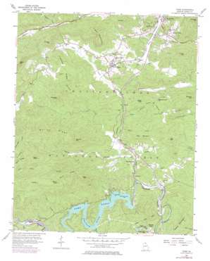
Tiger Topo Map Georgia
To zoom in, hover over the map of Tiger
USGS Topo Quad 34083g4 - 1:24,000 scale
| Topo Map Name: | Tiger |
| USGS Topo Quad ID: | 34083g4 |
| Print Size: | ca. 21 1/4" wide x 27" high |
| Southeast Coordinates: | 34.75° N latitude / 83.375° W longitude |
| Map Center Coordinates: | 34.8125° N latitude / 83.4375° W longitude |
| U.S. State: | GA |
| Filename: | o34083g4.jpg |
| Download Map JPG Image: | Tiger topo map 1:24,000 scale |
| Map Type: | Topographic |
| Topo Series: | 7.5´ |
| Map Scale: | 1:24,000 |
| Source of Map Images: | United States Geological Survey (USGS) |
| Alternate Map Versions: |
Tiger GA 1957, updated 1958 Download PDF Buy paper map Tiger GA 1957, updated 1965 Download PDF Buy paper map Tiger GA 1957, updated 1975 Download PDF Buy paper map Tiger GA 1957, updated 1984 Download PDF Buy paper map Tiger GA 2011 Download PDF Buy paper map Tiger GA 2014 Download PDF Buy paper map |
| FStopo: | US Forest Service topo Tiger is available: Download FStopo PDF Download FStopo TIF |
1:24,000 Topo Quads surrounding Tiger
> Back to 34083e1 at 1:100,000 scale
> Back to 34082a1 at 1:250,000 scale
> Back to U.S. Topo Maps home
Tiger topo map: Gazetteer
Tiger: Airports
Big Creek Flying Ranch Airport elevation 475m 1558′Tiger: Bridges
Paul A Green Bridge elevation 467m 1532′Wiley Trestle elevation 520m 1706′
Tiger: Capes
Persimmon Point elevation 513m 1683′Tiger: Dams
Athens YMCA Camp Dam elevation 513m 1683′Blalock Lake Dam elevation 560m 1837′
Tiger: Falls
Stekoa Falls elevation 549m 1801′Tiger: Mines
Borrow Pit elevation 611m 2004′Tiger: Parks
Rabun Beach Recreation Area elevation 533m 1748′Tiger: Populated Places
Burton Junction (historical) elevation 514m 1686′Lakemont elevation 489m 1604′
Laurel Falls elevation 613m 2011′
Tiger elevation 598m 1961′
Wiley elevation 533m 1748′
Tiger: Reservoirs
Athens YMCA Camp Lake elevation 513m 1683′Blalock Lake elevation 560m 1837′
Lake Rabun elevation 505m 1656′
Tiger: Ridges
Bee Branch Ridge elevation 637m 2089′Crukleton Ridge elevation 690m 2263′
Seals Ridge elevation 710m 2329′
Stamp Ridge elevation 786m 2578′
Wiley Mountain elevation 646m 2119′
Worley Ridge elevation 845m 2772′
Tiger: Streams
Boen Creek elevation 517m 1696′Boggs Branch elevation 545m 1788′
Falls Branch elevation 515m 1689′
Flat Creek elevation 522m 1712′
Hollifield Branch elevation 587m 1925′
Joe Creek elevation 526m 1725′
Pole Bridge Creek elevation 502m 1646′
Scott Creek elevation 567m 1860′
Stamp Creek elevation 545m 1788′
Stonewall Creek elevation 512m 1679′
Tiger Creek elevation 486m 1594′
Worley Branch elevation 513m 1683′
Worley Creek elevation 511m 1676′
Tiger: Summits
Boggs Mountain elevation 707m 2319′Cliff Mountain elevation 697m 2286′
Eastman Mountain elevation 709m 2326′
Jameson Mountain elevation 821m 2693′
Joe Mountain elevation 917m 3008′
Oakey Mountain elevation 796m 2611′
Owl Mountain elevation 776m 2545′
Rocky Mountain elevation 657m 2155′
Screamer Mountain elevation 897m 2942′
Seals Knob elevation 881m 2890′
Stamp Knob elevation 906m 2972′
Stonewall Knob elevation 803m 2634′
Stroud Mountain elevation 769m 2522′
Tiger Mountain elevation 851m 2791′
Timpson Mountain elevation 802m 2631′
Tiger digital topo map on disk
Buy this Tiger topo map showing relief, roads, GPS coordinates and other geographical features, as a high-resolution digital map file on DVD:
South Carolina, Western North Carolina & Northeastern Georgia
Buy digital topo maps: South Carolina, Western North Carolina & Northeastern Georgia


