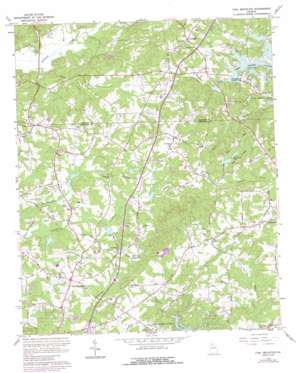
Coal Mountain Topo Map Georgia
To zoom in, hover over the map of Coal Mountain
USGS Topo Quad 34084c1 - 1:24,000 scale
| Topo Map Name: | Coal Mountain |
| USGS Topo Quad ID: | 34084c1 |
| Print Size: | ca. 21 1/4" wide x 27" high |
| Southeast Coordinates: | 34.25° N latitude / 84° W longitude |
| Map Center Coordinates: | 34.3125° N latitude / 84.0625° W longitude |
| U.S. State: | GA |
| Filename: | o34084c1.jpg |
| Download Map JPG Image: | Coal Mountain topo map 1:24,000 scale |
| Map Type: | Topographic |
| Topo Series: | 7.5´ |
| Map Scale: | 1:24,000 |
| Source of Map Images: | United States Geological Survey (USGS) |
| Alternate Map Versions: |
Coal Mounatin GA 1964, updated 1965 Download PDF Buy paper map Coal Mountain GA 1964, updated 1965 Download PDF Buy paper map Coal Mountain GA 1964, updated 1986 Download PDF Buy paper map Coal Mountain GA 1997, updated 2000 Download PDF Buy paper map Coal Mountain GA 2011 Download PDF Buy paper map Coal Mountain GA 2014 Download PDF Buy paper map |
1:24,000 Topo Quads surrounding Coal Mountain
> Back to 34084a1 at 1:100,000 scale
> Back to 34084a1 at 1:250,000 scale
> Back to U.S. Topo Maps home
Coal Mountain topo map: Gazetteer
Coal Mountain: Airports
Adams Heliport elevation 343m 1125′Coal Mountain: Dams
Anderson Dam Number One elevation 398m 1305′Anderson Dam Number Two elevation 399m 1309′
Beaverdam Creek Structure Number Four Dam elevation 362m 1187′
Beaverdam Creek Watershed Structure Number Five Dam elevation 361m 1184′
Etowah River Watershed Dam Number Nine elevation 347m 1138′
Kalb Dam elevation 397m 1302′
Lake Marie Dam elevation 378m 1240′
Norrell Lake Dam elevation 369m 1210′
Rendering Plant Lake Dam elevation 394m 1292′
Settingdown Creek Structure 10 Dam elevation 348m 1141′
Settingdown Creek Structure 59 Dam elevation 365m 1197′
Settingdown Creek Structure Four Dam elevation 360m 1181′
Settingdown Creek Structure Six Dam elevation 353m 1158′
Settingdown Creek Watershed Number 54 Dam elevation 354m 1161′
Thomas Lake Dam elevation 372m 1220′
Coal Mountain: Populated Places
Coal Mountain elevation 372m 1220′Lumpkin elevation 378m 1240′
Silver City elevation 378m 1240′
Coal Mountain: Reservoirs
Anderson Lake elevation 391m 1282′Anderson Lake Number One elevation 398m 1305′
Anderson Lake Number Two elevation 399m 1309′
Bruce Lake elevation 347m 1138′
Kalb Lake elevation 397m 1302′
Lake Marie elevation 378m 1240′
Norrell Lake elevation 369m 1210′
Rendering Plant Lake elevation 394m 1292′
Reservoir 59 elevation 365m 1197′
Reservoir Five elevation 361m 1184′
Reservoir Four elevation 362m 1187′
Reservoir Four elevation 360m 1181′
Reservoir Six elevation 353m 1158′
Settingdown Creek Watershed 10 Reservoir elevation 348m 1141′
Settingdown Creek Watershed Reservoir Number 54 elevation 354m 1161′
Settingdown Reservoir Number 56 elevation 360m 1181′
Thomas Lake elevation 372m 1220′
Coal Mountain: Ridges
Pea Ridge elevation 439m 1440′Coal Mountain: Streams
Black Mill Creek elevation 316m 1036′Mill Creek elevation 317m 1040′
Coal Mountain digital topo map on disk
Buy this Coal Mountain topo map showing relief, roads, GPS coordinates and other geographical features, as a high-resolution digital map file on DVD:


