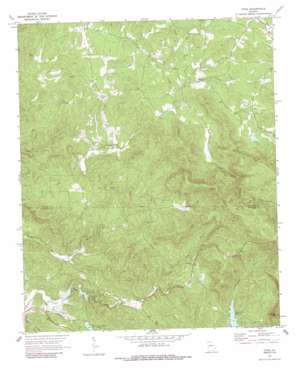
Dyke Topo Map Georgia
To zoom in, hover over the map of Dyke
USGS Topo Quad 34084e4 - 1:24,000 scale
| Topo Map Name: | Dyke |
| USGS Topo Quad ID: | 34084e4 |
| Print Size: | ca. 21 1/4" wide x 27" high |
| Southeast Coordinates: | 34.5° N latitude / 84.375° W longitude |
| Map Center Coordinates: | 34.5625° N latitude / 84.4375° W longitude |
| U.S. State: | GA |
| Filename: | o34084e4.jpg |
| Download Map JPG Image: | Dyke topo map 1:24,000 scale |
| Map Type: | Topographic |
| Topo Series: | 7.5´ |
| Map Scale: | 1:24,000 |
| Source of Map Images: | United States Geological Survey (USGS) |
| Alternate Map Versions: |
Dyke GA 1971, updated 1973 Download PDF Buy paper map Dyke GA 1971, updated 1987 Download PDF Buy paper map Dyke GA 2011 Download PDF Buy paper map Dyke GA 2014 Download PDF Buy paper map |
1:24,000 Topo Quads surrounding Dyke
> Back to 34084e1 at 1:100,000 scale
> Back to 34084a1 at 1:250,000 scale
> Back to U.S. Topo Maps home
Dyke topo map: Gazetteer
Dyke: Dams
Diamond Lure Lake Dam elevation 506m 1660′Ellison-Stifel Lake Dam elevation 606m 1988′
Grandview Lake Dam elevation 424m 1391′
Jones Lake Dam elevation 369m 1210′
Montag Lake Dam elevation 521m 1709′
Nalls Lake Dam elevation 461m 1512′
Talking Rock Watershed Dam Number 10 elevation 435m 1427′
Talking Rock Watershed Dam Number 13 elevation 356m 1167′
Upper Twin Mountain Lake Dam elevation 402m 1318′
Dyke: Populated Places
Dyke elevation 470m 1541′Pleasant Valley elevation 436m 1430′
Dyke: Reservoirs
Diamond Lure Lake elevation 506m 1660′Ellison-Stifel Lake elevation 606m 1988′
Grandview Lake elevation 425m 1394′
Jones Lake elevation 356m 1167′
Jones Lake elevation 369m 1210′
Montag Lake elevation 521m 1709′
Nalls Lake elevation 461m 1512′
Teague Lake elevation 435m 1427′
Twin Mountain Lakes elevation 402m 1318′
Upper Twin Mountain Lake elevation 402m 1318′
Dyke: Streams
Hobson Creek elevation 341m 1118′Mill Creek elevation 333m 1092′
Price Creek elevation 402m 1318′
Turkey Creek elevation 442m 1450′
Dyke: Summits
Sharptop Mountain elevation 787m 2582′Dyke digital topo map on disk
Buy this Dyke topo map showing relief, roads, GPS coordinates and other geographical features, as a high-resolution digital map file on DVD:


