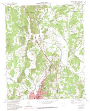
Calhoun North Topo Map Georgia
To zoom in, hover over the map of Calhoun North
USGS Topo Quad 34084e8 - 1:24,000 scale
| Topo Map Name: | Calhoun North |
| USGS Topo Quad ID: | 34084e8 |
| Print Size: | ca. 21 1/4" wide x 27" high |
| Southeast Coordinates: | 34.5° N latitude / 84.875° W longitude |
| Map Center Coordinates: | 34.5625° N latitude / 84.9375° W longitude |
| U.S. State: | GA |
| Filename: | o34084e8.jpg |
| Download Map JPG Image: | Calhoun North topo map 1:24,000 scale |
| Map Type: | Topographic |
| Topo Series: | 7.5´ |
| Map Scale: | 1:24,000 |
| Source of Map Images: | United States Geological Survey (USGS) |
| Alternate Map Versions: |
Calhoun North GA 1972, updated 1974 Download PDF Buy paper map Calhoun North GA 1972, updated 1988 Download PDF Buy paper map Calhoun North GA 2011 Download PDF Buy paper map Calhoun North GA 2014 Download PDF Buy paper map |
| FStopo: | US Forest Service topo Calhoun North is available: Download FStopo PDF Download FStopo TIF |
1:24,000 Topo Quads surrounding Calhoun North
> Back to 34084e1 at 1:100,000 scale
> Back to 34084a1 at 1:250,000 scale
> Back to U.S. Topo Maps home
Calhoun North topo map: Gazetteer
Calhoun North: Airports
Gus Moore Airport elevation 195m 639′Zack Airport elevation 218m 715′
Calhoun North: Bends
Fite Bend elevation 189m 620′Calhoun North: Bridges
Calhoun Bridge elevation 181m 593′Clem Holland Memorial Bridge elevation 185m 606′
Fork Ferry Bridge elevation 188m 616′
Calhoun North: Crossings
Calhoun Ferry (historical) elevation 181m 593′Exit 130 elevation 216m 708′
Exit 131 elevation 213m 698′
Exit 132 elevation 207m 679′
Exit 133 elevation 200m 656′
Fites Ferry (historical) elevation 188m 616′
Fricks Ferry (historical) elevation 181m 593′
Lands Ferry (historical) elevation 186m 610′
Newtown Ferry (historical) elevation 187m 613′
Resaca Ferry (historical) elevation 185m 606′
Calhoun North: Dams
Langford Lake Dam elevation 200m 656′Lee Lake Dam elevation 209m 685′
Moss Lake Dam elevation 199m 652′
Calhoun North: Lakes
David Pond elevation 196m 643′Calhoun North: Parks
Cherokee Indian Memorial elevation 198m 649′New Echota Historical Site elevation 195m 639′
Calhoun North: Populated Places
Angelville elevation 199m 652′Calhoun elevation 201m 659′
Damascus elevation 216m 708′
Echota elevation 202m 662′
Nance Springs elevation 210m 688′
New Town elevation 204m 669′
Resaca elevation 196m 643′
Soapstick elevation 205m 672′
Water Valley (historical) elevation 198m 649′
Calhoun North: Post Offices
Calhoun Post Office elevation 198m 649′Resaca Post Office elevation 196m 643′
Calhoun North: Reservoirs
Langford Lake elevation 200m 656′Lee Lake elevation 209m 685′
Moss Lake elevation 199m 652′
Calhoun North: Streams
Blue Springs Creek elevation 189m 620′Camp Creek elevation 184m 603′
Conasauga River elevation 187m 613′
Coosawattee River elevation 187m 613′
Crane Eater Creek elevation 188m 616′
Dead Mans Branch elevation 192m 629′
Dry Creek elevation 198m 649′
Graham Creek elevation 186m 610′
Lick Creek elevation 189m 620′
Oothkalooga Creek elevation 181m 593′
Polecat Creek elevation 189m 620′
Town Creek elevation 189m 620′
Calhoun North: Summits
Brogdon Hill elevation 277m 908′Calhoun North digital topo map on disk
Buy this Calhoun North topo map showing relief, roads, GPS coordinates and other geographical features, as a high-resolution digital map file on DVD:


