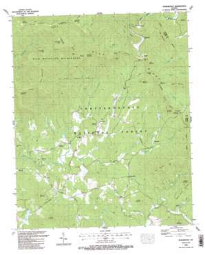
Tickanetley Topo Map Georgia
To zoom in, hover over the map of Tickanetley
USGS Topo Quad 34084f3 - 1:24,000 scale
| Topo Map Name: | Tickanetley |
| USGS Topo Quad ID: | 34084f3 |
| Print Size: | ca. 21 1/4" wide x 27" high |
| Southeast Coordinates: | 34.625° N latitude / 84.25° W longitude |
| Map Center Coordinates: | 34.6875° N latitude / 84.3125° W longitude |
| U.S. State: | GA |
| Filename: | o34084f3.jpg |
| Download Map JPG Image: | Tickanetley topo map 1:24,000 scale |
| Map Type: | Topographic |
| Topo Series: | 7.5´ |
| Map Scale: | 1:24,000 |
| Source of Map Images: | United States Geological Survey (USGS) |
| Alternate Map Versions: |
Tickanetley GA 1935 Download PDF Buy paper map Tickanetley GA 1946, updated 1956 Download PDF Buy paper map Tickanetley GA 1946, updated 1969 Download PDF Buy paper map Tickanetley GA 1947, updated 1947 Download PDF Buy paper map Tickanetley GA 1988, updated 1988 Download PDF Buy paper map Tickanetley GA 2011 Download PDF Buy paper map Tickanetley GA 2014 Download PDF Buy paper map |
| FStopo: | US Forest Service topo Tickanetley is available: Download FStopo PDF Download FStopo TIF |
1:24,000 Topo Quads surrounding Tickanetley
> Back to 34084e1 at 1:100,000 scale
> Back to 34084a1 at 1:250,000 scale
> Back to U.S. Topo Maps home
Tickanetley topo map: Gazetteer
Tickanetley: Dams
Cartecay River Watershed Structure Number Five Dam elevation 566m 1856′Cartecay River Watershed Structure Number Six Dam elevation 605m 1984′
Cartecay Watershed Dam Number 10 elevation 484m 1587′
Cartecay Watershed Dam Number Eight elevation 528m 1732′
Cartecay Watershed Dam Number One elevation 525m 1722′
Cartecay Watershed Dam Number Three elevation 505m 1656′
Tickanetley: Gaps
Big Creek Gap elevation 770m 2526′Doublehead Gap elevation 699m 2293′
Hardslate Gap elevation 748m 2454′
Low Gap elevation 758m 2486′
Ramp Gap elevation 1042m 3418′
Rolston Gap elevation 978m 3208′
Steamy Gap elevation 807m 2647′
Stover Gap elevation 996m 3267′
Tickanetley: Parks
Rich Mountain Wildlife Management Area elevation 1029m 3375′Tickanetley: Populated Places
Big Creek elevation 701m 2299′Diamond elevation 575m 1886′
Marion elevation 591m 1938′
Pisgah elevation 756m 2480′
Quill elevation 541m 1774′
Rolston elevation 524m 1719′
Roy elevation 530m 1738′
Stanley Mill (historical) elevation 681m 2234′
Tickanetley elevation 579m 1899′
Tickanetley: Reservoirs
Bearden Lake elevation 566m 1856′Diamond Lake elevation 556m 1824′
Garland Lake elevation 525m 1722′
Lowman Lake elevation 505m 1656′
Lowman Lake elevation 605m 1984′
Noblin Lake elevation 528m 1732′
Postell Lake elevation 484m 1587′
Tickanetley: Ridges
Fox Mountain elevation 888m 2913′Pine Ridge elevation 817m 2680′
Tickanetley: Streams
Anderson Creek elevation 493m 1617′Anderson Creek elevation 506m 1660′
Bearden Creek elevation 561m 1840′
Butler Creek elevation 736m 2414′
Garrett Branch elevation 533m 1748′
Holden Creek elevation 488m 1601′
Long Branch elevation 682m 2237′
Oliver Creek elevation 519m 1702′
Pink Branch elevation 587m 1925′
Roger Laurel Branch elevation 829m 2719′
Rolston Creek elevation 485m 1591′
Simons Branch elevation 501m 1643′
Stover Creek elevation 488m 1601′
Tickanetley Creek elevation 485m 1591′
Vandegriff Creek elevation 556m 1824′
Weaver Creek elevation 570m 1870′
Tickanetley: Summits
Aaron Mountain elevation 1028m 3372′Cartecay Mountain elevation 625m 2050′
Clark Mountain elevation 773m 2536′
Colbert Mountain elevation 795m 2608′
Columbia Top elevation 1039m 3408′
George Mountain elevation 698m 2290′
Gould Mountain elevation 852m 2795′
High Top elevation 939m 3080′
Jeff Mountain elevation 881m 2890′
Kimmons Mountain elevation 628m 2060′
Little Bald Mountain elevation 1198m 3930′
Marion Clayton Mountain elevation 723m 2372′
Reese Mountain elevation 691m 2267′
Rich Mountain elevation 1232m 4041′
Riley Mountain elevation 880m 2887′
Round Mountain elevation 770m 2526′
Stover Mountain elevation 1158m 3799′
Tickanetley Bald elevation 1209m 3966′
Turniptown Mountain elevation 1103m 3618′
Wolfpen Mountain elevation 1069m 3507′
Tickanetley digital topo map on disk
Buy this Tickanetley topo map showing relief, roads, GPS coordinates and other geographical features, as a high-resolution digital map file on DVD:


