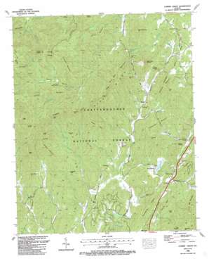
Cashes Valley Topo Map Georgia
To zoom in, hover over the map of Cashes Valley
USGS Topo Quad 34084g4 - 1:24,000 scale
| Topo Map Name: | Cashes Valley |
| USGS Topo Quad ID: | 34084g4 |
| Print Size: | ca. 21 1/4" wide x 27" high |
| Southeast Coordinates: | 34.75° N latitude / 84.375° W longitude |
| Map Center Coordinates: | 34.8125° N latitude / 84.4375° W longitude |
| U.S. State: | GA |
| Filename: | o34084g4.jpg |
| Download Map JPG Image: | Cashes Valley topo map 1:24,000 scale |
| Map Type: | Topographic |
| Topo Series: | 7.5´ |
| Map Scale: | 1:24,000 |
| Source of Map Images: | United States Geological Survey (USGS) |
| Alternate Map Versions: |
Cashes Valley GA 1935 Download PDF Buy paper map Cashes Valley GA 1946, updated 1956 Download PDF Buy paper map Cashes Valley GA 1946, updated 1972 Download PDF Buy paper map Cashes Valley GA 1946, updated 1975 Download PDF Buy paper map Cashes Valley GA 1947, updated 1948 Download PDF Buy paper map Cashes Valley GA 1988, updated 1988 Download PDF Buy paper map Cashes Valley GA 2011 Download PDF Buy paper map Cashes Valley GA 2014 Download PDF Buy paper map |
| FStopo: | US Forest Service topo Cashes Valley is available: Download FStopo PDF Download FStopo TIF |
1:24,000 Topo Quads surrounding Cashes Valley
> Back to 34084e1 at 1:100,000 scale
> Back to 34084a1 at 1:250,000 scale
> Back to U.S. Topo Maps home
Cashes Valley topo map: Gazetteer
Cashes Valley: Basins
Double Hogpen elevation 1091m 3579′Cashes Valley: Cliffs
White Cliffs elevation 808m 2650′Cashes Valley: Dams
Carrol Lake Dam elevation 567m 1860′Childers Lake Dam elevation 543m 1781′
Ellijay Watershed Dam Number 10 elevation 456m 1496′
Ellijay Watershed Dam Number Four elevation 444m 1456′
Ellijay Watershed Dam Number Nine elevation 483m 1584′
Ellijay Watershed Dam Number Two elevation 460m 1509′
Ellijay Watershed Number Three Dam elevation 537m 1761′
Fowler Lake Dam elevation 566m 1856′
Hensley Lake Dam elevation 494m 1620′
Shaw Lake Dam elevation 599m 1965′
Young Lake Dam elevation 562m 1843′
Cashes Valley: Gaps
Augerhole Gap elevation 646m 2119′Bushy Head Gap elevation 636m 2086′
Frozen Gap elevation 822m 2696′
Hatley Gap elevation 807m 2647′
Hickorynut Gap elevation 922m 3024′
Hudson Gap elevation 795m 2608′
McKenny Gap elevation 844m 2769′
Persimmon Gap elevation 661m 2168′
Polecat Gap elevation 1013m 3323′
Tipton Gap elevation 620m 2034′
Cashes Valley: Lakes
Hughes Lake elevation 566m 1856′Cashes Valley: Populated Places
Ai elevation 679m 2227′Burnett elevation 512m 1679′
Cherry Log elevation 483m 1584′
Chopped Oak elevation 544m 1784′
Flat Branch elevation 511m 1676′
Goose Island elevation 454m 1489′
Higdon Mill (historical) elevation 503m 1650′
Jones Mill (historical) elevation 464m 1522′
Lucius elevation 470m 1541′
Santaluca elevation 478m 1568′
White Path elevation 455m 1492′
Cashes Valley: Post Offices
Cherrylog Post Office elevation 472m 1548′Cashes Valley: Reservoirs
Allen Lake elevation 483m 1584′Carrol Lake elevation 567m 1860′
Childers Lake elevation 543m 1781′
Fowler Lake elevation 566m 1856′
Goose Island Lake elevation 456m 1496′
Hensley Lake elevation 494m 1620′
Hughes Lake elevation 561m 1840′
Jones Lake elevation 537m 1761′
Parks Lake elevation 460m 1509′
Shaw Lake elevation 599m 1965′
Young Lake elevation 562m 1843′
Cashes Valley: Ridges
Horse Ridge elevation 968m 3175′Leading Ridge elevation 476m 1561′
Redrock Ridge elevation 554m 1817′
Cashes Valley: Streams
Allen Branch elevation 486m 1594′Amy Creek elevation 495m 1624′
Bear Paw Branch elevation 579m 1899′
Boardtown Creek elevation 425m 1394′
Bryant Creek elevation 433m 1420′
Burnett Branch elevation 681m 2234′
Cherry Log Creek elevation 452m 1482′
Devilsden Branch elevation 646m 2119′
Dillard Branch elevation 748m 2454′
Dugger Branch elevation 768m 2519′
Frady Creek elevation 454m 1489′
Godfrey Branch elevation 473m 1551′
Harper Creek elevation 459m 1505′
Hatley Branch elevation 530m 1738′
Hice Branch elevation 441m 1446′
Jones Creek elevation 432m 1417′
Key Creek elevation 469m 1538′
Little Rock Creek elevation 481m 1578′
Long Branch elevation 652m 2139′
Polecat Branch elevation 646m 2119′
Postelle Creek elevation 626m 2053′
Rock Creek elevation 454m 1489′
Saltpeter Creek elevation 478m 1568′
Cashes Valley: Summits
Bart Top elevation 744m 2440′Bear Den Mountain elevation 851m 2791′
Big Hill elevation 663m 2175′
Bushy Head Mountain elevation 813m 2667′
Chestnut Mountain elevation 769m 2522′
Collins Mountain elevation 744m 2440′
Double Knob elevation 742m 2434′
Flat Top Mountain elevation 1094m 3589′
Fowler Mountain elevation 1021m 3349′
Frozen Knob elevation 878m 2880′
Hickorynut Mountain elevation 992m 3254′
Leatherwood Mountain elevation 579m 1899′
Little Bee Mountain elevation 726m 2381′
Patterson Mountain elevation 692m 2270′
Pine Mountain elevation 694m 2276′
Porter Mountain elevation 821m 2693′
Prince Mountain elevation 784m 2572′
Round Mountain elevation 686m 2250′
Saltpeter Mountain elevation 553m 1814′
Sheep Knob elevation 825m 2706′
Turkey Knob elevation 612m 2007′
Turkeypen Top elevation 595m 1952′
Cashes Valley: Valleys
Cashes Valley elevation 702m 2303′Jackson Hollow elevation 480m 1574′
Williamson Cove elevation 648m 2125′
Cashes Valley digital topo map on disk
Buy this Cashes Valley topo map showing relief, roads, GPS coordinates and other geographical features, as a high-resolution digital map file on DVD:


