Rockmart North Topo Map Georgia
To zoom in, hover over the map of Rockmart North
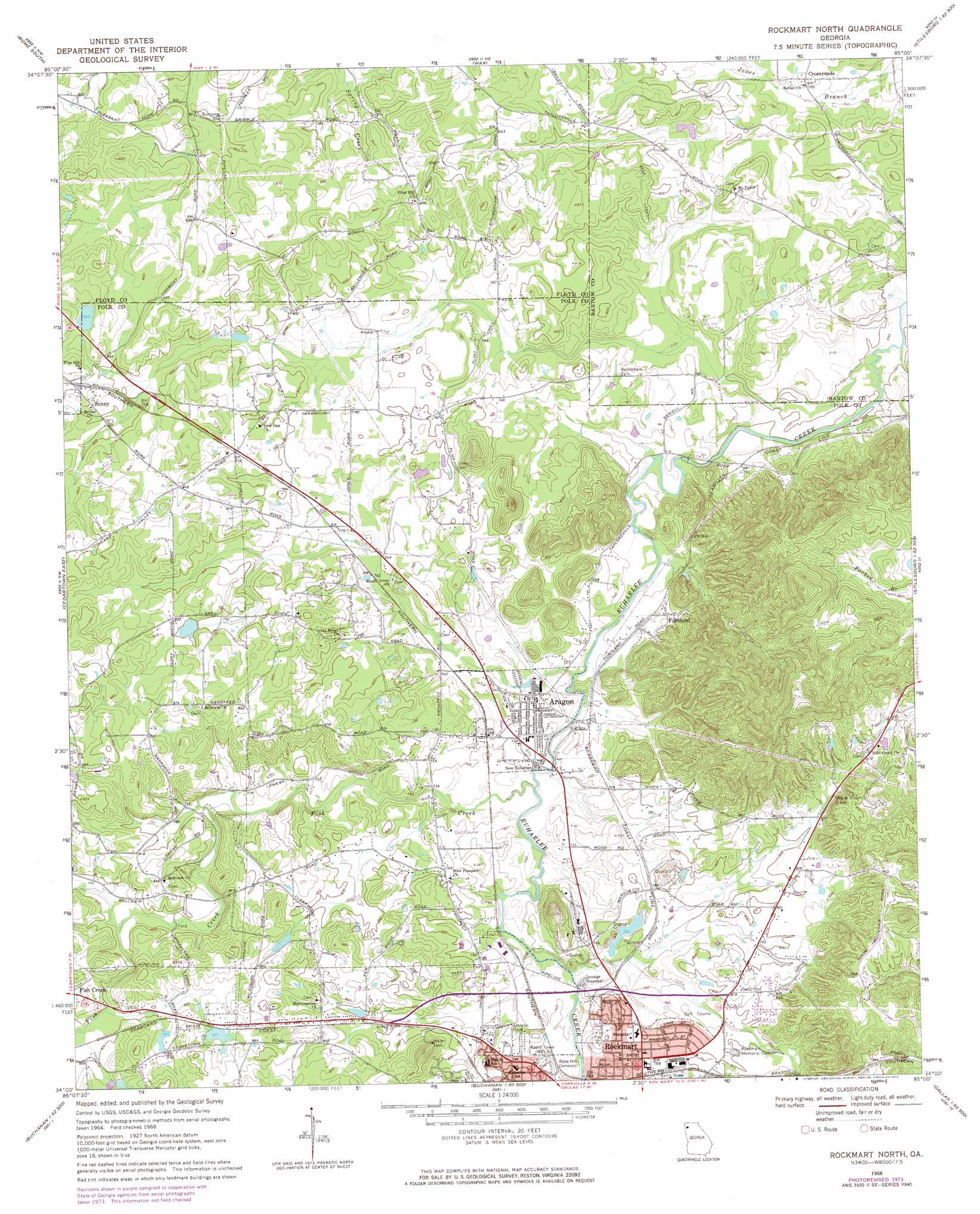
USGS Topo Quad 34085a1 - 1:24,000 scale
| Topo Map Name: | Rockmart North |
| USGS Topo Quad ID: | 34085a1 |
| Print Size: | ca. 21 1/4" wide x 27" high |
| Southeast Coordinates: | 34° N latitude / 85° W longitude |
| Map Center Coordinates: | 34.0625° N latitude / 85.0625° W longitude |
| U.S. State: | GA |
| Filename: | o34085a1.jpg |
| Download Map JPG Image: | Rockmart North topo map 1:24,000 scale |
| Map Type: | Topographic |
| Topo Series: | 7.5´ |
| Map Scale: | 1:24,000 |
| Source of Map Images: | United States Geological Survey (USGS) |
| Alternate Map Versions: |
Rockmart North GA 1968, updated 1970 Download PDF Buy paper map Rockmart North GA 1968, updated 1974 Download PDF Buy paper map Rockmart North GA 2011 Download PDF Buy paper map Rockmart North GA 2014 Download PDF Buy paper map |
1:24,000 Topo Quads surrounding Rockmart North
Rock Mountain |
Rome North |
Shannon |
Adairsville |
White West |
Livingston |
Rome South |
Wax |
Kingston |
Cartersville |
Cedartown West |
Cedartown East |
Rockmart North |
Tayorsville |
Burnt Hickory Ridge |
Benedict |
Felton |
Rockmart South |
Yorkville |
Dallas |
Tallapoosa North |
Buchanan |
Draketown |
New Georgia |
Nebo |
> Back to 34085a1 at 1:100,000 scale
> Back to 34084a1 at 1:250,000 scale
> Back to U.S. Topo Maps home
Rockmart North topo map: Gazetteer
Rockmart North: Dams
Pepper Lake Dam elevation 256m 839′Pine Hill Lake Dam elevation 255m 836′
Rockmart North: Mines
Deaton Mine elevation 225m 738′Rockmart Quarry elevation 236m 774′
Rockmart North: Populated Places
Aragon elevation 226m 741′Brewers (historical) elevation 253m 830′
Crossroads elevation 231m 757′
Hamlet (historical) elevation 232m 761′
Portland elevation 230m 754′
Posco (historical) elevation 224m 734′
Ravenel (historical) elevation 224m 734′
Red Ore (historical) elevation 233m 764′
Rockmart elevation 238m 780′
Seney elevation 256m 839′
Rockmart North: Reservoirs
Pepper Lake elevation 256m 839′Pine Hill Lake elevation 255m 836′
Rockmart North: Springs
Davette Spring elevation 218m 715′Deaton Spring elevation 222m 728′
Rockmart North: Streams
Fish Creek elevation 219m 718′Rockmart North digital topo map on disk
Buy this Rockmart North topo map showing relief, roads, GPS coordinates and other geographical features, as a high-resolution digital map file on DVD: