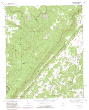
Jamestown Topo Map Alabama
To zoom in, hover over the map of Jamestown
USGS Topo Quad 34085d5 - 1:24,000 scale
| Topo Map Name: | Jamestown |
| USGS Topo Quad ID: | 34085d5 |
| Print Size: | ca. 21 1/4" wide x 27" high |
| Southeast Coordinates: | 34.375° N latitude / 85.5° W longitude |
| Map Center Coordinates: | 34.4375° N latitude / 85.5625° W longitude |
| U.S. States: | AL, GA |
| Filename: | o34085d5.jpg |
| Download Map JPG Image: | Jamestown topo map 1:24,000 scale |
| Map Type: | Topographic |
| Topo Series: | 7.5´ |
| Map Scale: | 1:24,000 |
| Source of Map Images: | United States Geological Survey (USGS) |
| Alternate Map Versions: |
Jamestown AL 1967, updated 1969 Download PDF Buy paper map Jamestown AL 1967, updated 1985 Download PDF Buy paper map Jamestown AL 2011 Download PDF Buy paper map Jamestown AL 2011 Download PDF Buy paper map Jamestown AL 2014 Download PDF Buy paper map |
1:24,000 Topo Quads surrounding Jamestown
> Back to 34085a1 at 1:100,000 scale
> Back to 34084a1 at 1:250,000 scale
> Back to U.S. Topo Maps home
Jamestown topo map: Gazetteer
Jamestown: Crossings
Billys Ford elevation 368m 1207′Jamestown: Parks
De Soto State Park elevation 458m 1502′Little River Canyon National Preserve elevation 395m 1295′
Jamestown: Populated Places
Berry Springs elevation 215m 705′Burgess elevation 253m 830′
Chesterfield elevation 226m 741′
Five Points elevation 460m 1509′
Grover elevation 220m 721′
Jamestown elevation 238m 780′
New Moon elevation 207m 679′
Jamestown: Ridges
Shinbone Ridge elevation 304m 997′Jamestown: Springs
Berry Spring elevation 213m 698′Jamestown: Streams
East Fork Little River elevation 371m 1217′Hurricane Creek elevation 366m 1200′
Straight Creek elevation 376m 1233′
West Fork Little River elevation 385m 1263′
West Fork Little River elevation 368m 1207′
Jamestown digital topo map on disk
Buy this Jamestown topo map showing relief, roads, GPS coordinates and other geographical features, as a high-resolution digital map file on DVD:


