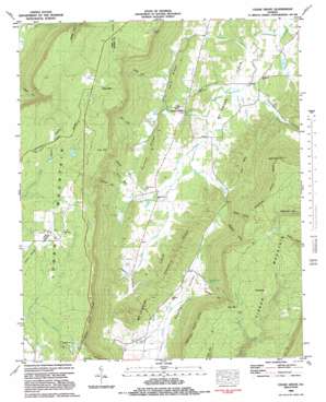
Cedar Grove Topo Map Georgia
To zoom in, hover over the map of Cedar Grove
USGS Topo Quad 34085f4 - 1:24,000 scale
| Topo Map Name: | Cedar Grove |
| USGS Topo Quad ID: | 34085f4 |
| Print Size: | ca. 21 1/4" wide x 27" high |
| Southeast Coordinates: | 34.625° N latitude / 85.375° W longitude |
| Map Center Coordinates: | 34.6875° N latitude / 85.4375° W longitude |
| U.S. State: | GA |
| Filename: | o34085f4.jpg |
| Download Map JPG Image: | Cedar Grove topo map 1:24,000 scale |
| Map Type: | Topographic |
| Topo Series: | 7.5´ |
| Map Scale: | 1:24,000 |
| Source of Map Images: | United States Geological Survey (USGS) |
| Alternate Map Versions: |
Cedar Grove GA 1936 Download PDF Buy paper map Cedar Grove GA 1946, updated 1960 Download PDF Buy paper map Cedar Grove GA 1946, updated 1968 Download PDF Buy paper map Cedar Grove GA 1946, updated 1972 Download PDF Buy paper map Cedar Grove GA 1947, updated 1947 Download PDF Buy paper map Cedar Grove GA 1982, updated 1983 Download PDF Buy paper map Cedar Grove GA 2011 Download PDF Buy paper map Cedar Grove GA 2014 Download PDF Buy paper map |
1:24,000 Topo Quads surrounding Cedar Grove
> Back to 34085e1 at 1:100,000 scale
> Back to 34084a1 at 1:250,000 scale
> Back to U.S. Topo Maps home
Cedar Grove topo map: Gazetteer
Cedar Grove: Airports
Mount Cove Stolport elevation 307m 1007′Cedar Grove: Cliffs
High Point elevation 713m 2339′Cedar Grove: Dams
Camp Adahi Lake Dam elevation 613m 2011′Cedar Grove: Gaps
Crow Gap elevation 625m 2050′Rape Gap elevation 523m 1715′
Cedar Grove: Parks
Cloudland Canyon State Park elevation 624m 2047′Cedar Grove: Populated Places
Cedar Grove elevation 269m 882′Mahan (historical) elevation 577m 1893′
Masseyville elevation 681m 2234′
McCutchen (historical) elevation 605m 1984′
Cedar Grove: Reservoirs
Camp Adahi Lake elevation 613m 2011′Scott Lake elevation 625m 2050′
Cedar Grove: Ridges
Harp Ridge elevation 323m 1059′Roland Ridge elevation 350m 1148′
Shankle Ridge elevation 411m 1348′
Tennessee Valley Divide elevation 487m 1597′
Tennessee Valley Divide elevation 496m 1627′
Cedar Grove: Springs
Anderson Cave Spring elevation 318m 1043′Forester Spring elevation 278m 912′
Cedar Grove: Streams
Aiken Branch elevation 279m 915′Andrews Branch elevation 252m 826′
Harper Branch elevation 287m 941′
Hatfield Branch elevation 247m 810′
Hise Branch elevation 271m 889′
Hogjowl Creek elevation 265m 869′
Mahan Branch elevation 256m 839′
Mill Creek elevation 261m 856′
Milligan Branch elevation 307m 1007′
Moore Branch elevation 257m 843′
Mud Creek elevation 257m 843′
Pocket Branch elevation 252m 826′
Rocktown Branch elevation 458m 1502′
Rogers Branch elevation 276m 905′
Shankle Branch elevation 285m 935′
Trickum Branch elevation 267m 875′
Voiles Creek elevation 253m 830′
Weathers Branch elevation 569m 1866′
Wheeler Branch elevation 261m 856′
Cedar Grove: Summits
Pigeon Mountain elevation 566m 1856′Cedar Grove: Valleys
Anderson Gulf elevation 287m 941′Gooseneck Hollow elevation 275m 902′
Henson Gulf elevation 292m 958′
Hickman Gulf elevation 307m 1007′
Hise Gulf elevation 303m 994′
Hogjowl Valley elevation 279m 915′
Kirkis Gulf elevation 302m 990′
Long Hollow elevation 271m 889′
McKaig Gulf elevation 404m 1325′
McLemore Cove elevation 249m 816′
Nichols Hollow elevation 274m 898′
Sparger Gulf elevation 295m 967′
Tatum Gulf elevation 302m 990′
Cedar Grove digital topo map on disk
Buy this Cedar Grove topo map showing relief, roads, GPS coordinates and other geographical features, as a high-resolution digital map file on DVD:


