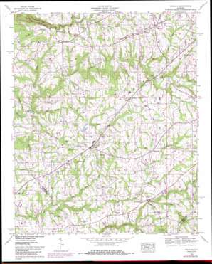
Douglas Topo Map Alabama
To zoom in, hover over the map of Douglas
USGS Topo Quad 34086b3 - 1:24,000 scale
| Topo Map Name: | Douglas |
| USGS Topo Quad ID: | 34086b3 |
| Print Size: | ca. 21 1/4" wide x 27" high |
| Southeast Coordinates: | 34.125° N latitude / 86.25° W longitude |
| Map Center Coordinates: | 34.1875° N latitude / 86.3125° W longitude |
| U.S. State: | AL |
| Filename: | o34086b3.jpg |
| Download Map JPG Image: | Douglas topo map 1:24,000 scale |
| Map Type: | Topographic |
| Topo Series: | 7.5´ |
| Map Scale: | 1:24,000 |
| Source of Map Images: | United States Geological Survey (USGS) |
| Alternate Map Versions: |
High Point AL 1936 Download PDF Buy paper map Douglas AL 1958, updated 1960 Download PDF Buy paper map Douglas AL 1958, updated 1976 Download PDF Buy paper map Douglas AL 1958, updated 1985 Download PDF Buy paper map Douglas AL 1975, updated 1977 Download PDF Buy paper map Douglas AL 2011 Download PDF Buy paper map Douglas AL 2014 Download PDF Buy paper map |
1:24,000 Topo Quads surrounding Douglas
> Back to 34086a1 at 1:100,000 scale
> Back to 34086a1 at 1:250,000 scale
> Back to U.S. Topo Maps home
Douglas topo map: Gazetteer
Douglas: Airports
Albertville Municipal Airport elevation 312m 1023′Douglas: Bridges
Flats Ford Bridge elevation 248m 813′Douglas: Populated Places
Bartlett (historical) elevation 299m 980′Douglas elevation 293m 961′
Friendship (historical) elevation 270m 885′
High Point elevation 312m 1023′
Horton elevation 299m 980′
Hyatt elevation 292m 958′
Mount Hebron elevation 268m 879′
Reedbrake (historical) elevation 271m 889′
Douglas: Streams
Big Branch elevation 231m 757′Big Branch elevation 250m 820′
Big Reedbrake Creek elevation 228m 748′
Carroll Branch elevation 254m 833′
Collins Creek elevation 270m 885′
Little Branch elevation 256m 839′
Little Hog Creek elevation 270m 885′
Little Mud Creek elevation 231m 757′
Little Reedbrake Creek elevation 228m 748′
Whitfield Branch elevation 226m 741′
Douglas digital topo map on disk
Buy this Douglas topo map showing relief, roads, GPS coordinates and other geographical features, as a high-resolution digital map file on DVD:


