Holly Pond Topo Map Alabama
To zoom in, hover over the map of Holly Pond
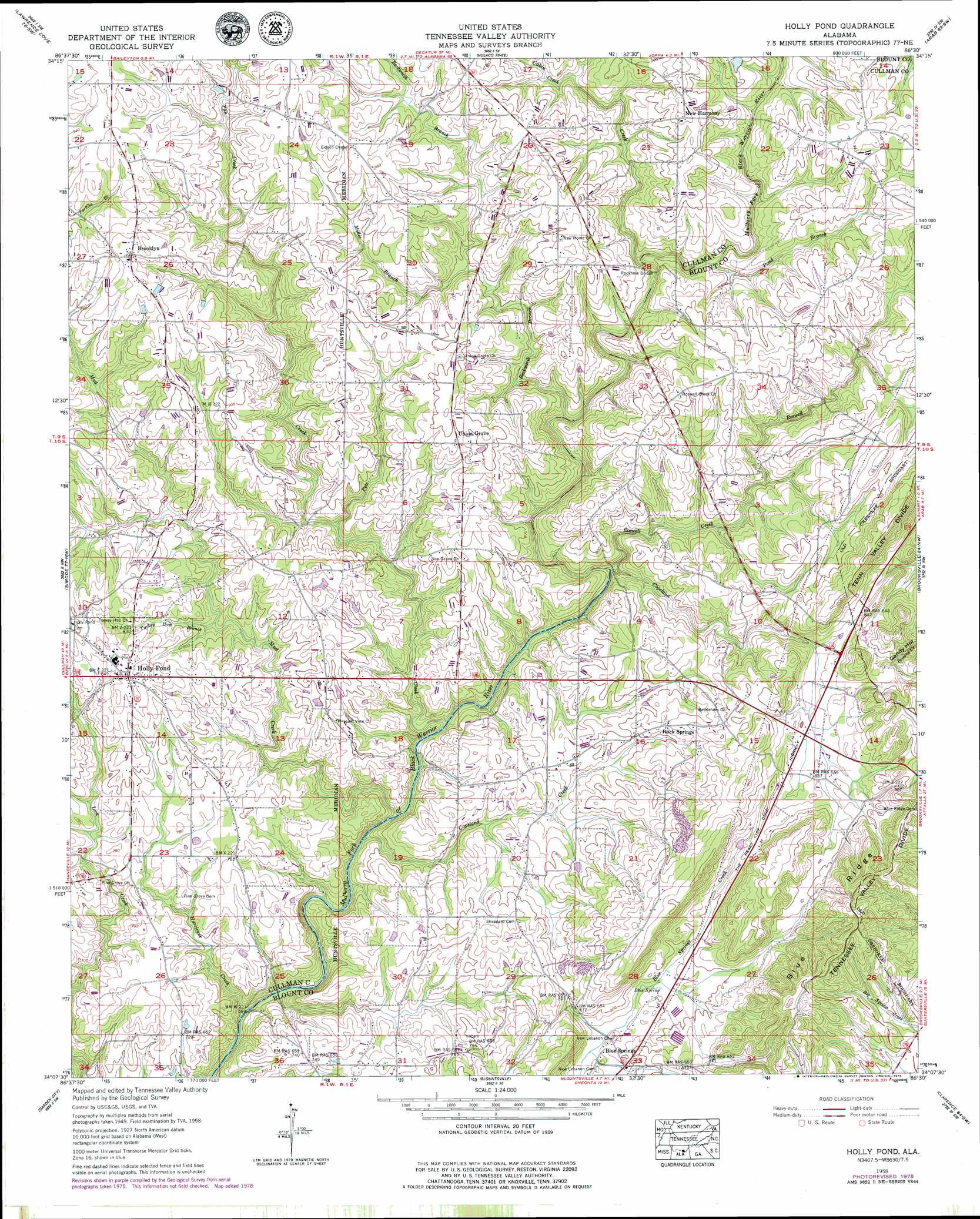
USGS Topo Quad 34086b5 - 1:24,000 scale
| Topo Map Name: | Holly Pond |
| USGS Topo Quad ID: | 34086b5 |
| Print Size: | ca. 21 1/4" wide x 27" high |
| Southeast Coordinates: | 34.125° N latitude / 86.5° W longitude |
| Map Center Coordinates: | 34.1875° N latitude / 86.5625° W longitude |
| U.S. State: | AL |
| Filename: | o34086b5.jpg |
| Download Map JPG Image: | Holly Pond topo map 1:24,000 scale |
| Map Type: | Topographic |
| Topo Series: | 7.5´ |
| Map Scale: | 1:24,000 |
| Source of Map Images: | United States Geological Survey (USGS) |
| Alternate Map Versions: |
Holly Pond AL 1936 Download PDF Buy paper map Holly Pond AL 1958, updated 1960 Download PDF Buy paper map Holly Pond AL 1958, updated 1960 Download PDF Buy paper map Holly Pond AL 1958, updated 1978 Download PDF Buy paper map Holly Pond AL 1975, updated 1977 Download PDF Buy paper map Holly Pond AL 2011 Download PDF Buy paper map Holly Pond AL 2014 Download PDF Buy paper map |
1:24,000 Topo Quads surrounding Holly Pond
Somerville |
Center Grove |
Newsome Sinks |
Guntersville Dam |
Mount Carmel |
Eva |
Lawrence Cove |
Hulaco |
Arab |
Guntersville |
Cullman |
Simcoe |
Holly Pond |
Brooksville |
Douglas |
Hanceville |
Garden City |
Blountsville |
Clarence |
Altoona |
Blount Springs |
Nectar |
Cleveland |
Oneonta |
Hyatt Gap |
> Back to 34086a1 at 1:100,000 scale
> Back to 34086a1 at 1:250,000 scale
> Back to U.S. Topo Maps home
Holly Pond topo map: Gazetteer
Holly Pond: Bridges
Rockhole Bridge elevation 242m 793′Holly Pond: Populated Places
Birdie elevation 244m 800′Blue Springs elevation 239m 784′
Brooklyn elevation 286m 938′
Holly Pond elevation 265m 869′
New Harmony elevation 288m 944′
Rock Springs elevation 257m 843′
Roswell elevation 280m 918′
Union Grove elevation 270m 885′
Holly Pond: Post Offices
Holly Pond Post Office elevation 264m 866′Holly Pond: Ridges
Blue Ridge elevation 329m 1079′Holly Pond: Springs
Blue Spring elevation 233m 764′Holly Pond: Streams
Beckworth Branch elevation 223m 731′Cabin Creek elevation 250m 820′
Copeland Creek elevation 219m 718′
Copeland Creek elevation 190m 623′
Hurricane Creek elevation 176m 577′
Millie Branch elevation 244m 800′
Mud Creek elevation 191m 626′
Pan Creek elevation 218m 715′
Pond Branch elevation 238m 780′
Roswell Creek elevation 206m 675′
Turkey Hop Branch elevation 232m 761′
Holly Pond digital topo map on disk
Buy this Holly Pond topo map showing relief, roads, GPS coordinates and other geographical features, as a high-resolution digital map file on DVD: